Walk 24 - Pangbourne and Whitchurch
Despite the dubious weather and recent floods, we had 24 people on this walk. Mostly a mixture of Berkshire and Chilterns Weekend Walkers and their associated 20s & 30s groups glad to get out and burn off some of the Christmas calories. (This walk was on Sunday 30th December)

We started in Pangbourne and crossed the bridge into Whitchurch. The Thames was very full and had spilled over into low lying gardens, car parks and completely covered the meadow along the Thames path! Luckily that wasn't part of our route.
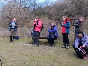
Passing through Whitchurch we branched left and headed toward the Thames Path at Hartslock Wood. This part of the Thames path is not a tow path and runs through a wooded embankment several metres higher than the river. Even today the path was high enough up for it to have escaped the flood waters.
We left the Thames Path at Hattonhill Shaw and headed north up to Primrosehill Shaw. From there we headed east in to Great Chalk Wood, where we stopped for our picnic lunch before continuing east and upwards to Cold Harbour (the highest point of our route at 157m). Then we turned southward (and mostly downhill) back to Whitchurch via Coombe End Farm and Beech Farm.
Although none of our route was flooded, it was very muddy throughout most of the walk and was quite slippery in several places. It certainly felt like we had a good work-out.
On our return to Pangbourne, some of us stopped off for a drink at the Cross Keys pub (after changing out of our muddy boots!). You can see our route on Google Maps.
Walk 23 - Marlow and Medmenham

There were fifteen people on our twenty-third walk, which followed a day of heavy rain. Needless to say, it was quite a muddy walk but the rain held off for most of the walk.
After a brief walk through Marlow town centre we headed west toward Bockmer End, via Davenport Wood and Marlow Common. This part of the walk was on high ground and wasn't too muddy. (The second half of the walk was rather different!)
We then headed south to Medmenham, stopping for our picnic lunch just outside the village. We also stopped for a refreshing drink in a very pleasant pub called the Dog and Badger in Medmenham before continuing the walk, going south towards the Thames.
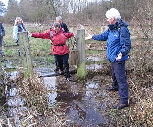
The walk was originally planned to follow the Thames path back to Marlow but in view of the recent weather, the leader took the wise decision to take an alternative route back via footpaths on slightly higher ground. Even so, we encountered flooded fields and very muddy footpaths. The weather was now on the turn, with heavy cloud building up and then rain, which got quite heavy just before the end of the walk. See our route on Google Maps.
Walk 22 - Dorney Common and Jubilee River
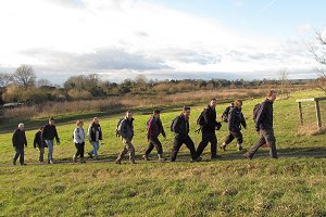
Fifteen people turned up to this 6 mile afternoon walk. The reason for the afternoon start time was to let the people that went to the Christmas Ceilidh, have a lie in. Even so, not many of them turned up! The walk started from Boveney and crossed Dorney Common on the way to the Jubilee River.

The Jubilee River is a man-made channel that diverts excess water from the Thames at Boulter's Lock and returns it downstream of Eaton. This was built over ten years ago to alleviate flooding to areas in and around the towns of Maidenhead, Windsor and Eton. It was certainly doing its job today, and looked quite full and fast flowing.

We stopped by the Jubilee River for a snack of mince pies left over from the previous night's Christmas social event. After that we followed the river upstream to Dorney village and then to Dorney Court where we stopped for coffee and cake at the Dorney Court Kitchen Garden. There was no pub stop today - You see, we aren't alcoholics!
The walk back took us past the entrance to the Rowing Lake but we weren't permitted access, so we followed the Thames Path back to Boveney. The walk finished around 4:30pm, about half an hour after sunset. There were some nice views at sunset and just after on the last stretch of our walk. See our route on Google Maps.
Walk 21 - Chaddleworth and Great Shefford

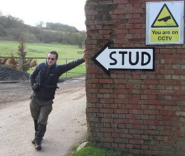
We had eighteen people (and a small dog) on this walk, which is a pretty good number considering it wasn't a joint walk with another group. The weather was cold but dry on this first Sunday of December.
Starting from the Ibex Inn at Chaddleworth, we followed the edge of the grounds of Chaddleworth House and then headed north west through open fields to Whatcombe racing stables, built on the site of Whatcombe medieval village. From there we headed south west, in the direction of East Garston, crossing farmland and Kite Hill.
About a mile before East Garston, we turned south to Maidencourt Farm, where we stopped for our picnic lunch by the River Lambourne.
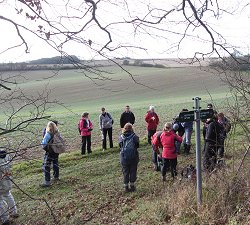
After lunch we walked along the edge of the river to Great Shefford, where we stopped off at the Swan Inn to warm up and rehydrate.

After that we headed north-east back to Chaddleworth through farmland and a golf course.
The nine mile walk included some muddy fields and a lot of ups and downs (490 metres total ascents). A good and satisfying work-out! At the end of the walk we stopped off at the Ibex Inn for another drink and to warm up. We're not really alcoholics! See our route on Google Maps.
Walk 20 - Woolhampton and Midgham

On Sunday 25th November we had a joint walk led by the Loddon Valley group, which had a turn-out of 28 people! These were a fairly even mix of Loddon Valley members and Berkshire Weekend Walkers with a sprinkling of people from the Chilterns group and one or two people new to the Ramblers. The morning was cold but fine, in contrast to the previous week of rainy days, which had left some roads and paths flooded.
The walk was themed around historic modes of transport in the area of Woolhampton, Midgham and Brimpton. Items of interest included an old coaching inn on the Great Western Road from Bath to London, now the A4. It also included the Kennet and Avon Canal, which was built between 1794 and 1810 to connect Bristol to Reading, forming an important trade route until its use was gradually eclipsed by the Great Western Railway, which first came into use in 1838.
The walk was quite wet under-foot in places due to the recent weather but further rain held off until after the walk finished. At only five miles, we were finished by lunch time and many of us stopped off at the Rowbarge pub in Woolhampton for a pleasant drink and a few of us also stayed for Sunday lunch. See our route on Google Maps.
Walk 19 - Stokenchurch and Wormsley Valley
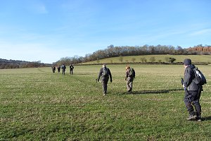
Fifteen people turned up to our nineteenth walk, which was pretty good considering the Berkshire Walkers 20s & 30s group had a walk on the same day. This may have been due to the weather, which was cold but sunny with a blue sky.
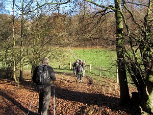
We started from outside the Kings Hotel in Stokenchurch and then crossed the M40 via a footbridge to Hailey Wood and south to Bowley's Wood. The walk was a mixture of fields and woodlands, with most of the autumn leaves on the ground now.
We then headed west across fields and through Blackmoor Wood to Christmas Common. From there we went east into Queens Wood where we stopped for our picnic lunch.
After lunch we continued east to Ibstone via Launder's Farm, Northend and Hale Wood and then north through Ibstone Common. We stopped at the Fox Country Inn for a drink before continuing on through Hartmoor Wood and then across farmland and under the M40 back to Stokenchurch.
This walk was a good work-out! All the paths were either going up or down hill, with a total ascent of around 410 metres (1350 feet). My boots needed a good scrub when I got home to get all the mud off - a recommended precaution these days, to reduce the spread of Ash dieback disease. See our route on Google Maps.
Walk 18 - Box Hill, Surrey

On Saturday 18th November we held a joint walk with the Berkshire Walkers 20s & 30s group. This walk was inspired by a visit to Olympic cycling events that took place there earlier this year.

The walk started from outside Dorking Deepdene railway station and initially headed to Pixham and then Lower Boxhill Farm, where we began our ascent. We avoided the most direct route straight up the hill in favour of a slightly easier diagonal route going north-east to Brockham Warren before joining the North Downs Way going west to Box Hill Country Park. (An ascent of 163 metres or 535 feet.)
We walked through the country park at the top of the hill to the viewpoint (see picture) and then onto the National Trust café. Some of us had our picnic at the view point while others favoured the NT café with its tempting cakes!
After lunch we headed down the hill to Westhumble, where we stopped at a local pub. Suitably refreshed, we carried on the walk, crossing the North Downs Way and passing through a vineyard on our way back to Dorking.
After the walk, a few of us had a second pub-stop while waiting for our train home. You can see our route on Google Maps.
Walk 14 - Henley, Shiplake and Harpsden

On Sunday 14th October, the fourteenth walk was a joint walk led by Roy of the East Berkshire Ramblers group. Thirteen people attended, including four from our group and a few from other groups in the area.
The walk started from Henley town centre and joined the Thames path going south. We followed the path over the long wooden bridges to Marsh Lock and back down to Shiplake.
At Shiplake railway station we met up with Dave Ramm, a campaigner for the Ramblers who was instrumental in re-establishing access to parts of the Thames path in this area. He led us along a recently restored public right of way through Lashbrook, along the tow path to Shiplake Lock, explaining along the way, what work had been done.
At one point the route took us through the back gardens of some large houses that had been built over the original public footpath. We stopped for lunch by Shiplake Lock after which Dave left us and Roy continued to lead us along the tow path to Shiplake College where we diverted inland.

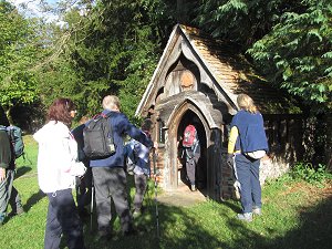
After passing through Shiplake we headed north through a mixture of woodland and fields to the tiny village of Harpsden. Roy showed us the little wooden chapel to St Birinus, behind the Parish Church of St Margaret, with barely enough room for half-a-dozen worshippers.
Also in Harpsden was a 17th century weatherboarded barn, which at some point had been tiled with large carved wooden squares. These apparently used to be wooden printing blocks for making patterned wallpaper! They certainly made an interesting feature.
We then headed back toward the Thames path via Mill Lane, but before reaching it we took a footpath that followed the railway back into Henley. All in all it was a very pleasant walk with good weather, an interesting route and with many snippets of information provided by both Roy and Dave.
Walk 13 - Wayfarer's Walk and Watership Down
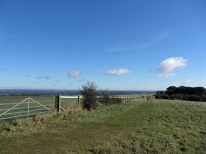
On Saturday 6th October, our thirteenth walk was held jointly with the Berkshire Walkers 20s & 30s group and was another figure-of-eight walk, with an option to finish after 8 miles instead of the full 13½. We had eleven people on the first part of the walk and five on the second.
The weather was sunny with clear blue skies, although heavy rain the previous night had made it wet underfoot in places.

The walk began at the White Hill car park and headed west along the Wayfarer's Walk across Watership Down, Nuthanger Down to Ladle Hill. The hill-fort at Ladle Hill is believed to be an example of an 'unfinished' hill-fort on the site of an earlier Bronze Age settlement. It also seemed to be a popular spot for the sheep and gave a commanding view of West Berkshire to the north, Beacon Hill to the west, and North Hampshire to the south.
We followed the Wayfarer's Walk a bit further south-west before leaving it for a footpath heading north down the hill to Wergs Farm. From there we walked through Sydmonton and back up hill to Nuthanger Down, stopping off for our picnic lunch on the way.

We then headed back the way we came along the Wayfarer's Walk, across Watership Down, to the car park where we had started. At this point those that only wanted an 8 mile walk left us.

The second half of the walk continued along the Wayfarer's Walk until we reached North Oakley, where we left it and took a footpath to Hannington. We stopped off at The Vine public house for a refreshing drink before carrying on into Hannington village.
We passed the village green and All Saint's Church before leaving Hannington on a footpath and then a lane that took us to Cottington's Hill, which is dominated by a television transmitter mast. Then we descended back to the car park having covered just over 13½ miles with a total of 629 metres of ascents. Quite a good workout! See our route on Google Maps.


