Walk 388 - Tyle Mill Lock and Ufton Nervet

Fourteen of us met up on Sunday 30th June, the day after a one-day heat-wave with temperatures in the thirties. Today was much cooler with temperatures in the low twenties and a pleasant breeze, which was much more suitable for walking.
The walk started by following the Kennet and Avon Canal from Tyle Mill Lock toward Sulhamstead lock. Then we left the canal and followed a footpath between two lakes (probably former gravel pits). A mixture of woodlands, fields and lanes took us through Whitehouse Green, Sulhamstead Abbot and Sulhamstead Bannister.
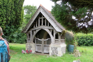
We stopped for our picnic lunch in the grounds of the demolished church of St Michael. There were several benches here, and the covered entrance/porch of the church, which is all that still stands. Some of us sat in the porch, where there were stone bench seats and a great wooden door without a church behind it.

After lunch, we continued our route through fields and woodlands, passing Ufton Nervet, Ufton Court and Padworth. We crossed a field near Padworth College where there was a black and white striped horse! Not a zebra, but a horse in a stripey drape.

We crossed the weirs at Padworth Mill and made our way to Aldermaston Wharf. Here we stopped at the Kennet and Avon Canal Trust Tea Rooms, where some of us had ice creams while others had tea and cake. The old cottage that is the tea rooms looked at odds with the very modern looking water-fronted houses either side.
Suitably refreshed, we left the cafe and followed the Kennet and Avon Canal towpath, passing Froudes Swing-Bridge, Towney Lock, and Ufton Lock. The tow path crossed the canal at Ufton Bridge and we continued to follow it until we reached Tyle Mill Lock, from where we had started. See our route on Google Maps.
Thank you to Ann and Kathy for leading the walk and to Denise for providing the photographs.
Walk 387 - Finchampstead and Moor Green Lakes

On Wednesday evening 26th June, the weather was rather cloudy and windy, which contradicted the forecast of sunshine all evening. Four of us met up by the green near The Queens Oak for a 4-mile mid-week evening walk.
We set off heading west from St James church along a lane that became a footpath, which curved south past Rectory Farm. We passed a field of lavender, set out neat rectangular plots. Further south, we passed through part of Fleet Hill before arriving at the Moor Green Lakes nature reserve. As there were only four of us today, we were able to see much more wildlife than usual.
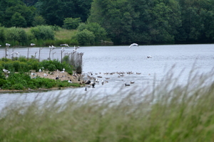
Our leader, Denise, does a lot of volunteer work for various wildlife conservation groups and is very knowledgeable, so we were treated to some expert identification of the various birds and creatures we heard and saw along the way.
Leaving the nature reserve along Lower Sandhurst Road, we passed a farm with poly-tunnels full of strawberries. A delicious strawberry-scented breezed wafted over us as we passed by.
As we approached St James church along a wooded footpath, we could hear bell-ringers going full tilt. They stopped by the time we reached the church, so we weren't deafened as we walked through the grounds. See our route on Google Maps. After the walk, we stopped off for a drink at the Queens Oak pub.
Thank you to Denise for leading the walk.
Walk 386 - Pangbourne and Sulham
Sunday 23rd June saw twelve of us (a mix of newcomers and regulars, plus members of other Ramblers groups and Meetup) assemble in Pangbourne on a warm but overcast day. The walk was one I'd led before, but with a slight modification to the route so as to include the hamlet of Sulham.
We started by following a lane that became a footpath running parallel to the River Pang, then crossing fields and joining Sulham Lane. After following the lane for a short distance, we crossed a wheat field and entered Sulham Wood. Here we had a steep but brief ascent to another path within the wood, this one taking us to the adjoining Mosshall Wood.

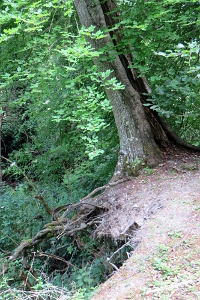
The path followed the top of a sort of cliff, where the land had fallen away, leaving some trees hanging on to the remaining soil for dear life!
Leaving the woods, we crossed fields of barley and then pastures on our way to Little Heath. Doubling back along Kiln Lane, we passed through woodland and then more fields, some pasture and some crops, until we joined Nunhide Lane. This passed Sulham House, St Nicholas Church and a splendid looking thatched gate house at the end of the lane.
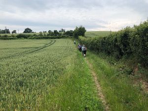
A footpath took us on a route parallel to Sulham Lane for a short while before we crossed the lane and made our way toward Tidmarsh. Stopping by the Pang river for our picnic lunch, we then popped into The Greyhound for a drink before continuing with the walk.
The last part of the walk passed through more wheat fields near Gregory's Hill and then up into the grounds of Pangbourne College. Leaving through their front entrance, we did a short stretch of road walking before crossing more fields of barley. As we reached Berry Copse, we could see a large field of opium poppies in the distance.
A wooded route took us through Berry Copse to Sots Hole, where we joined Shooters Hill (road), which we followed back into Pangbourne. See our route on Google Maps.
Thank you to Jason for taking some of the photos and for publicising my walk on Meetup.
Walk 382 - Friday Street, Leith Hill and Holmbury Hill
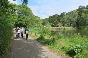
Just a few of us met up on Sunday 26th May for a walk in the Greensand Ridge area of Surrey. This is a bit out of our normal area, but well worth the journey, in my opinion. The weather started off well, with sunshine and blue skies.
Leaving the car park, we followed the lane past the mill pond and into the hamlet of Friday Street. Crossing through Severells Copse, we joined a bridleway called Leyland's Road. This took us through the woodland of Wotton Common, where we saw plenty of rhododendrons in flower. They seem to do well in the sandy soil here.

The long path gradually gained height until we reached the top of Leith Hill, the highest point on the Greensand Ridge. It is also the second highest hill in the south-east of England. (The highest being Walbury Hill, near Newbury.) There is an 18th-century Gothic tower on the summit, which is now owned by the National Trust and has a little tea shop.

We stopped here for refreshment. Some of us had tea and cake while one or two of us went up the tower to the viewing area at the top. On a clear day you can just see some of the London landmarks, however the weather was beginning to turn, with thick clouds appearing.
We left Leith Hill, heading toward Holmbury Hill, following the Greensand Way for some of the way. A steep path took us up to Holmbury Hill, where we stopped for our picnic lunch and to enjoy the views. The clouds were getting darker and the occasional spit of rain was felt.
Next we headed to the village of Holmbury St Mary, where we stopped for a drink at The Royal Oak pub. It began raining as we sat in the beer garden. Luckily the parasol on the table also served as an umbrella. The rain eased up as we finished our drinks and set off for the final leg of the route.
A fine drizzle tried to fall a couple of times on the way back, but it never got heavy enough for waterproofs. It was less than a couple of miles, crossing heathland and woodland, back to the car park. See our route on Google Maps.
Thank you to Sue J for leading the walk.


