Walk 401 - West Ilsley and the Ridgeway
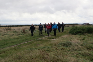
There is a phrase 'glutton for punishment', which could apply to me. Having been soaked on last Sunday's walk, and with the forecast for this Sunday being for more of the same, I still went along to the walk. However, the sheer optimism of the ten people who attended the walk was rewarded, as there was very little rain during the walk and none of the thunder that had been predicted.
Being a joint walk with the Pang Valley Ramblers, there was a mix of BWW and PVR members, but also we had two newcomers who were trying us out after visiting our stand at the Berkshire Show on the previous weekend.

We started the walk by following The Ridgeway westward over the Chiltern Downs, with rural views to the south and a mixture of old and new industrial views to the north. These included the modern Harwell Diamond Light Source (a synchrotron) and the remains of the partly demolished Didcot power station.
Soon we were heading south, through Kilman Knoll Down before joining Old Street (track). This we followed for a mile or so, up and down hill, before turning off into the woodland of High Robins.
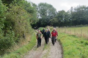
As the path opened out at Woolvers Borders, with fields one side and woodland the other, we stopped to have our packed lunches. On the woodland side of the path were many bramble bushes, but most of the blackberries had gone past their best without being picked. A missed opportunity of those who like to make jam, apple pies and crumbles.
After lunch, we continued eastward for a short while before turning north, passing West Ilsley Stables, Hodcott House and then skirting the village of West Ilsley.

Without seeing much of the village, we left it, crossing through the farmland of Folly Down, where sheep were grazing. It was now getting surprisingly warm and sunshine was breaking through the cloud.
We rejoined The Ridgeway at Bury Down and it was a short distance back to the car park. See our route on Google Maps. As we walked the final leg, there were portentous dark clouds on the horizon.
We were very lucky as ten minutes after we had finished our walk, there was a terrific downpour, flooding the roads and bringing the traffic to a crawl. We'd have been out in that if the walk had been a bit longer!
Thank you to Alistair and Pauline for leading this walk and inviting the BWWs to join them.
Walk 400 - Watership Down, Sydmonton, Ecchinswell and Kingsclere

The weather forecast for Saturday 21st September was for sunshine all day and temperatures in the mid twenties. By contrast, the forecast for Sunday 22nd was for heavy rain and thunderstorms. Guess which day our walk was scheduled? Even so, we had nine foolhardy optimists turn up for the walk on (you guessed it) Sunday.
This walk was to be a joint walk with the Pang Valley Ramblers, who by their absence, must have studied the weather forecast and thought better of it. More brave where the two women from the Mid Berks group who had only just joined the Ramblers and this was their first walk. We also had a people from the BWs 20s & 30s group and SABRE (one of the Surrey groups), plus a newcomer trying us out.

It started raining just before we set off and got quite heavy as we walked across Cannon Heath Down and Watership Down. Descending into Sydmonton, this was a familiar route for those who have done some of my other walks in this area, but I added a couple of new sections of footpath and lane in Ecchinswell that I've not walked before.
We stopped for lunch in a little park in Ecchinswell, which provided a park bench and some logs to sit on. There was also a pond and a stream, complete with ducks. Do ducks enjoy rainy weather? I'm not sure if they do, despite the phrase Nice weather for ducks, which is so often used when it's raining.

We passed through woodland and crossed fields to arrive at Kingsclere. Here we stopped at The Crown pub, which also served hot drinks - very welcome on such a day. The rain had stopped by the time we left the pub.
The last part of the walk was through the recreation ground in Kingsclere followed by the gallops by Park House Stables. Then came the ascent of Freemantle Park Down to Cottington's Hill, where the transmitter mast is, and finally back along Stubbington Down to the car park at White Hill. See our route on Google Maps. According to my GPS, we'd covered 16km (10 miles) and 565m (1800 feet) of ascent in total. A pretty good workout - and we didn't get any thunder or lightning.
Walk 399 - Basingstoke Parks and Old Basing

Sunday 15th September was a gloriously warm day, with blue skies and temperatures in the low to mid twenties Celsius. Seven of us met up for a repeat of a walk I'd led before in 2014, which largely follows the Basing Trail.
Starting at Basingstoke station, we walked through town to War Memorial Park, where we stopped to look at a large cage of budgerigars. (These have mostly been donated, apparently.) Next we stopped at Blackdam Ponds and watched the swans and ducks, some being feed by children. We also noticed a stork, keeping an eye on proceedings. Leaving the town, we crossed Crabtree Plantation and Basingstoke Common to reach Old Basing.

After passing some very old cottages, we arrived at Old Basing and Lychpit Recreation Ground, where we stopped for lunch, making use of their picnic tables. One of our members also made use of the swings!
After lunch we passed by the Village Hall before heading out of Old Basing and towards Little Basing. The trail then took us through Mill Field, to Barton's Mill pub and restaurant. Here we stopped for a drink.
Refreshed, we left the pub and followed the River Loddon for a short while before reaching Basing House and its Tythe Barn. Next we crossed fields to the remains of an amphitheatre near Basing lime pits. There was a group of people here having a barbecue. (Perfect weather for it.) Finally we crossed some moorland and found ourselves back in Basingstoke. We walked through Eastrop Park back to the station. See our route on Google Maps.
Walk 398 - Reading to Pangbourne
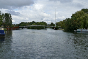
This weekend, our walk was on a Saturday - partly to have a change from all the recent Sunday walks, but also to make better use of public transport. This was a linear walk I'd led before, starting at Reading and finishing at Pangbourne. A train journey was required to return from Pangbourne back to Reading.
Twelve of us (including a few people from Meetup) met up in the square outside Reading station. Crossing under the station, we then joined the Thames Path by the Thames Water building.
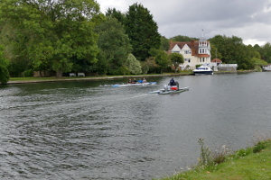
We crossed the Thames on the relatively new footbridge into Christchurch Meadows. We followed the Thames on the northern side, through the park, to the war memorial, where we crossed the river again on Caversham Bridge.
Back on the Thames Path we passed the Reading Rowing Club, where we saw a few rowers, but many more swans and geese. Next, we passed through Rivermead Park and then into open countryside.

As we approached Tilehurst, we left the open fields for a wooded corridor between the Thames and the railway. From here it was difficult to have a good view of either. This frustrated me when I heard a steam train passing by, which was so close but completely out of sight. The Thames Path left the river bank at Tilehurst and passed through a housing estate in Purley-on-Thames.
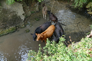
Emerging from the built-up area, we were soon at Mapledurham Lock, where we stopped for lunch. At the lock, we saw some cows that had somehow got into a small inlet by the side of the lock and were paddling around in the shallow water.
After lunch, we continued along the Thames Path until we reached Pangbourne, arriving about ten minutes before the next train to Reading. A couple of us decided to take that train, whilst the majority chose to stop off at The Swan pub for a drink on the river-side veranda, watching the boats go by before getting a later train back. See our route on Google Maps.
Walk 397 - Wick Hill and Longwater Lane, Finchampstead
The first Sunday in September was a bit cooler than our recent weather, only peaking at 19 degrees Celsius instead of last week's 30 degrees! Nineteen was also the number of people on this walk, an extended version of a walk that Ann and Kathy had led before.

We set off from the car park on Finchampstead Road, headed along Nine Mile Ride and turned off into Wick Hill Lane. The lane gradually became a footpath through woodland and eventually back into a lane emerging on the B3348, which we crossed into Dell Road. After some descent, we left the road for a footpath through the woodland of Finchampstead Ridges. This winding path eventually brought us out on Lower Sandhurst Road, north of Moor Green Lakes.
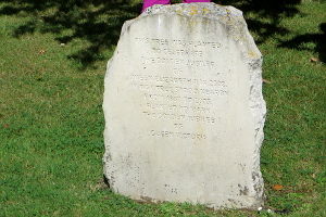
A footpath took us south, between two of the lakes and onto the Blackwater Valley Path, which we followed westward, crossing the B3016 and then northward into Finchampstead. We stopped at the Finchampstead Sports Club, where we were able to use their benches to stop and have our packed lunches. (There wasn't a cricket match taking place, so we weren't in anyone's way.)

After lunch, we followed a footpath to St James's Church by the Queens Oak. This name refers to a tree in the green and is the name of the local pub. The oak tree that stands in the green now was planted in 2002 on Queen Elizabeth II's golden jubilee and replaces a tree that was originally planted in the same green in 1887 on Queen Victoria's golden jubilee.
We didn't stop at the pub this time, but instead continued our walk to California Country Park, where we stopped to tea, coffee and cake at the cafe. We did a loop around Longmoor Lake while we were there. Suitably refreshed, we left the cafe and the park and followed the road back to the car park from where we'd started. See our route on Google Maps.
Thank you to Ann and Kathy for leading the walk.
Walk 393 - Eversley and Bramshill

On the first Sunday of August, fourteen of us met up on a warm but slightly cloudy day at the car park near St Mary's Church, Eversley. We set off, following the Three Castles Path into Heath Warren Wood. On entering the wood, we left left it to follow some substantial forest tracks.
These track were also being used for a local rally of horses and carts. The carts ranged from basic traps to fancy carriages, which were pulled by single or teams of horses, or in some cases, miniature ponies.
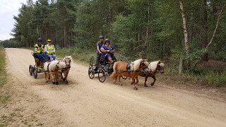
When we came to cross the road into Bramshill Plantation, we were greeted by a couple of marshals in high visibility jackets who were waiting for the horses and carts. With nothing to do at the time, they stopped the traffic for us so that we could cross the road, which was nice.
Making our way through Bramshill Plantation, we came across more horse and cart traffic. Stopping by some of the lakes, we were able to see all sorts of wildlife, including various types of dragon fly, a few pond skaters and a heron.

We stopped for a picnic by one of the lakes, which was very pleasant until the inevitable dog walker decided to get her dog to play fetch in and out of the water, frequently shaking itself dry right next to us. I like dogs, but am less fond of them when they douse my sandwiches in pond water.
Leaving Bramshill Plantation, we followed the Blackwater Valley Path back into Eversley, where we stopped for a drink in the garden of The White Hart pub. Heading back to the car park, we passed near Warbrook House, then passed through a small farm with some tiny goats, Egyptian geese and alpacas. Finally emerging behind the church, we crossed through the grounds and we were back. See our route on Google Maps.
Thank you to Denise for leading the walk and providing the photos.
Walk 391 - Four Downland Villages

Eight of us turned up in Brightwalton for this 8 mile walk around four downland villages: Brightwalton, Chaddleworth, Leckhampstead and Peasemore. It was an educational walk too, as the leaders stopped at each village and told us a little of its history.

Leaving Brightwalton, we headed south-west, passing Spray Wood on our way to Chaddleworth. Catching a glimpse of Chaddleworth House before heading south-east out of the village, we followed Wick Lane (track) before entering Leckhampstead on Manor Lane.
We took a slight diversion to look inside St James' Church, built around 1860, which has a rather eye-catching brick interior. It reminded me of the decorative brickwork in the great hall of the Natural History Museum in London.

We stopped to have our picnic lunch on the triangular green in Leckhampstead where there is a war memorial of unusual design. Its obelisk shape is not that unusual for such a monument, but it also included a clock. We sat under the trees for shade while eating out packed lunches.

After lunch, we followed the Downland Villages Riding Route to Peasemore. Here we stopped at their local pub for a welcome drink.
The route from Peasemore to Brightwalton Green involved crossing numerous contour lines on the map. First a little bit of uphill, then downhill, uphill, downhill again and finally uphill to Brightwalton Green.
Here we found a tiny library of second-hand books inside an old red telephone kiosk. It was a short distance from here to Brightwalton village, where we had started our walk. See our route on Google Maps.
Thank you to Ann and Kathy for leading this walk.
Walk 390 - Windsor Great Park and Valley Gardens
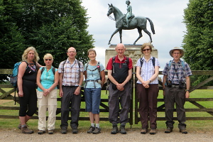
On Sunday 14th July, six regulars and one visitor from another group assembled at the Ranger's Gate car park in Windsor Great Park for a ten mile walk around the more southern areas of the park. Following Prince Consort's Drive, we passed the Ranger's Lodge, the Isle of Wight Pond and the York Club, before turning off at Sandpit Gate Lodge and heading east.

We stopped to admire the Queen Elizabeth II Golden Jubilee monument when a kind passer-by offered to take our photo by the monument. Continuing east, we turned south at Dark Wood to follow Duke's Lane.
Turning off Duke's Lane, passing through Millhill Plantation, crossing a footbridge and following the southern bank of Virginia Water, we reached a road bridge. Crossing this, we passed through heathland before crossing another bridge into the Valley Gardens.

Following the edge of Virginia Water, we reached the 100 foot high Canadian totem pole. Here we stopped for our picnic lunch as there were a couple of benches free next to the pole.
After lunch, we headed north to the Cumberland Obelisk, passing by Obelisk Pond on the way. The next stop was the Savill Garden Kitchen, where we stopped for coffee and cake, also making use of their convenient facilities while we were there.
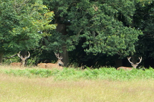
Heading north-west from the obelisk, we passed Smith's Lawn and Cumberland Lodge before joining the Three Castles Path heading up Snow Hill to the Copper Horse statue. On the way, we saw a few deer, eyeing us with mild disinterest. I expect they are quite used to people by now.
We admired the commanding view from the top of Snow Hill, which give a splendid view of Windsor Castle at the other end of The Long Walk. You could easily see Heathrow airport and just make out some of the London skyscrapers.
Turning to the west, we followed the road leading to the village, where we crossed Queen Anne's Ride. Looking one way we could see the castle and looking the other way, we could just see the Golden Jubilee statue that we'd passed near the start of the walk. We then retraced our steps back to the car park. See our route on Google Maps.
Walk 389 - Whitchuch, Laverstoke and Freefolk

We were in Whitchurch on Sunday 7th July. Not the Whitchurch near Pangbourne, where we often walk, but Whitchurch in Hampshire (between Andover and Basingstoke). Seven of us (4 BWs and 3 BWWs) met up at the station, five arriving by train, for an 8 mile walk inspired by the Whitchurch Mill Trail. My version of the walk was longer and included part of the Harrow Way but missed out a couple of mills.
We made our way south through the village and crossed the River Test by Town Mill. Corn was milled here as recently as 1940, but it has since been converted into a private house. Our route then followed the Test eastward out of the village. The river was hidden from us most of the time by the summer undergrowth. Leaving the Test, we crossed farm land and woodland to reach the hamlet of Laverstoke.
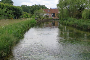
Laverstoke paper mill (15th century) once produced the paper used in Bank of England banknotes. Now it is home to the Bombay Sapphire gin distillery.
We crossed a field to the redundant Church of St Nicholas in nearby Freefolk. This tiny 13th century church contains a Jacobean tomb topped by recumbent effigy of Sir Richard Powlett who died in 1614. Leaving the church, we crossed some grassy fields and found a suitable spot for our picnic lunch.
After lunch we crossed the River Test near Bere Mill, which had also been a paper mill and is now a private residence. Another overgrown footpath took us up to the road, which we followed to the Watership Down Inn where we stopped for refreshment.
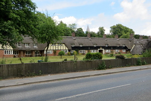
Leaving the pub, we passed a long terrace of thatched cottages. Designed in 1939, these terraced cottages and their impressively long thatched roof are a modern oddity.
We left Freefolk and headed uphill, passing through fields of wheat, barley and oats, on our way to the Harrow Way. This long-distance path was made up of a well-established footpath and a quiet lane.
We followed the Harrow Way westward for a while before taking a much less well-established footpath back to Whitchurch. A short bit of road walking brought us back to the station with ten minutes to spare before the next train home. See our route on Google Maps.


