Walk 419 - Marlow to Maidenhead on the Thames Path
This was the last walk we had before the Ramblers Association suspended all group walks in response to the Government's social distancing measures put in place on 16th March to prevent the spread of the COVID-19 virus. See https://www.ramblers.org.uk/volunteer-zone/coronavirus.aspx for more information.
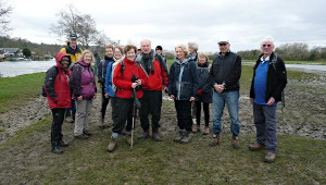
The Thames Path project, which planned to walk the Thames Path from Oxford to the Thames Barrier in London in fifteen sections led by local walking groups, has been dogged with problems. Many of the walks had to be cancelled, mostly because of the two significant storms in the early part of the year, and then the consequent flooding along various parts of the Thames. The project was just getting going again when the Coronavirus pandemic put a stop to it. Such a shame.
Seventeen people attended this walk, including members of SABRE, CWW and our group. I didn't get to go on this walk but I spoke to a couple of people who did and they said the Thames Path was still quite muddy from the recent floods, but it didn't spoil their enjoyment of the walk.
Thank you to Mark and Alan for leading this walk.
Walk 418 - Hook, North Warnborough, Greywell and Up Nately
Our previous walk was on Saturday 8th February, the day before Storm Ciara hit town. From that day, every walk in our programme had been cancelled due to storms and/or flooding. In fact, the walk we were supposed to be doing today (Saturday 7th March) along the Thames Path, had also fallen victim to the flooding and had been cancelled. So I came up with this walk as a last minute substitute.
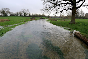
I decided to lead a walk that was outside the Thames Valley and in an area I was familiar with, so that I could make ad-hoc changes if paths were waterlogged. I was a little disappointed when only two people joined me for the walk, but in some ways I was relieved that I didn't have a huge party with me in case we ran into trouble with flooded paths on the route.
The three of us set off from Hook railway station and crossed the village along roads and alleyways to get to Holt Lane. This was the best route through Bartley Heath, which is boggy enough during a normal winter. Crossing the M3 motorway on a footbridge, our first challenge was the woodland path to North Warnborough. Every dip in the path was full of water, so frequent detours were required.
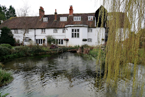
Next we followed a service road to the farm shop and then joined a footpath that followed the River Whitewarter. I had been nervous that this would be tricky, but despite the Whitewater being deeper and wider than I'd ever seen it, the footpath was fine. Crossing the road by the Mill House restaurant, which is built over the river and still has a water-wheel within, we stopped to look at the river level as it emerged from under the building. It was unusually high.
We followed the lane through Warnborough Green, where we encountered a number of highland cattle, who casually observed us as we passed by. The lane crossed the River Whitewater at a ford with a footbridge. The water was very high but not quite up to the bridge, so we were okay.

Joining the Basingstoke Canal at the swing bridge, we were relieved to see the canal was at its normal level. We followed the tow path to King John's Castle, where we stopped to have a look around and read the information boards. Continuing our route, we followed the canal towpath as far as the entrance of the Greywell Tunnel. Here we left the canal and popped into the Fox and Goose for a pint and a warm up by the log fire before heading up Greywell Hill. There was a massive trunk of a fallen oak tree to sit on while we ate our packed lunches and admired the view.
After lunch we followed the route of the tunnel through the woodland above it. Dropping down to the other entrance of the tunnel we followed a path that ran alongside an un-restored section of the canal that was now a nature reserve. Crossing the canal at the next bridge, we made our way to the hamlet of Up Nately.

We crossed back over the canal at another bridge and followed a track through woodland up to the M3. Here we passed over the motorway on a road bridge and followed the lane through farmland on our way to Newnham.
It was once we reached Newnham that the paths got really muddy. Firstly we crossed a very wet field at Owen's Farm and then followed a very muddy path back to Hook. Finally we were back in the village and we rinsed our boots in a stream and we had nice dry pavement back to the station. See our route on Google Maps.
My two companions on this walk had not walked in this area before and seemed to enjoy exploring it. Also the weather was relatively kind to us, with no rain at all, and a few glimpses of sunshine along the way.
Walk 417 - Dorchester-on-Thames to Wallingford and Back
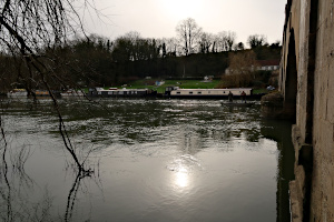
November last year, we were approached by Mark from the SABRE (Surrey and Beyond Ramblers) group who was organising a series of fifteen walks to follow the Thames Path from Oxford to the Thames Barrier at Woolwich. The Oxon Weekend Walkers, Chilterns Weekend Walkers and the Berkshire Weekend Walkers were invited to join in with this ambitious project.
The first two walks of the series were beset with problems - parts of the Thames Path in Oxfordshire were flooded and the OWWs also struggled to get leaders for their sections. So, the first walk to actually go ahead was the Dorchester-on-Thames to Wallingford section, which was led by Mark himself. The remaining eleven walks will be led by Mark, by us and by the CWWs.

Saturday 8th February was the day before Storm Ciara, which brought heavy rain and winds gusting to 60mph to large parts of the UK. By contrast, Saturday's weather was very pleasant. After a slightly overcast start, the sun broke through and the sky turned to the clear blue that you rarely see in Summer, but is more common on cold Winter's days. There was no hint of what Sunday was to bring.
Nineteen of us gathered in Dorchester-on-Thames, a mix of people from many different walking groups, some having travelled relatively long distances to attend the walk. This was my first face-to-face meeting with Mark, who I had been corresponding with since November, when the BWWs had been invited to contribute to the project. As we had both arrived quite early, we had time to chat as the other walkers arrived.

We set off from Dorchester, on a footpath that followed the River Thame to its confluence with the River Thames. The Thame is a tributary of the Thames, which rises in Buckinghamshire and discharges into the Thames just south of Dorchester. Here we joined the Thames Path, which showed the signs of recent flooding but the waters had receded and the path was slippery but quite passable. As we reached Shillingford, the Thames Path leaves the riverside and follows the main road into the village before rejoining the river at Shillingford Bridge.
The clouds had lifted by the time we reached Benson. We had a brief stop at the waterfront marina to have a drink and snack before we crossed the Thames at Benson Lock on the metal bridge over the weir.

We continued following the river's edge all the way to Wallingford. Here we left the Thames Path and went into town, stopping in the Market Square for lunch. Here, Mark made us aware of the shops and various cafes available to those who hadn't brought a packed lunch. There was just time for a few of us to have a swift half in The Dolphin pub before part two of the walk.
Only one person took the bus back to Dorchester, the rest of us electing to take Mark's cross country route. Heading west, we stopped at Kinecroft Park, site of the Bunkfest (a local music and beer festival) before leaving the town. We crossed numerous fields, all of which were thankfully less muddy that the leader had experienced during his pre-walk only two weeks earlier.
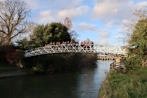
We stopped off at the Church of Saint Agatha in the village of Brightwell-cum-Sotwell. Our leader had read that one of the stained glass windows depicted a scene in which it appeared a character had three legs. We looked hard, but couldn't see any significant anatomical inaccuracies.
Next stop were the Sinodun Hills - Castle Hill (an Iron Age hill fort) and the slightly taller Round Hill, which are commonly known as Wittenham Clumps. Form here we could see the remains of Didcot Power Station, minus its already demolished cooling towers, and from the other side, we could see Dorchester and the Thames.
A rather slippery descent brought us to Little Wittenham, where we crossed the Thames once more and headed back to Dorchester. See our route on Google Maps.
Many thanks to Mark for leading this walk and for organising the Thames Path walk project.
Walk 416 - Hambleden, Turville, Fingest and Frieth

Sunday 2nd February saw twelve of us (including a few from the BW 20s & 30s group and a gentleman from the Oxford group) plus a dog gathering at Hambleden for a 12 mile walk.
We've done a number of walks from Hambleden over the years, but this is the first one I've been on where we started by heading south-west into Ridge Wood (crossing Skirmett Road). This woodland path then took us north-west and uphill for a couple of miles before it opened out into fields at Upper Woodend Farm.
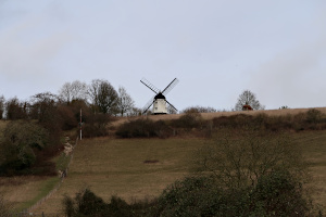
Continuing onwards and upwards, we reach Southend - not the seaside town in Essex but a tiny hamlet, high up in the Chiltern hills. It was a steep downhill followed by a steep uphill to Turville Court and then a slightly more gentle downhill to Turville village itself, overlooked as it is by the windmill on Turville Hill (as seen in the film Chitty Chitty Bang Bang).
Next, we passed through the hamlet of Fingest and stopped for lunch on a hillside overlooking Fingest and windmill on Turville Hill, with Fingest Wood behind us.
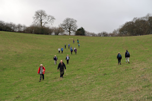
After lunch it was more uphill and downhill through woodland to reach Frieth, where we stopped for a drink at a very old-fashioned country pub, The Prince Albert. We sat outside as the tiny pub was packed inside. Then it was back through Frieth, south to Parmoor, followed by a long descent to Pheasant's Hill before eventually returning to Hambleden. See our route on Google Maps.
Although the weather was mostly overcast, there wasn't any rain and the views still looked good. The walk had taken nearly six hours, but as we'd set off soon after 10am, we were back by 4pm, with daylight to spare. The walk was quite a work-out, too, with around 700m (2,300ft) of ascent in total.
Thank you to Keith for leading this energetic walk.
Walk 415 - Warburg Nature Reserve and Stonor Park

On Sunday 26th January, we had a joint walk with the Pang Valley Ramblers group, which was led by Alistair and Pauline. We had twelve on this walk, which wasn't bad considering the weather forecast had been for a rather wet day. In actual fact, the rain held off for all but the last half hour of the walk, and even then, it was just a drizzle.
Starting from Middle Assendon, we followed a quiet lane to the remains of the medieval church at Bix Bottom. From there we followed the Chiltern Way uphill through Freedom Wood and Maidensgrove Scrubs, part of Warburg Nature Reserve. At the top, we continued following the Chiltern Way downhill through Park Wood and across a large field to Stonor village.

Next we followed the footpath through Stonor Park, stopping first to admire the manor house that has been home to the Stonor family for 850 years. Our leader gave us a brief lecture on the history of house and park. We stopped again in the picnic area of the park to eat our packed lunches before continuing on the footpath and out of the park. (We didn't see any deer, despite it being a deer park. However, we did see a large number of crows.)
We left the park following Shakespeare's Way as far as Kimble Wood, where had to pass under a fallen tree, which judging by the freshness of the splintered trunk, must have been a victim of the recent Storm Brendan.
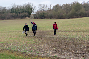
Our route double-backed so that we were now following a path that ran parallel to the one we'd taken through Stonor Park. At Coxlease Farm, we turned south and followed a ridge for about a mile before descending to the B480 road that runs through Middle Assendon. By now a light rain was falling, but we weren't far from the end of the walk. A short section of road walking brought us back to the cars. See our route on Google Maps.
We had started the walk promptly and not included a pub-stop, so we finished the 8-mile walk at around 2pm, before the rain had got going. The rain got steadily heavier as I drove home. I seem to remember the last walk Alistair and Pauline led for us also finished just before the heavy rain began. A pattern is beginning to form...
Thank you to Alistair and Pauline of the Pang Valley Ramblers for leading the walk and inviting us to join them.
Walk 414 - Woolley Green and Shottesbrooke

On Sunday 19th January, we were invited to join the Windsor and District group on an 8 mile walk around Cox Green, Woolley Green, Shottesbrooke Park and White Waltham. It was a crisp winter's day with clear blue skies and some crunchy half-frozen puddles.
There were twenty-three of us on the walk, a good mix of members of BWW and W&D groups plus a few people trying out the Ramblers. When we have this many people on a walk, it's a good idea to have a back marker, and I volunteered for this role. I was furnished with a copy of the route given to me by the leader, Joyce, before we set off. (I don't think I was an exemplary back marker, as I found myself gradually migrating to the middle on more than one occasion. Sorry!)
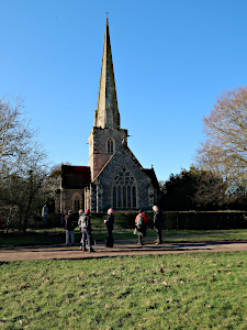
We set off from Ockwells Park and passed through Cox Green by following several roads before getting into open countryside. Then it was footpaths through fields taking us by Woolley Green and Littlewick Green to Shottesbrooke Park.
Passing the manor house, we stopped to admire the church of St John the Baptist, which has a tall, slender spire, reminiscent of Salisbury Cathedral. (We didn't go inside the church as it wasn't open.) Passing the pond, we left Shottesbrooke Park and made our way along a rather muddy footpath to White Waltham.
Here we stopped to eat our packed lunches, taking advantage of the benches by the cricket pavilion. A few of us took advantage of the pub opposite the cricket green. After lunch, we we followed some more footpaths that varied in degree of muddiness.

Although the scenery was quite varied along the way, much of the time was spent watching our feet to avoid a slipping over. There had been a lot of rain during the preceding week and it had left its mark on the landscape.
The last part of the walk had to be modified. Joyce had checked this part of the route before we set off and discovered that a footbridge we would have taken was partly submerged. So instead we retraced part of our outward route on the road, which was still icy in places. See our route on Google Maps.
Quite a few of us stopped at the cafe in Ockwells Park for a cuppa before going home. Joyce had made a ginger cake, cut into small pieces, which she'd passed around during lunch, and there was enough left over to have with our tea and coffee.
Thank you to Joyce from the W&D group for leading the walk, bringing the cake and for inviting the BWWs.
Walk 413 - Windsor Great Park
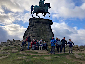
Our second walk of the year (and of the new decade) had twenty-two people on it, including several newcomers trying us out. The day was rain-free and mostly sunny. Although it had rained overnight, the paths weren't too muddy.
We started at the open air car park, near Queen Anne's Gate and joined the Long Walk about half way between Windsor Castle and the statue of George III on horseback (also known an the Copper Horse). We headed down the map, but up Snow Hill, to the statue.
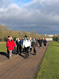
We stopped at the statue, to admire the view and get our breath back, before continuing south toward Cumberland Lodge. On the way, we saw a herd of deer who were quite unfazed by our presence, but they are very much used to people there.
Passing Cumberland Lodge, we followed a route that took us round behind the Savill Garden and then to the entrance, where we stopped to avail ourselves of the facilities. Stopping at the picnic area by the Cumberland Obelisk and Pond, we ate our packed lunches at the tables provided.
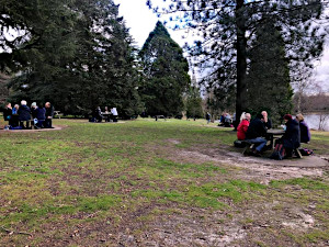
After lunch, we headed down toward the Valley Gardens, but didn't explore them this time. (We have done on other walks.) Instead we skirted the polo grounds at Smith's Lawn and made our way back to the Long Walk via a different route (Bishopsgate).
Heading back along the Long Walk, we retraced our steps back to the car park. See our route on Google Maps. Everyone had managed a good pace throughout the walk (which was a bit longer than advertised, but no one complained) so we're well on the way to burning off the Christmas calories.
Thank you to Lexi for leading the walk and providing the pictures for the scrapbook.
Walk 412 - Silchester and Pamber Forest

The first walk of the year (and the first walk of the decade) was attended by 22 eager walkers, some BWWs, some from other groups and several newcomers trying us out. We met up at the Wall Lane English Heritage car park and set off toward the West Gate of the remains of the Roman Town of Calleva Atrebatum.
We followed the ancient city wall to the North Gate, where we stopped to look at the information board. Then we continued along the wall until we'd nearly reached the East Gate, where we diverted to the amphitheatre, which is outside the city walls.

After exploring the amphitheatre, we passed through the grounds of the Church of Saint Mary the Virgin and back into Calleva Atrebatum where we saw a few alpacas. We followed the path that crosses the town from the East Gate to the West Gate where we made our exit.
Leaving the Roman town, we headed south and then south-west through farm land before following a couple of quiet lanes that took us around the outskirts of Silchester. Some more footpaths through mixed woodland took us into Pamber Forest.

A short way into the forest, we found some fallen trees to use as benches and had our packed lunches. Then we continued heading west on a forestry road and, just as it reached the western perimeter, we swapped onto another path, the Brenda Parker Way. This took us back through the forest in the direction of Silchester.
The path became quite muddy as we crossed Silchester Brook and its surrounding streams. An uphill stretch of footpath brought us into Silchester village, close to the Calleva Arms pub.

At this point, the group split into two. Most of us stopped off for refreshment at the pub while the others headed back to the car park, using a spare map I'd produced for such an occasion. We managed to find empty tables in the pub as we had fortuitously arrived as the Sunday lunch people were finishing up and leaving.
On leaving the pub, we followed the Brenda Parker Way back to Calleva Atrebatum and then took a short cut back to the car park. See our route on Google Maps. Although this walk was 6.5 miles long when I last led it in 2018, I added a little extra to it this time, making more like 7 miles. I don't think anyone minded as the weather was fine. (I wouldn't have done that if it was raining.)


