Walk 434 - Ewelme and Swyncombe Downs
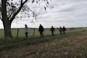
Autumn had noticeably started just before our walk on 27th September, with daily temperatures dropping by 10 degrees over the previous week. Gone were the tee-shirts and shorts and on went the fleeces and woollies. Six of us (including a recent joiner and a prospective new member) met up at an off-road parking area south of Britwell Salome in Oxfordshire (about 4 miles east-northeast of Wallingford) for a nine mile figure-of-eight walk led by Sharon.
We started by following the Swan's Way south from the parking area. This area is laced with good chalky paths, much loved by cyclists, of which we encountered quite a few. The open fields provided splendid views of the Chilterns, but exposed us to some stiff breezes on some parts of the walk. Very bracing!

Switching from the Swan's Way to the Chiltern Way we were now travelling north-west on a track called Potters Lane. Leaving the Chiltern Way, we crossed a couple of roads as we reached Rabbits Hill, where we stopped to admire the view before turning north and heading into the village of Ewelme. Here we re-joined the Chiltern Way, passing Church Farm where we saw some colossal Berkshire pigs, before completing the first loop of the figure-of-eight.
All of us stayed to do the second loop, which took us in the direction of Britwell Salome, a tiny village with a population of about 200 but has a church and a manor house. We didn't reach the village, but instead re-joined the Swan's Way and then switched to The Ridgeway at North Farm.
An uphill stretch took us to Dean Wood, where we found somewhere to eat our packed lunches. There was what looked like a disused horse jumping fence to sit on, surrounded by beech trees. As the wind blew through their leaves, the rustling sound was suggestive of the sea lapping a shingle shore.
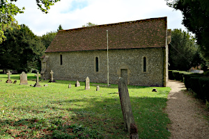
After lunch, we continued following The Ridgeway southward to Swyncombe House, where we stopped to look at the Grade II listed Church of Saint Botolph. We left The Ridgeway soon afterwards and followed Ladies Walk until it joined the Swan's Way which we followed north, back to where we'd started. See our route on Google Maps. We'd taken just under three-and-a-half hours (including the lunch stop) to complete nine miles with 1080 feet of ascent in total. Not bad!
Thank you to Sharon for leading this walk.
Walk 432 - White Hill, Overton and Watership Down

On Sunday 13th September, twelve of us gathered in the White Hill car park near Kingsclere on a warm and sunny day. Most of us were BWW regulars plus a couple of visitors from other groups. After the usual reminders of Covid-19 precautions, we set off on the Wayfarer's Walk, heading south-east and up hill to Walkeridge Farm.
Continuing on the Wayfarer's Walk, we passed a small camping and caravan site adjoining the farm as we descended through a tree-lined corridor towards the hamlet of North Oakley. Here we crossed through Manor Farm and then Freemantle Farm before leaving the Wayfarer's Walk as it crossed White Lane, near Patchbourne Wood. The route so far, was very similar to a walk I led in July, but that was about to change as we turned right and headed south-west along a byway through woodland.

The woodland gave way to open fields as we approached Ashe Warren Farm, and soon we were walking along quiet lanes. After a couple of junctions, we left the tarmac to join another byway, this one being part of the Harrow Way - an ancient trackway that crosses the south of England from Seaton in Devon to Dover in Kent.
We stopped off to have our picnic lunch in an adjacent field with views of the North Wessex Downs. The transmitter mast at Cottington's Hill was visible in the distance, acting as a marker of the area from which we'd started the walk. Soon after crossing the B3051, we left the Harrow Way, turning right and heading up hill and up the map. This path was lined by tall hedges that bore sloes, elderberries, hawthorn berries, rose hips and many other wild berries that we ought to have identified.

The path became a lane, which joined a minor road with a long straight section that we followed for about half a mile, carefully keeping out of the way of the occasional but fast road traffic. Leaving the road for a bridleway, we passed through woodland and then open fields. At Ashely Warren Farm, we passed a field of crops in which a few sheep were grazing. They looked up at us rather sheepishly (pun intended) making us wonder if they were actually supposed to be there!
Our route suddenly looked familiar to me again as we re-joined the Wayfarer's Walk where it passes the gallops on Watership Down. This we followed back to the car park on White Hill from where we'd started. See our route on Google Maps. We'd covered 12 miles and done 1,500 feet of ascent in total. I slept well that night!
Thank you to Lee for leading this walk.
Walk 431 - Greenham Common

On Sunday 6th September, six of us (including one potential new member) met up at the Control Tower car park at Greenham Common - once an RAF station and now a public recreation area and nature reserve. Although the sky was quite cloudy, it was warm with little wind, so no need for jackets.
We started off, heading east along the perimeter pathway - a well made gravel path that forms a wide rectangle around the remains of the old runway. As we approached Crookham Common, we diverted off the perimeter path to loop around the gravel pit ponds near Thornfold Park. Turning west at the old RAF Fuel Tank, we soon rejoined the perimeter path, which we followed westward until we'd passed the Business Park, where we turned south and looked for somewhere to stop for our picnic lunch.

We ate our sandwiches sitting on the heath near Brackenhurst. Continuing south after lunch, we came across an old fire plane, once used to train the ground crew to put out aircraft fires. It is a weird looking structure, made of sheet steel and vaguely aircraft-shaped. It sits in a pond, presumably to catch and collect the extinguisher foam.
Looping round, through the woodland of Brackenhurst, we rejoined the perimeter path and continued westward, passing the old missile silos, which have more recently been used as a film location for two recent Star Wars movies.
As the perimeter path turned north, we branched off to go further westward into woodland near Sandleford. Looping around, we emerged from the woodland and rejoined the perimeter path, heading east.

On this part of the route, we saw cattle and cyclists, and as we got closer to the car park, families playing by the ponds near Bury's Bank. We continued along this straight gravel path until we reached the Control Tower Cafe and the car park where we had started. See our route on Google Maps.
All but one of us had the time to stop for refreshments. The cafe is set up for outdoor use only at the moment, due to the Covid-19 restrictions. There was a cordoned one-way system guiding you to one window to order and pay and then another window to collect your drinks. The tables were placed with a good distance between them with notices asking people not to move them. This arrangement works well while the weather is good, but I imagine these places will struggle when winter comes.
Thank you to Jean-Paul for leading this walk.
Walk 430 - The Ridgeway, Bury Down and Blewbury

We had two walks on the August Bank Holiday weekend. I went to Monday's one, along with four others. Congregating at the Bury Lane car park on The Ridgeway near West Ilsley, we were surprised how warm it felt, with sunshine breaking through the cloud and virtually no wind. Off came the fleeces, before we'd started walking.
We set off, following the Ridgeway, westward on top of Bury Down, until we reached a junction of paths at East Hendred Down. We took a path heading north-east, which soon became a track and then a lane as it descended past the Rutherford Appleton Laboratory and arrived at the village of Chilton. After crossing the Chilton junction of the A34, we passed through the village itself. We saw a lot of new houses before passing the old cottages in the centre of the village and finally leaving via Place Farm.

We followed a track that crossed a dismantled railway and joined the Lynch Way at a tee-junction. After stopping for a water break, our leader (Lee) decided to give some map-reading tuition to one of our recent joiners. Holly then led us (voluntarily) to the little village of Upton and then to the larger, and very picturesque village of Blewbury, with its thatched cob walls, before handing back the map.
After a brief discussion, a unanimous decision was made to visit the Red Lion pub for refreshment in their garden. A mid-walk pub-stop is a rare treat these days, and only occurs if everyone is agreeable. Many of us are understandably cautious about visiting populated places. Refreshed, we continued our route, heading south out of the village and up Churn Hill, stopping to admire the view of Blewburton Hill (a hillfort).

Throughout the walk, we noticed an abundance of berries on hawthorn and blackthorn bushes. We spotted people picking the sloes to make sloe gin. The old fashioned rule is to pick them after the first frost, however this year they were ripe much earlier than normal and you can always pop them in the freezer to simulate a good frost.
Coming down the other side of Churn Hill, we passed a field of sunflowers and borage, often seen growing together, and then a field of maize. Crossing through some gallops, it was uphill again at Blewbury Down and Compton Downs, and we were back on the Ridgeway again. Passing through a tunnel under the A34, we were back on Bury Down and soon at the car park. See our route on Google Maps. With twelve miles and 460 m (1,500 ft) of ascent in total, it had been a good work out!
Thank you to Lee for leading this walk and to Holly for navigating from Chilton to Blewbury.
Walk 428 - Wallingford, North Stoke and Grim's Ditch
Wallingford's Riverside Car Park on a bright and breezy August morning: an empty and sad-looking outdoor swimming pool surrounded by a razor wire-topped security fence; a family inflating paddle boards and canoes for a day on the Thames; seven Berkshire Weekend Walkers getting ready for a 10.5 mile walk.
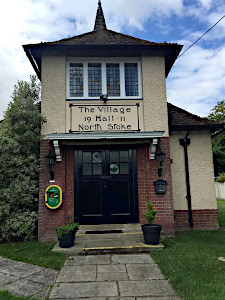
The first few miles of our walk were on named paths: the Thames Path to the Wallingford ring road bridge over the river and then the Ridgeway to North Stoke. Here there was the chance for an early coffee break in the garden of the village hall, a sign above the hall's door proudly announcing that the it had been built in 1911. I wonder how many walkers have stopped here for a coffee or tea break in the intervening one hundred and nine years?
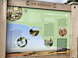
We left the course of the Thames at Littlestoke Manor on another named path - the Swan's Way - as we gently climbed up and over a chalk downland landscape of large fields of recently harvested arable crops and past Watch Folly, present on the Ordnance Survey map but no longer present on the ground.
After having survived the first of two crossings of the A4074, we stopped for lunch at the tiny village of Ipsden.

There wasn't a cricket match being played on the green, so we had to be content with admiring the distant view of what remains of Didcot Power Station.
After lunch we walked north, resisting the temptations of the King William IV pub at Hailey. Just over a mile after Hailey (and still thirsty) we reached the iron age linear fortification - or boundary marker - known as Grim's Ditch. Just as on the recce for this walk, our arrival coincided with the appearance of black clouds and a - thankfully short - shower. Waterproofs were on and then off as we followed Grim's Ditch back towards our second crossing of the A4074. Once again, we all survived and were now honing in on the finish. Past a caravan park, across a water meadow and, quite suddenly, there was Wallingford Bridge and the Riverside Car Park.
Thank you to Nigel for leading this walk and writing it up, and to Sharon for providing the photographs.
Walk 427 - Ecchinswell, Sydmonton and Ladle Hill
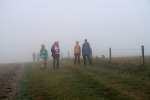
If I had to choose one word to describe our walk on Saturday 16th August, it would be "misty". Nine of us, including two leaders, met up at Ecchinswell Village Hall and recreation ground for this hilly walk, promising spectacular views from Ladle Hill and the Wayfarer's Walk. Well... we got the hills, even if we didn't get the views.
We set off heading west through fields and woods before following turning south to follow a lane and then a track, taking us into the Sydmonton estate. Passing 'Laundry Cottages', we continued on the track as it curved westward to Wergs Farm. Here we followed a quiet lane southward before trudging up a long footpath that rose 330 feet in elevation in about a mile. Joining the Wayfarer's Walk, we continued upward to Ladle Hill, the site of an iron-age hill fort, now just earth works.

We diverted from the path to explore Ladle Hill and observe the promised views. In fact, it was so misty that we had trouble seeing one side of the earth works from the other, let alone see anything of the Sydmonton estate. The grassy hillocks and the sheep appearing out of the mist made it feel a bit like Dartmoor or The Lake District. Anyway, we stopped here to eat our lunch, without a spectacular view to admire.
After lunch, we rejoined the Wayfarer's Walk and continued eastward for about a mile before heading down a steep path into Sydmonton. We walked along the path that passes Sydmonton Court and rejoined the track we had taken in the morning. We turned off before reaching 'Laundry Cottages' and went north-eastward, passing Watership Farm, until we reached Ecchinswell Road.

Although we could have turned left and been back at the car park in half a mile, we turned right and then took a steep footpath up to Nuthanger Farm. Here we stopped for a chat about Richard Adams' book, Watership Down, which features a number of identifiable locations in this area. From the top of the hill, we should have been able to look across the valley and see Watership Down and Ladle Hill, but not only was it too misty, but the maize in the field in front of us was over six feet tall.
Heading back down, past Nuthanger Copse, we crossed a road and a field, before taking a footpath back into Ecchinsell. A short bit of road walking took us past an old mill and a school, back to the car park. See our route on Google Maps. We all agreed that Mike and Alison should lead this lovely walk again, when the visibility is better.
Thank you to Mike and Alison for leading this misty and hilly walk.
Walk 426 - Cookhamdean Common and Bisham Woods
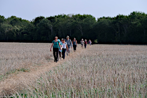
Sunday 9th August was in the middle of a six-day heatwave, with daily afternoon temperatures in the thirties Celsius. Sensibly, Jane decided to lead her walk starting at 9:30, an hour earlier than originally planned, so that we could complete the walk before it got too hot to walk in comfort.
Eleven of us met up at Cookham railway station for a six and a half mile walk that would include 470 metres of ascent. It seemed both strange and familiar to be in a group of eleven walkers, as group sizes have been limited to six (including the leader) since our walks restarted in July. The Ramblers decided to increase the limit in August to thirty! We feel that thirty is far too large a group to lead, while still trying to maintain social distancing, so we imposed our own limit of twelve for this walk.

The sky was a little hazy and there was a pleasant breeze as we left the station at Cookham Rise. We crossed the recreation ground and followed footpath signs through a housing estate, coming out into the countryside at Lower Mount Farm. Next, our route took us through several large fields before entering some woodland, where the shade was much appreciated.
Emerging from the wood, we crossed Cookhamdean Common and some farmland before getting back into the shade of Inkydown Wood, Fultness Wood and Quarry Wood. A few steep slopes took the path up high, occasionally giving views across the Thames to Marlow, and bring us out of the wood at Winter Hill. There is usually an ice cream van waiting in a lay-by here, but sadly not today!
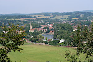
We ate our packed lunches here, sitting on the ridge with views of Westhorpe Park boating lake and Little Marlow, before heading south into the picturesque hamlet of Cookham Dean. We turned off the road by the church and followed a track down the hill and back to Cookham station, this time passing by some of the more up-market houses in the village. See our route on Google Maps.
The early start to this walk had paid off, as we finished the walk at about 12:45, before the real heat of the day had built up. I think we may do a few more early starts before the summer is out. It's easier to get up early this time of year and an early start means less traffic on the roads and fewer people about. Also, an early finish means there is more of the day left to do other things - if it isn't too hot!
Thank you to Jane for leading this walk.
Walk 425 - Dunsden Green, Binfield Heath and Crowsley Park
Thanks to changes in the Ramblers Covid-19 guidance issued at the very end of July, on 2nd August six walkers could become seven on this circular walk starting at Emmer Green on the northern edge of Reading.
Leaving the car park next to Caversham Park Tennis Club - where practice for next year's Wimbledon seemed to be in full swing - we walked past Loddon Brewery heading for Dunsden Green. An information board on the Green told us that poet Wilfred Owen had spent several weeks here in the summer of 1911. This attractive hamlet of southern England would have been a world away from the horrors that he was to face on the Western Front just a few summers later.
Leaving Dunsden Green we passed through fields of corn, wheat, barley and flax as footpaths took us in the general direction of Shiplake. We took care as we passed by Sunday morning leisure walkers and Shiplake dog walkers - and their ever happy dogs - all, like us, enjoying the warm sun.

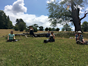
Not feeling well enough dressed for passing by the grounds of Shiplake College, we veered off north through Shiplake Woods and then through High Wood to the Bottle and Glass pub at Binfield Heath. Entry to the lovely pub garden has to be by pre-booked appointment in this Covid-19 summer. No pub lunch for us and so we walked on to our own picnic lunch stop in Crowsley Park.
The leader earned points for the attractiveness of the lunch stop but was in danger of losing them as rain drops started to fall. A two percent chance of rain doesn't mean it cannot rain. Luckily for the leader's credibility - and for those without waterproofs - the single offending rain-cloud quickly moved on.
There was just an hour's walking after lunch as we headed back to our starting point. The northern edge of Reading always arrives unannounced; it is a pleasant surprise that the countryside can be so attractive just a few hundred yards before the houses of Caversham Park and the Reading traffic re-appear.
Thank you to Nigel for leading his first walk for us and for writing it up afterwards.
Walk 424 - Upper and Lower Basildon

On Sunday 26th July, we had a walk with two leaders. This meant that we could do the walk as two separate groups of six people, allowing twelve of us to go walking without infringing the current regulations. One group started at 10:00 and the other group at 10:30, so that we wouldn't meet. I was in the 10:00 group.
From Upper Basildon, we went south down Gardeners Lane and east through Knapp's Wood. Next we followed a lane past a couple of farms and onto to Pangbourne Road. We weren't on the busy road for long, taking a footpath through Barnard's Copse, Berry's Copse and emerging from Sot's Hole onto Shooters Hill.
Here we came across the Berkshire Walkers 20s and 30s group, who where on a walk of their own, going the other way. We chatted briefly - at a respectable distance!
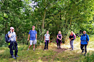
Crossing the road, we joined the tow path that runs along the Thames between Pangbourne and Lower Basildon, on the opposite bank from the official Thames Path. We passed many fishermen along the way as we followed this path to Lower Basildon, where it left the river and took us to St. Bartholomew's Church.
Here is the resting place of Jethro Tull, the 17th century agricultural pioneer who invented the seed drill, not the 1970's progressive rock band! We had a quick look inside the church before heading off along the lane up to the A329.
We followed this busy road for a short distance before taking a footpath past Hillfields Farm to Harley Hill Wood. Here we stopped for our picnic lunch, while our other group stopped for their lunch by the Thames.

After lunch, we followed the western perimeter of Basildon Park on a quiet lane and then took footpaths through farmland until we arrived back in Upper Basildon, where we'd started. See our route on Google Maps.
The weather had been mostly good. After a sunny start, we had a brief rain shower, lasting long enough for us to put on waterproof jackets before it was replaced by sunshine again - a pattern that had repeated itself from time to time throughout the morning, but none of the showers were heavy.
It was good to have seen the Berkshire Walkers out walking. Not many of the local groups have restarted yet. In fact they met both of our groups on their route, whereas our two groups didn't meet each other at all. This method of doing one walk with two groups, half an hour apart, worked very well and is certainly worth doing again.
Thank you to Ann and Kathy for leading this walk.
Walk 422 - Hurley and Ashley Hill

On Sunday 12th July, six of us met up in Hurley Village, which was remarkably crowded. It was a warm, sunny day and I expect people were keen to get out now that it is permitted as lock-down is being eased. Luckily most of our walk would be away from the crowded areas.
We started off, heading eastward through a static caravan park and then through fields toward Temple Park. Then we joined the Thames Path near Temple Lock, heading west, towards Hurley Lock. The Thames Path was crowded but we managed to maintain social distancing most of the time. The path got wider as we headed away from Hurley.
We came across an elderly gentleman feeding the swans. I think he must do this regularly, as the swans and their cygnets headed straight toward him as he arrived.

We left the Thames Path (and the crowds) at Frogmill Farm, taking a track up to Henley Road and crossing it to join a footpath heading south and uphill. We diverted onto some very well-kept permissive paths through Juddmonte Farms (a horse breeding farm, owned by Prince Khalid bin Abdullah of Saudi Arabia) and then joined the Chiltern Way.
We sat down to eat our packed lunches by Channers wood. Following the edge of the wood, we made our way to Top Farm before heading up Ashley Hill. We pass the Dewdrop Inn on our way, but we're not going into pubs on our walks at the moment. After a pleasant walk down the east side of Ashley Hill, we turned north and followed a track into the expansive grounds of the Berkshire College of Agriculture.

Passing the rather grand Hall Place and walking through the BCA zoo, we then took a small detour to see the statue of Diana the Huntress. Next we followed a wide and grassy path up to High Wood, which enjoyed views of Ashley Hill to the south and Speen Hill to the east. After crossing through the wood, we then had views to the north, looking over Hurley and the Thames to Danesfiled and the Chiltern Hills the other side.
A steep path took us down to Hurley Bottom. We cross Henley Road again before returning to Hurley Village, which was as crowded as ever. See our route on Google Maps. The walk had been a good eight miles that had included a total 515 metres of ascent - and it felt like it once I'd got home!
Thank you to Lawrence for leading this walk.
Walk 421 - Hannington, North Oakley and Cottington's Hill

On Sunday 5th July, we had our first official BWW walk since lock-down began in March. There are now special restrictions to help prevent the spread of Covid-19, which mean that no more than six people (including the leader) can attend a walk. All attendees have to book a place on the walk, in advance and provide contact details. Also, social distancing measures are to be in place and extra care is needed when handling gates and stiles, etc.
Many other walking groups have not restarted their walks yet, so we were rather cautious of how well this would work for us. There was a possibility that no one would want to go on group walks yet, or alternatively we would be inundated with people from all the local groups desperate to get walking again.
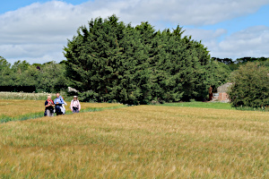
We had five people, including me (the leader) on this walk, although we did hear from a few others who would have liked to attend but weren't available this time. We started at 10:00 from the free car park on White Hill, south of Kingsclere, and followed the Wayfarer's Walk south-eastward to North Oakley.
I had advertised this walk as 7 miles with an option to extend to 8.5 miles. We stopped in North Oakley to decide whether to stay on the Wayfarer's Walk and take the longer route or to stick to the original shorter route. Being a small group, it was easy to make such decisions and get a unanimous agreement, which was to continue on the longer route. We passed through Freemantle Farm and a newish tree plantation before reaching White Lane, where we left the Wayfarer's Walk.

We followed White Lane to a crossroads where we turned left onto Hannington Road, which we followed north before taking a footpath through Warren Bottom Copse. It was too late in the year to see the bluebells that usually populate these woods in May/June time. Soon we were entering the picturesque village of Hannington, where we stopped on the green to eat our packed lunches (after sanitising our hands).
We decided to take the scenic route back through the woodland on Freemantle Park Down, by Cottington's Hill, which returned us to the car park on a permissive path with a nice view of Watership Down. See our route on Google Maps.
It felt quite like old times, walking in an organised group; the main difference being that we had to leave bigger gaps when passing other people.
I'd like to thanks all those who came on my walk and complied so readily with the new restrictions.


