Walk 444 - Great Bedwyn and Shalbourne
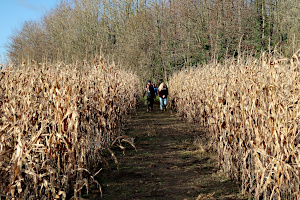
On Saturday 12th December, six of us met up at Bedwyn railway station in Great Bedwyn for the first walk to be led for us by Ian, a relatively new member of the group. During the November lock-down, Ian took advantage of the rule allowing him to go out by himself for exercise, to explore this area and devise new walks for the group.
Leaving the station, we joined Brook Street as it crosses the railway line, the River Dun and the Kennet & Avon Canal on an undulating multiple bridge. Soon afterwards, we left the road to follow a footpath heading southwards through woodland and fields.

Our route took us from Jockey Green, through Castle Copse, Folly Farm, Webb's Gully and Newtown Farm, before bringing us to the pleasant little village of Shalbourne. Here we stopped for a snack break - it was too early for lunch. Some of us bought cups of tea from the local shop, while others had brought flasks. We sat on the benches on the green, next to a decorated tree, to enjoy the moment.
Suitably refreshed, we walked along the main road through the village, winding its way between the various buildings, both ancient and modern. On reaching a bend in the road, flanked by thatched houses, we turned off onto a muddy footpath leading us down to some watercress beds. At this point the leader realised that we should be looking at a church and not watercress beds, so we returned to the road. (We hadn't gone far, so it didn't take long.)

The next bend in the road revealed another, similar-looking footpath. This was the one we wanted and it did indeed lead us to the fine looking old church of St Michael and All Angels. We didn't wander in with our muddy boots.
Soon we were crossing the countryside again, following the course of a stream to Eastcourt Farm and then heading up to Upper Slope End Farm. Entering Stype Wood, we followed a very long and very straight track called Long Walk. We think this may have been the entrance drive to Stype Grange at one time. Nowadays, easier access would be from a nearby road on the other side of the grange.

A quiet lane took us from Stype Wood down to the Kennet & Avon Canal, just north of Little Bedwyn. We followed the towpath through Little Bedwyn, passed Potter's Lock and back to Great Bedwyn. The low sun ahead of us reflected on the surface of the canal, making it look like molten silver in an ingot mould. Or perhaps not! Anyway, there were a couple of young women paddle-boarding along the canal ahead of us. We kept pace with them most of the way back to Great Bedwyn.
I thought this was an excellent walk and had gone very well for this leader's first walk. (See our route on Google Maps.) Ian has planned some other walks in this area, but we will have to wait a while before we can enjoy those walks. The current Coronavirus situation means that we have had to suspend all group walks for the time being.
Thank you to Ian for leading this walk - his first for the BWWs.
Walk 441 - Ascot and Great Pond

A group of 9 of us met at one of the car parks at Ascot racecourse. We were most fortunate for it to stay dry throughout the walk given the forecast and previous days heavy rain and winds.
We took a left along Winkfield Road (A330) and short way down crossed to take a footpath along the Old Straight Mile. This led to the ornate Golden Gates adjoining a lodge a listed building (1879) and marks the original straight mile of the course. From there we entered the lanes of Cheapside before turning into Sunninghill Park, part of Windsor Forest until 1630. The 19th century house in the grounds was once the residence of the Duke and Duchess of York, and sold for over fifteen million pounds.
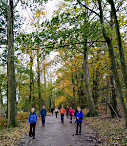
Crossing a meadow, we entered Wood End and following tracks emerged onto the main road. Taking a path beside the Crispin pub we walked along the lanes and hamlet of Woodside with its many distinctive properties. At its heart another two country pubs that as a group we have visited before and well recommended.
We took a track in between houses, which narrowed besides hedgerows then through swing gates leading to a field and paddocks. Here we encountered some standing water following the recent heavy rains requiring some negotiating around.
Emerging onto a road and passing some houses, we turned into Mill Ride Golf Club, which is an old coach road. Part way along a track leads to an estate and leads to an avenue of stately Wellingtonias and follows in reverse direction the Three Castles Path, a 60 mile long distance route from Windsor to Winchester, which continues across the road and onto the racecourse.

We followed the waymarkers, which include a section of the historic Church Path, then on under the subway and taking a flight of steps we crossed the new straight mile course a permitted path.The first Ascot meet was August 1711 founded by Queen Ann as she thought it would be a good place to gallop horses. The first race named "Her Majesty's Plate" had a prize worth 100 guineas. The racecourse has been synonymous with the Royal Family ever since.
From here we were back onto Winkfield Road and at the end reached the car park where we'd started. As we enter another period of "lockdown" we reflected on how this may be the last BWW walk for a while, we appreciate not just the countryside but the group as a whole and will all miss it, but hopefully to meet again soon.
Thank you to Kathy for leading the walk and for writing it up.
Walk 439 - Whitchurch-on-Thames
On Sunday 25th October, twelve of us (including a visitor trying out the group) met up in the car park outside the village hall in Pangbourne. It was surprisingly warm and sunny, considering we'd had a downpour only an hour earlier and the previous day had brought us 40mm of rain and winds gusting to 45mph.
The walk was a modified version of one I've led before and started with a quick trip through Pangbourne village centre before crossing the toll bridge into Whitchurch-on-Thames. Rather than following the main road through Whitchurch, we took a detour via the Church of St Mary the Virgin. Back on the main road, we headed up the hill before branching off onto the Hartslock Bridleway (also the Thames Path). The path then took a seriously steep dip and rise before entering Hartslock Wood.

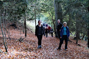
Here the Thames Path follows the river, high up on a narrow path on a steep wooded bank. The mixture of trees meant that there were leaves of every shade of autumn colour and a carpet of fallen leaves beneath us. Occasionally we passed people coming the other way, which required some careful footwork to prevent a tumble down the steep bank! Fortunately the path widened as we entered Lower Hartslock Wood.
As the Thames Path left Lower Hartslock Wood, we left the Thames Path by heading up a very steep grassy path to the top of the dome-shaped Hatton Hill. Stopping to get our breath back, we also took the opportunity to admire the view of the Thames and Chiltern Hills. Next, we walked up a steep road to Upper Gatehampton Farm and followed a path leading to Great Chalk Wood.

Just before entering the wood, we stopped for our picnic lunch, sitting in the sunshine in an empty grassy field. It wasn't until later that someone pointed out that there was a sign on the gate through which we'd entered the field saying Beware of the Bull! It might have been more accurate if it had said Beware of the Wasp as a solitary stripy nuisance paid us too much attention while we tucked into our packed lunches.
Walking through Great Chalk Wood, there were so many autumn colours on display, plus quite a few muddy puddles, so walking along while looking up at the trees was a little bit hazardous. We joined the Chiltern Way and followed that very briefly before heading out of the wood at Stapnall's Farm and following a quiet lane to Cold Harbour. We left the lane near Furzemoor Plantation and headed south across a field of cows.

Next came the weird wood. This has a clearly defined path into it, which leads you to a clearing with no obvious route out. Being the consummate professional that I am, I'd done a pre-walk and so knew how to find the way out. It emerged into Beech Farm, where we followed a well defined path through the farmland to join the main road into Whitchurch. A light rain began to fall as we passed through the farmland, but it only lasted long enough for us all to put on our rainproof jackets before it stopped again.
We followed the road through Whitchurch and across the toll bridge back into Pangbourne. Here we took an alleyway that bypassed the village centre and emerged opposite the railway station - just as the train back to Reading was leaving! It would be an hour until the next one. The rest of us walked the short distance to the car park and said our goodbyes. See our route on Google Maps.
Walk 438 - Old Windsor and Runnymede

This was the second of the two walks on the weekend of 17th/18th October.

The autumn colours and a dry day with a little early mist made for an enjoyable walk today.
With eleven walkers (four were guests) we left the recreation ground in Old Windsor, headed down to the River Thames and followed the path to Runnymede.
We saw the really large owl at one house, and then each of us were choosing a property (or two) along the way that we would like to live in!
We then had a history lesson at the Jurors Chairs and Magna Carta followed by a unanimous dislike of the "Writ in Water" art installation addition - funded by National Lottery and Arts Council.

It was a steady climb thereafter up Coopers Hill to the RAF Memorial for visit and lunch stop.
From there we descended to the village of Englefield Green and a short road walk before taking tracks, fields and lanes to arrive above Runnymede and the JFK Memorial.
Following a little more history we walked back over the meadow and rejoined the river, retracing our steps back to the start.
Thank you to Kathy for leading this walk and providing the photos and write-up.
Walk 437 - Greenham Common and Headley

We had two walks on the weekend of 17th/18th October. I went to the 13.5 mile walk on Saturday, along with five other people including Lee (the leader) and Dan, a visitor from the BW 20s & 30s group. In fact, most of us there had been members of the BWs years ago, before transferring to the BWWs, so Dan was amongst old friends.
The walk started from Thatcham railway station and immediately joined the Kennet & Avon Canal, heading west. After about half a mile, we crossed the canal on a swing bridge and took a footpath that passed Chamberhouse Farm and headed uphill through woodland to Greenham Common. Crossing the common, we reached the last remaining section of the 10,000 feet long runway, that was once the longest in Europe. Most of it was dug up when RAF Greenham Common was closed.
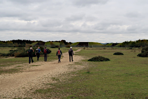
After a brief discussion, we decided to take a slight detour and stop for a hot drink at the Control Tower Cafe, now set up for outdoor operation only, due to the Coronavirus restrictions. Warmed by our drinks, we carried on heading west and then south towards the grass-topped concrete hangers that once housed American long-range bomber aircraft and more recently appeared in two Star Wars films. From there, we made our way to the old Fire Plane, once used to train fire fighting crews.
Leaving Greenham Common through some woodland, we followed the busy A339 eastward to a roundabout, where we then followed a quieter road into Bishop's Green. A narrow alley took us from the road into the woodland of Sydmonton Common. After another brief discussion, we decided to take the longer and more scenic route.

Here we stopped by a tributary of the River Enbourne for a socially-distanced picnic. Then, a mile or so of woodland walking took us through Sydmonton Common, which was quite hilly. A bit of road walking took us to more woodland, this time in Headley. Crossing the very busy A339 once again, we then walked along the long but quiet Ashford Hill Road, turning off after about a mile to reach Hill View Farm.
Crossing a large cow field, Lee decided to let me go on ahead, with directions to keep to the footpath. Meanwhile, he seemed to be heading in a different direction. It soon became obvious that the directions he'd given us would have meant crossing a style into an adjacent field and then crossing back into the first field a few metres later. Needless to say, we skipped that rather pointless part of the route and followed Lee.
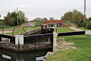
A steep path through woodland took us up Huntsmoor Hill, where we joined the Benda Parker Way. This led us through farmland and then through the garden of a rather large private house, complete with tennis court. No sign of any tennis players.
We continued following the Brenda Parker Way until it crossed the River Enborne. Several more miles of footpath and road walking took us through woodland and farmland as we made our way north to Midgeham Lock. We started watching a very wide narrow-boat negotiating the lock, but decided to press on as it was getting late, and followed the tow path back to Thatcham. See our route on Google Maps. It was gone 5pm when we finished, and with all our optional detours, the length of the walk was 15 miles with 620m (over 2000ft) of ascent in total. I was quite tired after that!
Thank you to Lee for leading this walk.
Walk 436 - Goring, Moulsford and Aldworth

Six of us met up on Sunday 11th October in Goring-on-Thames for a 12 mile walk with lots of hills - and a pub-stop! A rare thing for us these days, and the Key reason why this walk had a limit of six people (including the leader).
We left the Orchard Wheel car park and followed the High Street as it crossed the River Thames to Streatley. We followed the Thames Path as it headed north on the west side of the Thames. We didn't see many people on the path, just one lone fisherman, but a few boats passed by on the river.
On reaching Moulsford we left the waterside by the Beetle and Wedge pub. This had been the easy bit of the walk before we started crossing all of those contour lines!
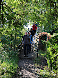
It was uphill through the village of Moulsford and more uphill as we headed out into countryside and to Shortlands Hill and Kingstanding Hill. Then came a little bit of downhill to Starveall Farm followed by a lovely walk through the valley of Unhill Bottom, with Unhill Wood on the left and North Unhill Bank on the right. Some of trees were sporting leaves of red and yellow.
Suddenly the footpath disappeared as we passed from a field of crops into a very recently ploughed field. Luckily the earth was quite dry, but it was still hard work - like walking on a sandy beach. When the footpath returned, it went up a long hill. The path finally levelled out and went into a wood. We found some fallen trees to use as benches to sit on and have our picnic lunch.
After lunch, we very briefly joined The Ridgeway and left it again to follow a route to Aldworth, where we visited The Bell Inn. We didn't enter the actual pub at all, as there was a desk outside the front door where we ordered and payed for our drinks, which were brought out to us. We carried them to the pub garden, were the tables were appropriately spaced apart - some under cover of a large marquee. There were hand sanitiser dispensers all around and there were outside toilets, so no one (except staff) went into the pub. That's probably as safe as it gets.
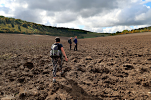
Suitably refreshed, we left Aldworth and crossed a couple of fields into Westridge Green and then descended into a valley where we passed Kiddington Cottage. Here we saw a strange sight - a motorised box made its way across the lawn and approached us quite closely before turning round and trundling back to the house. We think it must have been a robot lawn mower, but it was almost silent and the grass behind it seemed relatively unchanged. Maybe it was sent out to observe us.
Reaching Rectory Road, we passed Thurle Grange before turning off to cross Goring and Streatley golf course on a very steep path to the top of Streatley hill. The ascent involved ringing a bell at intervals to warn the golfers that we were potentially in their line of fire! We made it to the top without incident.

At the top, we turned sharp left onto Lardon Chase, where we enjoyed some good views before taking the steep descent into Streatley. Emerging near the Bull Inn we crossed the main road and then the Thames on the same bridge as we'd used on the way out. We didn't retrace our outward route exactly, but left the High Street to pass through the grounds of St Thomas's Church and then made our way back to the car park via Station Road. See our route on Google Maps.
During the twelve miles, we'd done about 610 metres (nearly 2000 feet) of ascent in total. My legs and feet were fizzing! We'd been very lucky with the weather, which had been mild for the time of year, and despite the appearance of some grey clouds in the afternoon, not a drop of rain had fallen all day.
Thank you to Mike for leading this walk.
Walk 435 - Wargrave, Crazies Hill and Bowsey Hill

Holly led her first walk for us on Sunday 4th October. It had been a very wet weekend, with Yellow flood warnings issued by the Met Office and over 100mm of rain having fallen over the past couple of days. Nevertheless, twelve of us gathered at Wargrave station to do this seven mile walk, in which muddy fields and waterlogged paths would be guaranteed!
We started with some road walking from the station and through the village. This wasn't without hazard as there were large puddles in the road that cars would spray high into the air. From the High Street, we followed School Lane and turned off into Dark Lane - not as sinister as it sounds, just a quiet residential road. This led us to Blakes Road before we took a very straight road with a high hedge along one side called Crazies Hill (the road, not the hedge).
Behind this huge hedge was a large ornamental pond and behind that was Wargrave Manor, but we couldn't see either of them. We turned right into Highfield Lane and then onto a footpath through fields that took us to, and then through, Hennerton Golf Course.
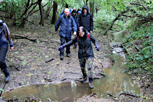
A steep uphill section led us away from the golf course and onto Worleys Lane, which we followed briefly before passing through a footpath enclosed by trees, like a green tunnel, emerging at Crazies Hill village. Here we joined the Chiltern Way, which led us into High Knowl Wood. This mixed woodland was picturesque, despite the dismal weather, but we noticed more than the usual number of streams flowing through it.

We stopped off to eat our packed lunches when we'd reached a crossroads quite near the top of Bowsey Hill. It seemed an opportune moment to do so, as the rain had stopped. The occasional passing dog took an interest in our lunch before being called away by their slightly embarrassed owners.
The path back down the hill was muddy and occasionally divided by a stream. One or two of these needed a bit of concentration to cross. Once we were out of the woods, we crossed an extremely muddy field near Highfield Park. The leader assured me that this had been a nice solid path through a field of maize only a few weeks before, but the crops had gone and the rain had arrived.
Back on Blakes Road, we retraced our steps through Dark Lane and School Lane back to the High Street. See our route on Google Maps. Here, half of the group stopped off at The Bull for some refreshment while the other half made their way back to the station car park. We were the only people in the pub garden. Hardly surprising in such weather, but at least we were suitably dressed for it.
Thank you to Holly for leading this walk and to Lawrence for recording the route on his GPS. I forgot to do so myself.


