Walk 462 - Aldermaston and Padworth Common

Wading through a jungle of bracken.
Sunday 20th June: From Aldermaston Wharf across the Kennet at Padworth Mill and joining Fisherman's Lane to emerge at Aldermaston and then continue on our path across farmland where encounters with long, lank herbage and an agitated herd of cows and their offspring made for a lively start on an overcast morning.
We welcomed the sodden but secure path south alongside Paices Wood country park and finally emerged onto the A340 at the edge of Tadley. A brief inspection of AWE perimeter fence and a by-way took us east and we eventually emerged by the SSSI Decoy Heath. Its abundant Damsel and Dragonflies sadly not airborne.

Group photo on the Aldermaston and Padworth Common walk.
South then to the Hants/Berks boundary at Padworth Common where we took lunch, got slightly lost and headed south on tracks and over farmland to reach the ruins of St John the Baptist church. Once sited in what was known as Ufton Nervet but now in Ufton Green (a long story).
Onward to reach the Kennet towpath at Tyle Mill and back to Aldermaston Wharf past the alas temporarily closed Kennet Trust tea-room. See our route on Google Maps.
All seemed to enjoy the walk despite the going being harder than expected for the time of year and further than advertised.
Thank you to Keith for leading the walk and providing the write-up.
Walk 461 - Kintbury and Inkpen Common
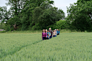
Crossing a wheat field near Inkpen Common.
Finding somewhere to park in Kintbury on Saturday 19th June proved more difficult than expected, as two other walking groups were starting their walks from the same village. Luckily, most of our group arrived by train, so we didn't contribute too much to the parking problem. There were eleven of us, including four visitors to our group.
Ian started his walk by following Station Road, but before reaching the village centre, we left the road for alley-ways and footpaths, passing St Mary's Church and the Blue Ball pub on the way. Ian was frequently informing us about the history of the place, including stories of the "Swing Riots", which were the agricultural equivalent of the Luddite Riots. (He's a teacher, you know.) Soon we were heading south through farmland toward Inkpen Common.
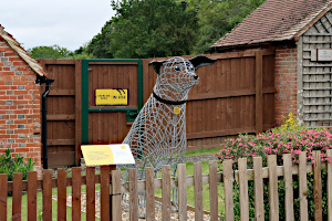
A statue of a dog at Dogs Trust, Hamstead Marshall.
As we made our way through Inkpen Common, the footpaths often merged with lanes and drives. On several occasions, we shared the lane or drive with a Post Office van. This happened so frequently, we thought Ian must have known the route of the Postman. In fact, the Postman started to recognise us, giving a wave and a grin on each subsequent encounter.
Heading east, toward Hamstead Marshall, we crossed farmland and woodland before reaching the village. Here was the Dogs Trust at Plumb Farm. After saying hello to the dog walkers and admiring a metal mesh statue of a delightful dog, we stopped at the White Hart Inn for drinks and snacks. Having a pub-stop on one of our walks is still a novelty in these time of Covid restrictions.

A real horse-drawn barge!
Next, we were heading into Hamstead Park, and Ian was giving us some historic insight into the place. We stopped at another St Mary's Church and had our lunch in the grounds before leaving the park and joining the Kennet & Avon Canal tow path.
After seeing a few hoof prints on the towpath and discussing how the towpath was originally for the horses towing barges, we were pleasantly surprised to see an actual horse-drawn barge! The horse had been feasting on foliage while the barge went through a lock. Afterwards, it took a lot of persuading to get the horse to give up it's snack break and get back to the hard work of towing a barge full of passengers.
A couple more miles on the towpath brought us back to Kintbury, where we had started our walk. See our route on Google Maps.
Thank you to Ian for leading this walk.
Walk 460 - Eversley and Hazeley Heath

Crossing Warren Heath, near Eversley.
Liz led her first walk for us on Sunday 13th June. She'd tried out the walk during lockdown and kindly agreed to lead it for us. Starting from the car park near St Mary's Church, Eversley, we followed the Three Castles Path southward through Warren Heath. This long-distance path links Windsor Castle with Winchester Great Hall, via Odiham Castle, which we visited on our walk last weekend. (See walk 459)
Warren Heath has some areas of pine plantation and other areas of mixed woodland, with wide paths running through them. The paths got narrower as we left Warren Heath through Birch Bottom and Warren Hill Farm.

On the Three Castles Path near Hartley Wintney.
The Three Castles Path took us to the eastern tip of Hazeley Heath, where we departed from this long-distance path and followed a well established path into Hazeley Heath. Being close to Hartley Wintney, this area is popular with dog walkers and families. We also saw a few horses and riders.
Taking a zig-zag route through the heath, we passed a picturesque pond by Crabtree Lodge, a country residence that always seems to be in the process of being extended. Following the edge of the heath, we made our way north-west to Hazeley.

The pond by Crabtree Lodge.
We stopped for an early lunch at Hazeley, where we found a couple of benches and a nice grassy area to sit. It was a warm, cloudless day, with temperatures already in the 20s Celsius when we started. It was therefore a little surprising to a lone jogger, sweating away in the heat.
After lunch, we followed Plough Lane up to Bramshill Plantation. The quiet lane was used more by cyclists that cars. The lane eventually joined a much more busy road, which we crossed so we could walk along a footpath on the edge of the plantation.

Some llamas at Yalden's Farm.
Here was saw a deer, quiet close to us in the wood. I think it was a roe deer, but I'm no expert. It was relatively small with grey-brown fur. It wasn't frightened of us and followed a parallel path to us for a while before disappearing.
Crossing the road again, we were in Heath Warren Wood for a while and then passed through a couple of farms, one with field of llamas. Finally we passed through a field of barley and a little bit of woodland, to find ourselves in the church yard of St Marys - a stone's throw from the car park. See our route on Google Maps.
We finished about 1:30pm, which meant we'd avoided the hottest part of the day, and certain people could get home before kick-off! (UEFA: Scotland v Czech Republic)
Thank you to Liz for leading her first walk for us.
Walk 459 - Odiham, Dogmersfield and North Warnborough

A couple of Suffolk Punch horses at Broad Oak.
We did a figure-of-eight walk on Sunday 6th June. Although the route isn't really shaped like that numeral on a map, it does have two loops that join somewhere near the middle, allowing people a choice of walking the whole route (11 miles) or just the first loop (6.5 miles). We had eleven of us on this walk, including a couple of newcomers, trying us out. The walk got off to an inauspicious start, as the road the the car park at Odiham Wharf was closed for resurfacing as we arrived - on a Sunday!
Anyway, we all managed to get to the car park, some on foot having parked in side roads, and some having been let through by the workmen. We started the walk by following the towpath of the Basingstoke Canal in a generally eastward direction to Dogmersfield, its character gradually changing along the way.
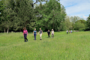
Crossing a meadow between the River Whitewater and the Basingstoke Canal.
After about three miles, we left the canal and entered Dogmersfield Park. We stopped by Tundry Pond, which looks more like a lake to me, and had our picnic lunch while watching the wildlife on and around the water. After lunch, we crossed through the park and passed Dogmersfield Lake, finally crossing some woodland to Broad Oak. Here we was some enormous brown horses (possibly of the Suffolk Punch breed).
Passing a few cottages, we crossed Broad Oak Bridge and were on the canal towpath again, now going the other way. Back at Odiham Wharf, we said goodbye to our visitors, who didn't want to overdo things on their first walk. The rest of us continued following the canal to North Warnborough, where left it. We crossed a field of cows, crossed a busy road, and crossed a ford over the River Whitewater.

On the towpath, heading back to Odiham Wharf.
Soon after rejoining the canal towpath, we stopped to look at the remains of Odiham Castle. Also known as King John's Castle, it was constructed between 1207 and 1214. The castle had fallen into ruin by 1600 and in 1792 the Basingstoke Canal was built through the southern corner of its bailey. The canal passes over the River Whitewater close by on what is technically an aqueduct, but you could easily walk over it without realising. We stopped to look at this, too.
We left the canal as it entered the Greywell Tunnel. Opened in 1794, this tunnel is 1230 yards (1.12km) long, but was closed in 1932 after part of it had collapsed. When the canal was restored in the 1970s, the tunnel was found to be home to many species of bat. It remains closed and is listed as a Site of Special Scientific Interest.

Seven cygnets on the Basingstoke Canal.
We followed a lane that crossed the River Whitewater at Deptford Bridge and then followed a footpath through a wheat field. This brought us back to the canal at a swing bridge. On the towpath once again, we passed though North Warnborough and made our way back to Odiham Wharf car park. See our route on Google Maps. We were unable to stop at the Waterwitch for a post-walk drink as all their tables had already been booked.
Despite the number of walkers and cyclists on the towpath, and the number of boats, kayaks and paddleboards on the water, we still managed to see a fair amount of wildlife. We saw ducks with their ducklings, swans with there cygnets, various fish of different sizes, dragon flies and damsel flies. And despite the forecast - it didn't rain!
Walk 458 - Hartley Wintney, West Green and Mattingley

Approaching a gate, guarded by white horses.
On Monday 31st May, I led a walk for the Berkshire Weekend Walkers that wasn't in Berkshire and wasn't at the weekend - although it was a Bank Holiday. Twelve of us met up in Hartley Wintney on what proved to be the hottest day of the year so far. We had good mix of regulars, not so regulars and newcomers. I'm sure we have more people trying us out these days than we did before the pandemic.
This walk was a patchwork quilt of bits of walks I'd done during lockdown, which were all quite local to me, in North-East Hampshire. We started the walk by following the High Street and joining the Brenda Parker Way as it went through Hartley Wintney into Hazeley Heath. On entering the heath, we almost immediately left it, heading now to West Green through woodland and then farmland.

The 15th century timber framed church at Mattingley.
On the way, we were stopped by an elderly dog walker who enquired about our route. He seemed to approve of our itinerary and suggested a good pub to visit on the way. Much appreciated though the advice was, in the current situation it can be difficult to organise pub-stops on our walks.
Leaving West Green, we made our way to Mattingley, crossing the River Whitewater on route. Before we got to the river, there was a metal swing gate, guarded by what were either large ponies or small horses. They seemed quite friendly and after a bit of gentle nose stoking, we were allowed through.

A picture-postcard view of Dipley Mill.
We stopped to have our packed lunches in the grounds of Mattingley Church, a Grade I listed timber framed church, dating back to the 15th century. It was getting quite hot now, and the cereal bar in my packed lunch had gone from crunchy to gooey.
After lunch, we crossed farmland to Dipley, where a public footpath went through the private gardens of Dipley Mill. These picturesque gardens are sometimes opened to the public. Equally impressive is the view of the mill from the road bridge in front, so a detour was taken to have a look. Mentioned in the Doomsday Book, this was still a working flour mill until its conversion into a country house in 1927.

Strolling through Hazeley Heath.
Crossing a meadow and some farmland, we reached Hazeley Heath. Here we saw a small herd of deer, drinking from a pool before they noticed us and disappeared into the woodland. A long walk through the heath took us past the gatehouse to Bramshill House, once used as a police college.
Out in the open again, a board walk led us though more heathland and then a steep slope took us up to a viewpoint. This hill had once been used for training tank drivers and there was a concrete ramp down the steepest side of the hill. After admiring the view, we crossed the southern tip of Hazeley Heath and soon found ourselves back in Hartley Wintney. See our route on Google Maps.
Thank you to Liz for one of the photographs. (The rest are my own handiwork.)
Walk 457 - Aldworth and the Ridgeway
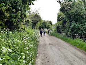
The Ridgeway, near Aldworth.
On Saturday 29th May, seven of us set off from outside the Bell Inn in the picturesque village of Aldworth. Our route took us north east through fields to the hamlet of Westridge Green and then along tracks to the Ridgeway. Although the walk was only five miles long, the next section (1.6 miles west along the Ridgeway) included 567 feet of ascent.
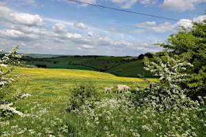
Looking back over Streatley Warren.
The views from the Ridgeway across Streatley Warren were beautiful, with carpets of vibrant yellow buttercups enhancing the contours of the rolling landscape.
The best however was still to come, when we turned south off the Ridgeway. We enjoyed the most stunning view looking back over Streatley Warren, complete with young lambs and calves; altogether the most idyllic English country scene!
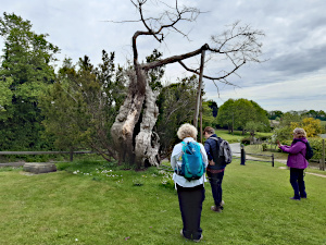
The 1,000 year old Aldworth Yew.
Our return route back to Aldworth included visiting the very interesting 13th century church of St Mary's Church. We enjoyed seeing the wonderful 1,000 year old Aldworth Yew, the Aldworth Giants inside the church (the resting place of nine of the de la Beche family) and visiting the grave of Laurence Binyon, the poet who wrote For The Fallen, which is often recited at Remembrance Day services.
The walk concluded with most welcome refreshments in the garden of the award winning Bell Inn, which dates back to the 15th century.
Thank you to Sue from leading this walk, for writing it up and providing the photos.
Walk 455 - Pewsey and the White Horse Trail
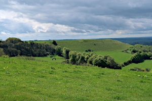
The Giant's Grave as seen from Oare Hill.
We had an early start on Saturday 22nd May, starting our walk at 9:40 in Pewsey, Wiltshire. Ten of us, including a visitor trying us out, gathered at Pewsey railway station for one of Ian's "ten mile walks". This one being over 12 miles with around 1900 ft (570m) or accent in total. Ian is a great walk leader and his walks are full of interesting features, but he hasn't got the hang of estimating the mileage yet.
We set off along Buckleaze Lane through Pewsey and joined the White Horse Trail heading north. We crossed the Kennet & Avon Canal at Pains Bridge and continued north on this long-distance path towards a ridge of hills.

The Tan Hill Way on Huish Down.
The path then turned east and went steeply upward onto the Giant's Grave, gaining 100m (330ft) of height in ten minutes. Needless to say, we stopped at the top to admire the view - and get our breath back!
We followed the ridgetop eastward, and temporarily left the White Horse Trail to follow the Mid Wilts Way as it circled round Martinsell Hill, the site of an Iron-Age Hillfort and the third highest point in Wiltshire. Now on the Tan Hill Way we headed west and re-joined the White Horse Way, getting a view of the Giant's Grave from the other side.

A tiny circle of standing stones at Huish Manor.
Next, the route was to have gone through Gopher Wood, but the leader new how wet and muddy the woodland path would be, so we detoured around the wood and then made our way to the small village of Huish. We sat in the grounds of St Nicholas Church to have our packed lunches.

Caught in a a downpour at East Stowell Farm.
After lunch, we took a footpath that passed through the ornamental gardens of the manor house, where we saw large metal sculptures, a three-way bridge and a small circle of standing stones. Most unusual.
The weather forecast had predicted rain in the early afternoon, and it duly arrived as we were crossing East Stowell Farm. The rain was quite heavy, but didn't last for long. It stopped as we arrived at the picturesque village of Wilcot, with its many thatched buildings, including the pub.
Leaving the village, we took a footpath through fields, which joined a road that crossed the Kennet & Avon Canal on a high bridge. We left the road at the bridge and followed the canal towpath through Pewsey Wharf to Pains Bridge. Here we joined our outward path and retraced our steps back to Pewsey railway station. See our route on Google Maps.
Thank you to Ian for leading this walk.
Walk 454 - Finchampstead and California Country Park

A pretty mix of bluebells and stitchwort near Finchampstead.
Six of us, (five regular members of BWW and a new member trying out the Ramblers for the first time) met by the village green in Finchampstead for this short 5.25 mile walk. Heading south from St James' Church, we soon came across our first woodland with a wonderful carpet of bluebells; these were looking even more spectacular than they were on the pre-walk.

A swan and two cygnets at California Country Park.
After crossing over the main road through Finchampstead, we went west, walking along the edge of Fleet Copse and enjoying much birdsong on the way.
We then made our way north to California Country Park; the route taking us along well defined paths, the majority of which were bordered by a pretty mix of bluebells and stitchwort.

Great Crested Grebe at California Country Park.
During the pre-walk, a pair of swans had been spotted building their nest on a small pond just by the main lake at California Country Park and it was wonderful to see that two cygnets had recently hatched. We spent time admiring the young family before walking round the lake where there were plenty of Mallard Ducks, Coots, Moorhens, Canada Geese and a Great Crested Grebe.

A Moorhen at California Country Park.
On leaving the lake, we headed south back towards the village of Finchampstead to enjoy refreshments in the garden of the Queen's Oak pub and make the most of the glorious sunshine. Originally called The White Horse, the pub was renamed after Queen Victoria planted an oak tree on the village green opposite the pub. It is apparently the only pub in the country to be called the Queen's Oak.
The weather forecast for the morning had looked somewhat miserable with a 98 percent chance of rain, but we were extremely fortunate and only saw a very light shower throughout the walk.
Thank you to Sue from leading this walk, for writing it up and for providing the photos.
Walk 453 - Great Bedwyn and Savernake Forest

Our picnic lunch spot in the Savernake Forest.
It was a grey, drizzly morning on Saturday 15th May. Nine of us were busy putting on waterproofs at Bedwyn railway station, anticipating a rather wet walk. As it turned out, the rain never got heavy and it cleared up by lunchtime, so the waterproofs weren't really put to the test.
We started by walking through Great Bedwyn, passing thatched cottages and then more modern houses as we reached the outskirt of the village. Crossing a field, we entered Chisbury Wood. Exiting the wood, we crossed a field and followed Chisbury Lane to Bedwyn Common, which is also mixed woodland.

The Ailesbury Column on Three Oak Hill.
Mixed woodland is a recurring feature of this walk. Leaving Bedwyn Common, we crossed a road and a field before entering Birch Copse and the Savernake Forest. We zig-zagged through Birch Copse, following forest tracks, crossing the course of a Roman road, and crossing Grand Avenue before finding a good spot for our picnic lunch - a collection of dismembered tree trunks to sit on.
After lunch, we joined Grand Avenue and followed it to the centre of the forest, where eight paths converge. We turned left and followed Sawpit Drive, turning off, just before it reached the A346 road. A couple more turns and a long straight leg took us to the Ailesbury Column on Three Oak Hill.

St Katharine's Church and War Memorial.
This ionic column was erected in 1789 by Thomas Bruce, Earl of Ailesbury. There is a long avenue between it and Tottenham House called Column Ride, but this on private land and is not a public footpath. We briefly followed Three Oak Hill Drive and then took a footpath that ran parallel to Column Ride to get to Tottenham Park.
Crossing Tottenham Park, we got to see the Ailsebury Column from the other end of Column Ride. Leaving Tottenham Park, we reached St Katharine's Church and War Memorial. We stopped here and had a look at this relatively large and ornate church that serves such a small parish. Ian, the leader of our walk, explained that this church had been damaged during the second world war by an explosion in a nearby ammunition store.

Finishing the walk at Great Bedwyn.
Leaving the church, we were back in Bedwyn Common again. Following a path through Stock Common, we joined Hatchet Lane, a track that took us to the southern tip of Great Bedwyn. Taking the road back into the village, we stopped in the centre. Those who had arrived by train (more than half of the group) decided to visit a local pub while waiting for the next train home.
Although advertised as a 10 mile walk, we'd covered about 12.5 miles, but our leader is Australian, and more used to kilometres than miles. None of us minded the extra exercise. See our route on Google Maps.
Thank you to Ian for leading this walk.
Walk 452 - Forty Green, Winchmore Hill and Penn
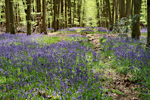
Bluebells in Priestlands Wood, near Penn Street.
Sunday 9th May was a bit grey to start with, but was considerably less wet and windy than the previous day. Ten of us gathered in a car park on the outskirts of Forty Green, near the Royal Standard of England pub. While we were waiting for everyone to arrive, the leaders explained that this was reputedly the oldest Freehouse in England, dating as far back as 1100, and had been a safe haven for Charles I during the English Civil War.
We started the walk by heading into Forty Green and through Knotty Green, then out into the countryside on our way to Winchmore Hill. I've never walked in this area before and wasn't sure what to expect. It certainly isn't flat, but the hills were gentle. We passed through open fields and woodland with plenty of bluebells on show.
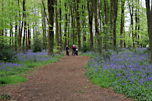
More bluebells in Charcoal Grove near Penn Street.
When we reached Penn Street, a hamlet only a mile or so from the village of Penn, we stopped for lunch. There were a few benches on the green where we sat to eat our packed lunches. One of our group realised that she'd worked in a Christmas card packing factory nearby, many years ago. Small world!
After lunch we passed two pubs on our way through Penn Street, which seemed plenty for such a small place. Then we entered a strip of woodland, carpeted with bluebells. Passing Penn House, we entered Charcoal Grove, where a mighty rhododendron bush looked down upon us. A mixture of woodland and fields brought us to Penn village, which wasn't much bigger than Penn Street. Beacon Hill was next and then more fields and woodland took us back to Forty Green.

A rhododendron in Brook Wood, near Penn.
We arrived back at the car park at 3pm. See our route on Google Maps. Here we said our goodbyes to some of the group and then the rest of us went to the Royal Standard of England pub (as previously mentioned). The walk leaders had booked a table for us, which is part of the current Covid regulation, but was also necessary as all the other tables were full when we arrived! It's obviously a very popular pub. Luckily it was a dry day, as all the tables were outside. (Covid regulations again.)
At first it seemed quite strange, going to a pub again after such a long time in lock-down, but soon we were enjoying a pleasant drink and the conversation was flowing. Almost like old times - except that you needed to put on a face mask to go inside the pub to use the facilities.
Thank you to Ann and Kathy for leading this walk.
Walk 451 - Watlington and Christmas Common
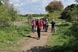
Joining the Ridgeway near Watlington.
A walk planned for last autumn - a victim of the November lockdown and then the Winter lockdown - finally happened on a cool, sunny Sunday in early May. So, six months later than planned, eight Berkshire Weekend Walkers set off from Watlington's car park for their 7-mile walk, beginning with an exploration of the town centre.
Watlington is a very small town. We walked past some attractive cottages and a few (closed) cafes, past lamp posts colourfully decorated by crocheting members of the town's Women's Institute, past one pub and one school and we were in the flat countryside surrounding the town.
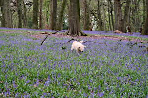
A dog swimming in a sea of bluebells in Lower Deans Wood.
Heading back south in the direction of Watlington Hill, minor roads and a short section of the Ridgeway then brought us to our only climb of the walk as we trudged up the long hill to Christmas Common.
Walking through carpets of bluebells in Lower Deans Wood then brought us to our lunch spot just below Watlington House. Walking through the field gate, we found ourselves in a meadow, at the top of a hill with the ground falling steeply away from us. We could see for miles. Red kites circled high above.
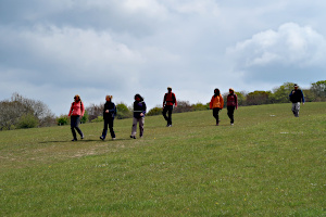
Descending the hill from Watlington Park.
The walk leader may have gained marks for his choice of lunch spot but he quickly lost them, thanks to a poorly completed risk assessment form. Unfortunately, for the leader, his risk assessment had failed to identify the potential hazards posed by the experienced red kites of Watlington Hill circling high above. Looking on the bright side, he had eaten most of his cheese and tomato sandwich before one fast-thinking, swift-diving kite ripped it from his grasp!
Lunch over, we left the kite crime scene and walked - or ran - down the hill to briefly re-join the Ridgeway, before field paths took us back towards Watlington. Soon after walking by six tiny, turbo-charged ducklings in a pond we were back in the town. Past the parish church and then past the brightly-knitted lamp posts, past the attractive cottages and the few (closed) cafes and we were back where we had started. See our route on Google Maps.
Thank you to Nigel for leading the walk and for writing it up.
Walk 450 - Bury Down, Stanmore and West Ilsley

Posing for a group photo.
We had two walks on the weekend of 24th/25th April, but I didn't make it to either. However, Keith (who led the walk on Sunday) has kindly written up his walk and provided some pictures:
Starting at Bury Down car-park in bright sunshine, but with a fresh wind, we headed west along the Ridgeway and a brief halt to view and cogitate on the nature of Scutchamer Knob (originally called Cwichelm's Barrow - see Wikipedia for details). Then we carried on until turning south through Whether Down and a relief from the wind so a short coffee stop.

Crossing through farmland on a well-defined path.
Heading south along Old Street and enjoying great views in the sunshine of the oil-seed rape blooming yellow and on to see the blue-bells flowering in the surviving woodland at Old Street's highest point.
Further south and onto Illsley Downs Riding route before turning east toward Stanmore village and taking lunch on a windy but scenic field boundary.
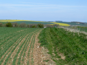
Views of The Ridgeway.
Through Stanmore, then north and back to East Illsley where we noted The Swan had sadly not yet re-opened, so not much chance of a swift half before heading back up to the Ridgeway and under the A34 back to Bury Down.
Thanks to all for such good company and sticking with the steady pace. Some healthy, glowing faces in the sunshine back at Bury Down after all the wind and sun.
The walk was approximately 12.5 miles, with 230 m (650 ft) of ascent and a stile count of 3.
Thank you to Keith for leading the walk, taking the photos and writing it up.
Walk 448 - Fleet Pond and Pyestock Hill
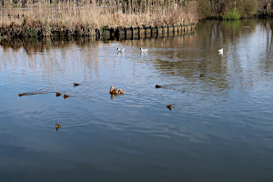
A duck with ducklings and some black-headed gulls on Fleet Pond.
It was a crisp, clear morning when ten of us met up on Sunday 18th April at Fleet railway station. We had an equal mix of regulars and visitors for a revised version of a walk I last led here in 2017. Although we'd started our walk earlier than usual, there were already quite a few other people there, so the walk was frequently punctuated by moments of standing to one side to let others past on the more narrow paths.
Following the path down the western edge of the pond, we stopped at a pier to watch some of the wildlife. A Mallard duck was shepherding her ducklings around while some noisy Black-Headed Gulls fought with each other nearby. In the distance I saw a pair of Great Crested Grebes, a few Egyptian Geese, and much nearer were a couple of Mute Swans expecting to be fed. They were disappointed. We didn't feed them.

Sandy Bay, aka The Beech, at Fleet Pond.
Continuing around the southern edge of the pond, we stopped what the locals call the beech. It used to be a bit more sandy than it is now, but it's still a nice spot to stop and admire the scenery. Next, we doubled back and turned south to follow the stream that feeds the pond from a weir by the Basingstoke Canal at Pyestock Hill.
Reaching the canal, we shared the towpath with a few joggers and cyclists before leaving it as the canal enters Fleet and turning south into the Forest of Eversley. This piece of forest seems a long way from Eversley village in the Hart district of Hampshire, but I'm informed that the word Eversley means "Wild Bore Clearing", so perhaps this is where it got its name. We didn't see any wild boar, just some cows and bullocks of various varieties.

Crossing the stream that links Fleet Pond and the Basingstoke Canal.
Rather than taking the forest track that I normally follow, we took a more circuitous (and picturesque) route through the forest. Turning east, we followed a track through Norris Hill, which emerged from the woods at a massive roundabout that bridges the canal. Crossing this, we re-entered the forest at Pyestock Hill and found somewhere to stop and have our packed lunches.
Heading mostly north, we skirted the new Hartland Village housing estate, which had been a massive industrial complex when I last led this walk. We passed through heathland and woodland, turning west, back to the pond and ultimately the railway station where we had started. See our route on Google Maps. Thanks to our early start and lack of a pub-stop, it was only about 1:30pm when we finished the walk.
Walk 446 - Goring, Aldworth and Ashampstead

The Aldworth Giants at St Mary's Church, Aldworth.
The walk on Saturday 10th April was the second walk that Ian had led for us. Ten of us met up in Goring on a rather cold and grey day for a walk that promised to include hills and churches. After leaving Goring and crossing the Thames into Streatley, we encountered our first steep hill - Lardon Chase. Once we'd got our breath back, we descended through the golf course on the other side of the hill to Thurle Grange.
Turning south, we made our way through fields to Aldworth. Not stopping at the Bell Inn, as it isn't allowed to open just yet, we continued to St Mary's church. As we approached, we could hear it's bell tolling in honour of HRH Duke of Edinburgh, who's death had been announced the previous day. The bell ringers were leaving as we arrived, and they invited us to take a look at the "Aldworth Giants" in the church.
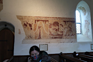
Frescoes at St Clement's Church, Ashampstead.
Originally standing at 7 ft tall, these 14th century statues of the knights of the De La Beche family were damaged by Parliamentarians during the English Civil war. We ate our packed lunches in the church yard before heading off towards Ashampstead.
A mostly woodland walk led us to Ashampstead Green and then we took a small diversion to a farm shop at Cassy Fields Farm, where we we able to make use of their toilet facilities, buy refreshments and consume them at some handy picnic tables.
After our tea/coffee stop at the farm shop, we crossed a field to St Clement's Church to see the medieval frescoes. The paintings are thought to date from C.1230-40 and were plastered over during the reformation and remained undiscovered until 1895.

Heading up to Hartridge Lye Wood, Ashampstead.
A mixture of woodland, fields and hills took as back to Streatley and then Goring. On route, we crossed a part of Grim's Ditch at Bowler's Copse. We'd already crossed another part of it earlier, at Portobello Wood, where our leader announced that no-one knew what Grim's Ditch was. A brief bit of Internet searching suggests that it's a Bronze Age territorial earthwork running between the Pang and Thames valleys. There are other such earthworks with the same name elsewhere in the UK.
Our final hill (slightly steeper and longer than Lardon Chase) brought us out behind the YHA at Streatley, leaving us with about half a mile of road walking back to the car park at Goring. This included a slight detour past St Thomas's church, just to add another one to the list of churches on this walk. See our on Google Maps.
Thank you to Ian for leading this walk.
Walk 445 - Knowl Hill, Bowsey Hill and Crazies Hill
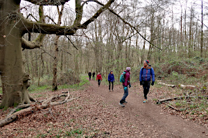
Walking through woodland on Bowsey Hill.
This walk on 2nd April was our first walk this year! Our last walk had been on 12th December. The Coronavirus lockdown put a stop to organised walks before Christmas and these measures have now been eased enough for us to be allowed to resume walking again. Seven of us (including the leader, Julia, who has recently re-joined our group) met up in Knowl Hill to go for a short (5 mile) walk. The morning started off cold and overcast, but the sun gradually showed itself as the walk progressed.
We started the walk by following the A4 Bath Road for a short stretch before turning into Canhurst Lane. This lane soon became a footpath as it headed upwards into Lindenhill Wood. The leader was pleased to tell us that the paths were considerably less muddy than they had been when she'd pre-walked the route a few weeks earlier.

Stopping in Bottom Boles Wood.
The sun came out as we reached the top of Bowsey Hill. The woodland was quite light and airy, as the trees were mostly still bare from Winter, with new leaves just beginning to grow on them. These tiny leaves have such a vivid green colour. The woodland floor was carpeted with the leaves of bluebell plants, yet to flower.
We did see a few patches of blue flowers, which were a similar colour to common bluebells, but the flower shape was quite different. At first we thought they might be Spanish bluebells, but our leader was sure that they were Spring Squill (Scilla Verna). I did an Internet search when I got home and it appears that Spring Squill and Spanish Bluebells do look quite similar, but I think the flowers we saw were more likely to be Spring Squill.
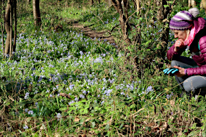
Examining some Spring Squill.
Leaving the woods, we made our way to the village of Crazies Hill, stopping in a field to have a snack and drink. Our leader had brought some mini chocolate bars for the group, as an early Easter present.
We made a large u-turn through the village, taking various lanes, footpaths and alley ways, both wide and narrow. Soon we were heading back to Bowsey Hill, through High Knowl Wood. At the top of the hill, we passed our outgoing route before making our descent on part of the Knowl Hill Bridleway Circuit. This brought us out on Star Lane, which took us back to the place where we'd started.
Although this was a short walk of just 5 miles, it included over 525 feet of ascent. See our route on Google Maps.
Thank you to Julia for leading this walk.


