Walk 478 - Henley-on-Thames and Mill End

Following the Thames Path from Henley.
On Sunday 26th September, seven of us (including three guests) met at the free car park near the football ground in Henley for a 6.8 mile circular walk. The weather forecast was mixed and the journey there somewhat overcast, but once we set off, we enjoyed sunshine all the way!

Lunch-stop at Hambleden Lock.
Our route into the centre of Henley was along a path that took us behind the rowing museum and past the station.
We then crossed over the bridge to walk along a very picturesque section of the Thames Path to Hambleden lock and weir where we enjoyed seeing several boats pass through the lock while eating our lunch. On such a lovely day, there was certainly plenty of traffic on the river, enjoying the last of the summer sunshine.

The weir at Mill Bank.
Our route back to Henley was via Aston and a small section of the Chiltern Way, where we enjoyed distant views back down to the river.
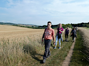
The Chiltern Way near Aston.
A refreshment stop hadn't been planned, but it was hard to resist walking past the Chocolate Cafe in Henley and we were fortunate to get a table outside, especially as the town was busy and bustling!
Our route back to the car park was along the Thames Path again and we were serenaded by a local brass band playing in the park and by a jazz group on a paddle steamer providing music for a lunch cruise down the river.
Before leaving the Thames path to return to our cars, we took time to explore the weir at Mill Bank and again enjoy the paddle steamer as it sailed past. See our route on Google Maps.
Thank you to Sue for leading this walk, for writing it up and for providing the photos.
Walk 476 - Balmore Walk and Sonning Eye

Christchurch Bridge, the first bridge on our walk.
On Saturday 11th September, Alexandra led a semi-urban walk from Reading that visited Balmore Walk and Sonning Eye before returning along the Thames Path. Taking advantage of a recent change to the Ramblers Covid-19 rules, this walk did not require booking in advance. So we waited at the start point to see who turned up.
Eight people (including two visitors) arrived before the published start time, so nine of us started the walk by following the Thames Path for a few hundred yards/metres to the relatively new Christchurch Bridge. This pedestrian and cycle bridge was opened in September 2015 and it has a rather unusual design. It is suspended by cable-stays that are anchored to a single mast on the Christchurch Meadows side of the river. The mast passes through the bridge platform itself.

Stopping for our picnic lunch at Dunsden Green.
We crossed the Thames into Christchurch Meadows and made our way through it, then taking a diagonal path across Westfield Park. Following Westfield Road up to the busy junction with the A4155 and B480, we carefully crossed both of these roads and climbed some steps into Balmore Walk. This grassy high ground commands views over Reading from Earley to Prospect Park.
A bit of road walking brought us to Hemdean Bottom or Bugs Bottom, depending which map you look at! Continuing north and then east, we passed a golf course before a bit more road walking took us through Emmer Green. Next, we crossed a field and arrived at All Saints Church at Dunsden Green. After having a look inside, we carried on to the green, where we stopped for lunch.
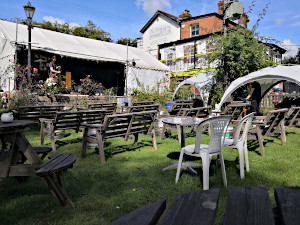
The pub garden of the Flowing Spring.
For a day that had started out so overcast, it was warming up nicely, although the previous day's rain had made it rather humid. After lunch, we made the short but steep walk down to The Flowing Spring on the A4155 Henley Road. We stopped here for drinks and sat in the garden, which was being prepared for a wedding reception later that afternoon. The band were setting up their equipment just as we left.
Dodging the cars, we followed Spring Lane to Sonning Eye, crossing Sonning Bridge over the Thames. Joining the Thames Path we passed Sonning Lock and marvelled at the number of different leisure craft on the water. Paddle-boarding is the latest trend, which looks a little precarious to me. Standing up on an oversized surf board while manipulating a paddle strikes me as something almost guaranteed to end in a capsize. We saw one sensible paddle-boarder sitting cross-legged on his board.

Group photo taken by Reading Bridge.
Soon we passed Thames Valley Business Park, with it's gleaming pagoda-like buildings and its own lakes. In front of that is Thames Valley Park Nature Reserve where we saw large areas of a plant with strange clustered flowers, some with a white feathery-like material protruding from them. One of our group identified the plants as wild carrots, and we later realised the white material on some of the flowers was in fact goose down that had caught on them as it had blown by. Before long, we were amongst lots of geese and swans. There were feathers everywhere!
Avoiding the hoards of cyclists using the same path, we arrived at Kings Meadow and it was a short distance back to Reading Bridge, where we had started our walk. See our route on Google Maps.
Thank you to Alexandra for leading this walk.
Walk 475 - Pewsey Downs

Stopping for tea at the Honeystreet Mill Cafe.
Rosy led her first walk for us on Saturday 4th September. This 12 mile walk was designed as a continuation of the walk Ian led in May along the Pewsey Downs in Wiltshire, this time exploring the western half of the downs. The walk started from Wilcot, which is a small village a couple of miles north-west of Pewsey.
Although twelve people had booked a place on this walk, we only ended up with six. The plan had been for some of the group to arrive by train at Pewsey and be collected on the way by some of those arriving by car. A last minute cancellation of the train disrupted our plans with not enough time to arrange car sharing from Berkshire.
We started the walk by following the Kennet and Avon Canal westward for a couple of miles then stopped at the tiny hamlet of Honey Street, where there was a cafe.
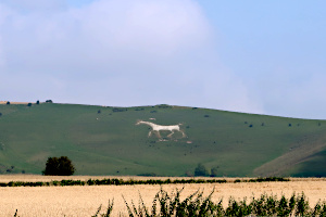
The Pewsey White Horse on the side of Walkers Hill.
Well, it would be rude not to stop for tea, wouldn't it. So that's what we did. Ian generously bought half-a-dozen chocolate brownies for the group to have with our tea. We sat at a table on their patio, which overlooked the canal.
Leaving the cafe and the canal, we walked through the picturesque village of Stanton St Bernard, with its thatched cottages, before heading through farmland towards the downs. From time to time, we caught a glimpse of the Pewsey White Horse carved into the side of the chalk downs. Later, our route would take us right past it.
Before our uphill slog to Rybury hill-fort on Clifford's Hill, we passed a large field of sunflowers, behind which, we could see several of the hills that made up the Pewsey Downs. We would be walking along them before long.

Pewsey Downs behind a large field of sunflowers.
Leaving the hill-fort for Tan Hill, we soon joined Wansdyke, an early medieval defensive earthwork joining the Savernake Forest and Morgan's Hill in a fairly straight line, with a ditch on the north side and a ridge on the south side. We followed this eastward for a mile before stopping for our picnic lunch, sitting on the ridge.
After lunch we left Wansdyke and headed south across a field to join the White Horse Trail on Pewsey Downs. We passed the chalk horse, which doesn't look so good close up. You can't really see the shape of it, but you can see the weeds!
We continued along the top of the downs, to Walkers Hill, where we could look back at where we'd previously been and get a better view of the chalk horse. Next came Adam's Grave, a Neolithic long barrow, commanding panoramic views of the downs.
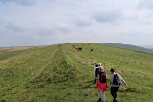
Following Wansdyke on Tan Hill.
It was downhill now, to the Pewsey Downs car park and then we joined the Workway Drove track, which became more overgrown, the further away it got from the car park. Not a popular route, I suspect. A thoughtful farmer had allowed a detour along the edge of a barley field, running parallel to the track. This was much easier going.
Some minor road walking through West Stowell took us onto a footpath that led us back into Wilcot, where we had started. See our route on Google Maps. We'd done 11.8 miles with 452m (1500ft) of ascent, so a good workout with wonderful views.
Most of us stayed on for some very welcome refreshments at the Golden Swan, not far from where we'd parked. There was a wedding reception taking place there, so we could hear the pub before we saw it! There was still plenty of space for us.
Thank you to Rosy for leading her first walk for the BWW.
Walk 474 - Hungerford and Ramsbury
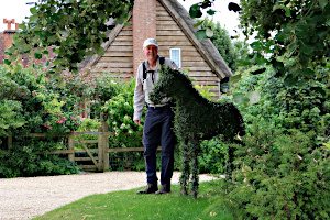
A topiary horse in Crooked Soley.
The August Bank Holiday had a rather autumnal feel to it as six of us gathered in Hungerford for a 12.5 mile walk to Ramsbury and back. We soon warmed up as we got going on the walk, which started by crossing through the town on Church Street and then Parsonage Lane before entering the grounds of St Lawrence Church.
Next, we crossed the Kennet and Avon Canal on a swing bridge, the other side of the church, and followed the River Dun to Freeman's Marsh. Crossing the A4 Bath Road we marched uphill through farmland, then through woodland before downhill into the village of Chilton Foliat, crossing the River Kennet on the way.
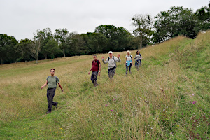
Some of the undulating countryside promised in the walk description.
Next came a long track, rutted and overgrown, steadily gaining height to Crooked Soley. Walking through this hamlet, we spotted a topiary horse in someone's garden. There were no gates or fences, so our intrepid leader strode up the driveway and posed for a photo of him stroking the horse.
Leaving Crooked Soley, we passed through Foxbury Wood, Fewley Coppice and Balaam's Wood, crossing a fair number of contour lines on the map. These were just some of the undulations mentioned in the leader's walk description.
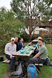
Stopping for a cup of tea in Ramsbury.
Crossing farmland, we descended into the tiny hamlet of Whittonditch. Then we followed the Whittonditch Road into the village of Ramsbury. The charm of the village became more apparent as we approached the centre, where we found old cottages, pubs and a large church without a spire.
We stopped here to eat our packed lunches, then had a look inside the church before stopping for tea at a local cafe. The leader was particularly delighted by the cafe garden as it contained a Eucalyptus tree, much like those native to his homeland of Australia.
While enjoying our cups of tea, we took stock of the walk so far. We were at the furthest point from the start of the walk and yet we seemed to have already done 8 miles of the 12.5 mile walk! Ian assured us that the route back was more direct, but there was much (friendly) banter about Ian's reputation for frequently underestimating the length of his walks.

Approaching Hungerford on the Kennet and Avon Canal.
With the tea drunk, and us sober, we left the cafe and Ramsbury. After crossing the River Kennet, we followed a long and undulating footpath through farmland and woodland to Froxfield. Here we joined the Kennet and Avon Canal, which we followed into Hungerford, passing the swing bridge we'd crossed when we'd set out and continuing along the canal until it passed under the High Street. See our route on Google Maps.
Consulting my GPS after the walk, we'd covered a distance of 13.4 miles, which is only 7% over the stated mileage, so Ian was vindicated. However, the total ascent throughout the walk added up to 700m (2,300 ft) which is a fair amount of undulation!
Thank you to Ian for leading this walk.
Walk 473 - Tilford Common and Frensham Ponds
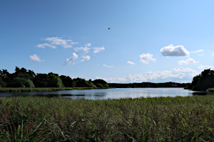
Frensham Little Pond. Looks quite big to me!
The weather was much better than expected on Sunday 22nd August when seven of us (including visitors from the Loddon Valley Ramblers and the Hampshire 40+ group) met up for an 8.5 mile walk. The visitor from LVR was Clive, who has walked with us a few times last year and the visitor from Hants 40+ was Denise, who used to be in our group and has led many walks for us. The leaders where Julie and Mark, who we don't see that often, so this walk felt like a bit of a reunion.
The walk started from Tilford, in Surrey, but proved to be quite different from the walk we did from here in July. We set off heading south-west along a wooded bridleway that crossed Tilford Common to Frensham Little Pond. Despite its name, this large body of water looked more like a lake to me.

Walking through The Flashes.
We followed the eastern edge of the pond and then a footpath through more woodland before emerging into heathland. There was an abundance of purple heather amongst the heathland shrubs and bracken. The soil in Frensham Common is very sandy and there is a particularly sandy area by Frensham Great Pond known locally as the beach, however, this was not on our route.
We crossed Churt Common to arrive at The Flashes. This part of Frensham Common is a beautiful mixture of pine trees, purple heather and the occasional silver birch, with a series of hills to the south known as The Devil's Jumps. We made our way up the tallest one. This exertion was rewarded (once we'd got our breath back) with some excellent views and some benches that had been thoughtfully placed near the top.
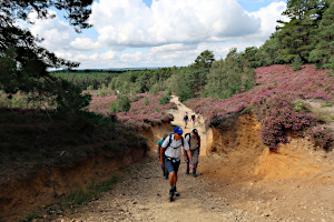
Joining the ridge path on Kettlebury Hill.
We had lunch while admiring the views before heading back down to cross more heathland and ascend Kettlebury Hill. The sand on the path, as we crossed from Frensham Common to Hankley Common, changed from grey-white to orangey-yellow.
We joined a path that followed a ridge, with splendid aerial views of Hankley Common. This is MoD land and we took a detour to see an interesting feature - The Atlantic Wall. This was built in 1943 by Canadian troops as a replica section of the German Atlantic anti-tank wall. It was used by the allies to practice techniques for breaching the German wall in preparation for Operation Overlord in 1944.
Leaving the ridge path for the Greensand Way, we crossed a golf course with it's manicured greens in stark contrast to the purple heather between them.

The remains of the Atlantic Wall.
We all agreed to the optional pub-stop at the Duke of Cambridge, which had plenty of outdoor seating and even an outdoor bar! We suspected that this outdoor structure had original been built to serve food from a barbecue, but had been re-purposed during the pandemic to allow the pub to operate when people weren't allowed to go inside. A novel alternative to table service.
Suitable refreshed, we headed back into Tilford Common and made our way to Frensham Little Pond. From here, we retraced our outgoing route back to the car park at Tilford. See our route on Google Maps. The extra detours to see the Atlantic Wall and for the pub-stop had mysteriously increased the length of the walk by over three miles! We didn't mind. The weather was good and the countryside was stunning.
Thank you to Julie and Mark for leading this walk.
Walk 472 - Hungerford to Newbury on the Kennet and Avon Canal

Water lilies on the Kennet and Avon Canal, near Guyer's Lock.
On Saturday 14th August, Jean-Paul led a nine mile linear walk from Hungerford to Newbury, with an option for people to join the walk at Kintbury for a shorter, six mile walk. I suspect that it being the holiday season, and that people are now able to meet up with friends they've not seen since lockdown, had led to the smaller than usual attendance. Only five people attended this walk.
The walk started at Hungerford station after a short delay. The train from Newbury, transporting our walk leader, had to wait for a steam train to use the line before it could set off. I was already at Hungerford and saw this train as it whizzed through the station. I could just make out the dining car, with its curtains, tables and lamps where passengers had no doubt enjoyed a first class breakfast a little earlier.

Two narrow boats about to pass each other near Dreweat's Lock.
We joined the canal towpath, close to the railway station, and began the first leg of the walk to Kintbury. Two more people were joining us at Kintbury, and we were already late due to the train, so the first three miles were brisk and non-stop. The towpath switched sides at Dun Mill Lock, and now we were walking with the River Kennet to our left and the Kennet and Avon Canal on our right. No chance of getting lost here.
Passing under the railway, the next section was sandwiched between the railway line and the canal, and brought us to Kintbury Lock, were the other two walkers were waiting to join us. After a brief stop for a snack and to use the facilities at Kintbury, we continued along the towpath. The canal was noticeably busier here, and we passed the horse-drawn barge as it negotiated Dreweat's Lock.

Entering Newbury towards the end of our walk.
At Hamstead Lock, the leader offered us an option for a pub-stop at The Red House in Marsh Benham. This would add less than a mile to the route, while providing a welcome change from the towpath as well as refreshment. The pub was a real delight, with a lovely pub garden, excellent real ales and friendly table service.
Returning to Hamstead Lock, we ate our packed lunches while watching a couple operating the lock and taking their narrowboat through. The final leg of the walk took us past Benham Lock, under the A34, past Guyer's Lock and into Newbury. Keeping a watchful eye on the time, we upped the pace toward the end of the walk and made it to the railway station with five minutes to spare before the hourly train took us back to Kintbury and Hungerford. See our route on Google Maps.
Thank you to Jean-Paul for leading the walk.
Walk 471 - Lily Hill Park and Swinley Park
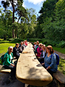
Trying out the giant picnic bench.
Kathy led a short (5 mile) walk for us on Saturday 7th August. This walk was fully booked with twelve of us plus the leader. Our Baker's Dozen was made up of regulars, not-so-regulars and a couple of visitors trying us out. A good turn-out considering the extremely variable weather we were having. Fine drizzle, heavy downpours and occasional sunny intervals were the order of the day. We were very lucky as the walk coincided with the sunniest part of the day.
This walk was discovered by the leader during lock-down, when we were allowed out to walk by ourselves once a day. Lily Hill Park and Swinley Forest are local to Kathy, and the she got to know them well during the lockdown. Today, we shared her discovery.
Starting our walk from the car park by the Running Horse roundabout, we entered Lily Hill Park through Starch Copse, which brought us out into Western Meadow. Here we could see Lily Hill House, built in 1817 when the land was first privately acquired by the Vincent family, having previously been part of Windsor Forest. The house is now used as office space and the gardens are now a municipal park, managed by Bracknell Forest Council.

Examining some wood carvings in Lily Hill Park.
The park contains many varieties of trees and shrubs, plus a number of interesting wood carvings. Kathy showed us some of these features, including the Story Telling Throne, carved from a tree stump. Entering the Eastern Meadow, we saw the giant picnic bench, carved from one tree. It was too early for lunch, but we sat around it just to try it out. The thirteen of us occupied less than a third of it's total length.
Leaving the park via Forester's Hill we passed a number of Wellingtonia trees and rhododendrons. Crossing the A329 London Road, we followed a byway that passed Allsmoor Field and Allsmoor Pond, bringing us out near Martins Heron railway station. Here we stopped to admire the large mural of an old fashioned railway station with steam trains, painted on a brick wall by a local artist.

Wood carving of a stooping old man.
Soon we were in Swinley Park, a plantation forest with broad paths popular with dog owners, walkers and horse riders alike. Crossing into Englemere Pond Nature Reserve, we stopped by the pond to have our packed lunches. Some ducks traversed the pond, expecting to be fed. They weren't disappointed, as a couple of mums and their young children turned up with bread to throw for the ducks.
Leaving the nature reserve, we walked along the busy A329 London Road until we passed the entrance of Heathfield School. Next to this was a footpath through a strip of woodland, which seemed to have more than its fair share of Rowan trees, bearing their clusters of orangey-red berries. The path brought us to Longhill Park, through which we walked before cutting through a couple of residential roads and back into Lily Hill Park.
While making our way back to Eastern Meadow via Vincent's Hill, we passed an interesting sculpture made from an upturned tree. From the angle we approached it, we thought it was some kind of sea creature, but from the front, it was a stooping old man with a beard. We then retraced our steps through Western Meadow and Starch Copse back to the car park. In just five miles we'd seen so many interesting features - and we'd had much more sunshine than rain.
Thank you to Kathy for leading this walk.
Walk 470 - Crowthorne, Horseshoe Lake and Heath Pond
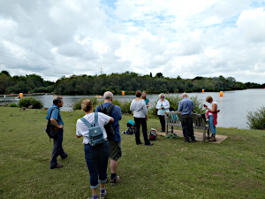
Taking a drink stop by Horseshoe Lake.
On Sunday 1st August, nine of us set off from Crowthorne Station for a 6.5 mile walk. Our route took us through the well-kept grounds of the prestigious Wellington College, along what is called The Kilometre, as that's exactly how long the road is that links the two perimeter gates.
We left Wellington College close to the bottom of Crowthorne High Street, from where we entered Edgbarrow Woods Nature Reserve, which comprises of a mix of woodland and heathland.
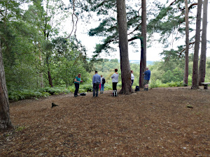
Admiring the view from Finchampstead Ridges.
Crossing over the railway line, we entered Ambarrow Woods, walking past Ambarrow Hill, which might have one time been a staging hill where monarchs stood to shoot deer.
Our next point of interest on the route was Horseshoe Lake, where there was plenty of activity to entertain us, in the form of paddle boarding. It was here that we had a short drink stop, during which there was much discussion about the skills required to paddle board successfully, which is not something that some of us felt confident trying!

Leaving Finchampstead Ridges.
After walking round Horseshoe Lake, we headed up to Coalpit Copse (highly recommended in the Spring for beautiful carpets of bluebells) and made our way up to the heather clad Finchampstead Ridges, which is an area managed by the National Trust. Here, we enjoyed lovely views as we stopped for lunch.
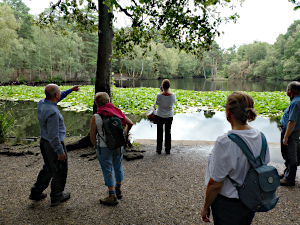
Admiring the waterlilies at Heath Pond.
Crossing Wellingtonia Avenue, which is lined with over one hundred giant sequoia trees, we then visited Heath Pond and compared with previous years, we were surprised to see the abundance and number of varieties of water lilies on the pond this year.
From Heath Pond it was just a short walk back to Crowthorne Station. It was lovely to welcome four guests to the group for this walk and we hope they will join us again.
Thank you to Sue for leading this walk, for writing it up and providing the photos.
Walk 469 - Middle Assendon, Pishill and Stonor Park

Inside the church at Pishill.
On Saturday 31st July, six walkers including the walk leader joined this varied walk, starting from Middle Assendon in the Stonor Valley. Pausing to explore the remains of St James's Church at Six Bottom we continued up through Freedom Wood admiring the wild flowers along the hedgerows. The meadows of Maidensgrove Scrubs were buzzing with insect life and we saw some especially striking Peacock butterflies.
Our route then took us down through Pishillbury Wood along the Oxfordshire Way to the hamlet of Pishill. Its name with origins in the 13th Century is derived from the Latin pisum for pea and Old English for hill and means "hill where peas grew". Here, by popular demand we took a look inside the small and traditional Pishill Parish Church.

Cows and a Bull blocking the path.
Then we headed up through the fields south of Turville Heath enjoying the Chiltern scenery stretching across from the fields of golden barley. As we began to negotiate Summer Heath it started to rain, but undeterred we emerged from the woodland with the intention of crossing the rolling fields to get to Southend.
Greeted by a warning notice "Bull in Field" we soon spotted that a herd of black cows were sheltering under the far hedge in front of the very gate we needed to pass through. As we slowly approached the cows showed no sign of moving and on spotting the bull was with them we wisely retraced our steps and found an alternative route to Southend along the road.
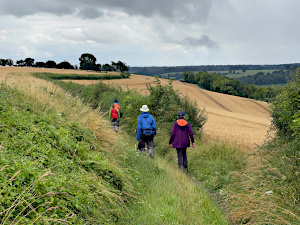
On the way down to Paradise Wood.
With the rain continuing, we picked up Shakespeare's Way through more woodland where some logs provided us with a slightly sheltered lunch spot after which we continued on towards Stonor Park. The Rhododendrons along the way were so overgrown it felt like we were on quite an adventure!
Grateful that the rain had eased we walked through Stonor Park, where we were fortunate enough to see at fairly close range some stags with most impressive antlers. It then remained for us to tackle the incline at Almshill Wood before the return leg down towards Paradise Wood - which was also very overgrown leaving us with wet legs and sloshy boots. After crossing the final field we were soon back at the start. See our route on Google Maps. Sadly the Rainbow Inn was not open despite a sign suggesting otherwise, so, just about escaping a new downpour of rain, we reflected on the eventful walk and said our goodbyes.
Thank you to Julia from leading this walk, for writing it up and providing the photos.
Walk 468 - Basingstoke and Old Basing

Stained glass window. St Mary's Church, Old Basing.
There was an ominous weather warning in place for the 25th July along with the threat of lightening. Nine people (six regulars, two guests, and one new person) gathered outside Basingstoke Station and patiently listened to my prepared spiel developed as a result of the excellent walk leader training I had received.
We headed out of Basingstoke on a footpath which runs alongside the railway track. I described this section of the walk as "urban meets the countryside", but in actual fact, this footpath was a fairly leafy affair.
We crossed the road and then headed over the field to make our way behind Barton's Mill pub. Next, we trekked over Mill Field, a mixture of grass and scrubland aimed at attracting wildlife. A footpath took us to a meadow whereby we followed a reliable pathway alongside it. After about a mile, we took a right turn where I had planned for a proper coffee stop. As we were now downwind of Basingstoke Sewage treatments, this was shifted along a little to a crossing over a pretty stream.
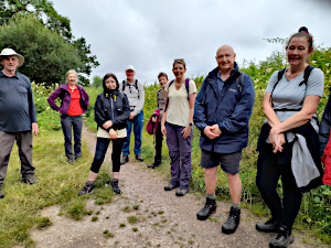
Some of the group on the Basingstoke and Old Basing walk.
Walking back down the River Lodden required a fight through the undergrowth (it had been so gorgeous earlier in the year with the bluebells and snowdrops). When we emerged from the undergrowth we were on The Street, a charming road in Old Basing.
This we followed down to St Mary's Church. Some of the group had a quick look around this 16th Century Church (14th Century in some places). Perhaps its best appeal was the popular discovery of a set of toilets. Following a passageway which winds its way around the church and alongside a graveyard, Lawrence told us an interesting fact about a blind French person learning to read by running his hands over the gravestones. It had started to drizzle on and off by now and there was a lot of coats putting on and then taking off.

Some wild flowers at the War Memorial Park, Basingstoke.
Heading now for Basingstoke Common where I did my duty as leader and advised of the presence of horses. They weren't interested in us at all. We took our life in our hands to cross the London Road. The remains of the classical arch to the Hackwood Estate are still impressive now as they must have been in their day.
We trekked up the side of the Crabtree plantation, a nature reserve, furthest away from the footpath. I had spied a picnic bench situated under a tree on an early recce where I planned lunch. However, this possibly might have been a figment of my imagination as I couldn't now find it. There was another bench in the field where a race developed amongst some of us as to who could get there first. Everyone was then too polite too actually use it and most sat of the floor.
We then meandered our way through the Black Dam ponds. We crossed over the dual carriageway and into The War Memorial Park. There was an amazing area of wildflowers here (although this did include some Sweet Williams.) We passed the bird cage which provoked mixed feelings, although I think they seemed happy enough.
Essentially it was now a matter of walking through the council buildings and heading back towards the direction of the station.
Thank you to Pat from leading her first walk for us, for writing it up and providing the photos.
Walk 467 - Goring Bush Walk
The description in the programme for Ian's walk was "a 10+ mile bush walk", which I think must be Australian for a 12.5 mile walk mostly through woodland. With temperatures rising to the high twenties Celsius on Saturday 17th July, we were grateful for the woodland shade.
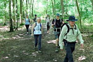
Passing through Little Oaken Wood en route to Greenmoor Hill.
Seven of us (five regulars plus two guests) met at the car park behind The Catherine Wheel pub in Goring. We crossed the railway by way of the footbridge in the station, then joined the Chiltern Way as it passed through a very up-market cul-de-sac and a recreation ground before we were out in open countryside. We weren't in the open for long as we soon entered Great Chalk Wood, which was surprisingly muddy, despite the recent warm and dry weather.
Emerging from Blackbird's Bottom (not quite how it sounds) we were back in the open again, crossing a field by the Oratory Prep School. We were back in woodland again by Greenbroom Farm Shop and heading toward Greenmoor Hill. At this point Ian mentioned how difficult it was navigating through woodland and admitted he had recce'd this walk three times and each time the route had turned out differently. Luckily I was able to help out with my GPS receiver.
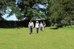
Crossing the common at Collins End.
We stopped for lunch, sitting on fallen trees at the side of the path, before crossing Deadman's Lane and continuing through more woodland. We were briefly out in the open on the common and Collins End, where we felt the full heat of the afternoon sun. It wasn't long before we were back in the shade as we entered Bottom Wood.
Some road walking was necessary to join the Chiltern Way again near Path Hill. This we followed to Coombe End Farm, where we left the Chiltern Way crossing farmland to Cold Harbour and then back into the shade of Great Chalk Wood.
We bimbled around in the woods until we found the path we had come in on in the morning. We retraced our outgoing path back to Goring. Ian explained the phrase "balloon walk" meaning that the majority of the walk is a circular route, with a common section at the start and finish - the balloon string. Take a look at the shape of our route on Google Maps and make up your own mind.
Thank you to Ian for leading this shady walk.
Walk 466 - Tilford and Crooksbury Common
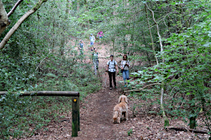
Descending Crooksbury Hill on our way to The Sands.
There was a slight complication to the walk on Sunday 11th July. One of the leaders was having to self-isolate and she was the one who had the route in an app on her phone. After an unsuccessful attempt to transfer the route from one leader's phone to the other, they tried sending the route to me via email. I was able to print the route as a paper map and so was able to help navigate the route the old fashioned way.
Seven of us, which included three regulars, two not-so-regulars and two guests (and Dylan the dog) met up by the green in Tilford. The walk started by crossing the River Wey and heading north-east into the village. Next we followed Whitmead Lane eastward out of the village and then took a rather muddy byway to Charleshill, where the track met the main road by a pub called The Donkey.

Peeking into Mother Ludlam's Cave while Dylan takes a muddy drink.
More woodland paths led us through Crooksbury Common and then up Crooksbury Hill. It's only 163m (535ft) but the ascent is quite steep - enough to test my asthma! Needless to say, we had a break at the top to catch our breath and admire the view.
Slightly embarrassingly, I led everyone down the wrong path, so we had to go back up the hill to find the right one! This footpath emerged onto the road into The Sands. Again I led everyone in the wrong direction along the road before doing a U-turn. Oh the shame of it! And I'd helped run the walk leaders training day the previous weekend! Anyway, I concentrated a bit more on navigation and a bit less on talking, and the rest of the walk went without error. Back in the countryside, we crossed fields and joined the North Downs Way and then swapped to the Greensand Way.

Standing in the ruins of Waverley Abbey.
This path followed the River Wey to Moor Park Nature Reserve, where we stopped to look at Mother Ludlam's Cave, supposedly once the home of a white witch. Our leader told us the story of Mother Ludlam's cauldron, now residing in Frensham Church.
Next stop was the remains of Waverley Abbey, which was the first Cistercian abbey in England, founded in 1128. It's had a tough history, being severely damaged by flood, then King John confiscated all of the Cistercian Order's property after a dispute with the Pope, and finally there was King Henry VIII's Dissolution of the Monasteries. We stopped here to eat our packed lunches and then explore the ruins.
Another mile or so of footpaths got us back to Tilford, where there was a cricket match being played on the green. How civilised. See our route on Google Maps.
Thank you to Kathy for leading this walk without her usual co-leader.
Walk 465 - Nettlebed Estate

Stopping in Bromsden Farm to admire the statue.
On Saturday 10th July, Tim led a 10-mile walk for us, exploring the Nettlebed Estate. The early morning rain had finished by the time eight of us (including four guests) assembled outside the Red Lion pub in Rotherfield Peppard. After the usual introductory speech from the leader, we set off in the direction of Shepherd's Green.
A few narrow, tree-lined paths brought us to the edge of Shepherd's Green and then it was more open footpaths through farmland to Bromsden Farm. Here we stopped to admire a statue of a horseman, incongruously standing in a field.

Statue of a Horseman and Bromsden Farm.
Rumour has it, that this fibreglass statue was a prop used on the James Bond film "Golden Eye". Apparently, it once sported Pegasus-like wings. [Information courtesy of Mark Percy.] I shall look out for it when I next watch that film.
A curved route took us through woodland to Lower Highmoor and the Nettlebed Estate. Then crossing a field of oats brought us to Nettlebed where we were confronted by a farm shop and cafe called The Cheese Shed.

The Cheese Shed farm shop and cafe.
We opted to have our packed lunches first and then stop there for coffee and cake. The open-sided barn with spacious seating inside and out was eminently suitable for a mixed party such as ours in these pandemic times.
The return route passed through the woodland of Devil's Hill and Nott Wood, the open fields of Newnhamhill Farm, then woodland again through Bear Wood and Ovey Wood. Finally, Greatbottom Wood and Littlebottom Wood brought us back to the starting point of the walk. See our route on Google Maps.
During the second part of the walk, the leader realised he didn't have his car keys with him. We've all had that sinking feeling at sometime, so we were all sympathetic. Quite surprisingly, when we got back to the cars, the leader discovered his keys - still in the ignition of his unlocked car!
Thank you to Tim for leading this walk.
Walk 464 - Walk Leader Training Day
A small group of us met up in Pangbourne on Sunday 11th July for a "Walk Leader Training Day".

Some useful equipment for planning and leading walks.
We have several members of our group who would like to lead walks for us, but don't feel quite ready yet. This event was designed to help people learn a few tricks of the trade plus help improve navigational skills. I'd printed off some maps of the area, along with some useful information sheets for everyone, and Lee directed the proceedings. He's done a few events like this before.
Each of the participants took turns in leading a section of the walk. After identifying where they were and being told where we needed to go, it was up to them to determine the route. There were frequent stops for discussion about how to deal with the types of situation likely to occur when walking in these parts. A pub-stop was nicely timed to coincide with our only rain shower.
Although we'd only walked about 6 miles in four hours, everyone said they'd enjoyed the event and had learned a useful amount from it. We are planning to run a similar event in November, as several people told me they'd wanted to go to this one but were available.
Thank you to Lee for leading this event.
Walk 463 - Hungerford Common and Lower Green
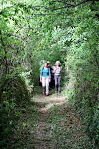
A woodland path near Templeton.
On Saturday 3rd July, Ian led another one of his Ten Mile Walks. (This one was eleven miles long.) The walk got off to a delayed start and those of us who drove to the walk were stuck in a traffic jam and those who arrived by train were on a delayed service. Anyway, we all made it there and we only started about 20 minutes later than planned.
We left Hungerford railway station and followed Park Street into Hungerford Park. Dodging the cow pats, we crossed the park and joined a footpath heading south-east for about a mile, to Templeton Stud. A number of paths through woods and fields brought us out at Lower Green.

An impressive tree-house between Lower Green and Inkpen.
Due to our late start, it was already lunchtime and the green offered us benches under a tree and a felled tree trunk to sit on for our picnic lunch. While we ate, we saw a man painting the red telephone box on the corner of the green. Like many phone boxes nowadays, it had been decommissioned and re-purposed as a small library. We stopped for a chat with the man before continuing our walk.
The plan was to visit St Michael's Church on our way out of Lower Green, however, an accidental detour was made and we headed towards Inkpen. It was a nice route, with boardwalks to keep us out of the mud, and we passed a magnificent tree-house before the walk leader realised he hadn't seen any of these things on the pre-walk. On reaching Manor Farm, we made a U-turn and headed back into Lower Green.

A tree-line avenue on the Prosperous Estate.
After looking at St Michael's church (exterior only, as it was locked) we headed west towards Mount Prosperous. (It wasn't a mountain.) We entered the Prosperous Estate along a tree-lined avenue which passed a walled garden. It was a pleasant surprise to find that the owners had provided public access to some steps and a viewing platform, which allowed us to see into the walled garden. It was very impressive.
The walled garden belonged to a house, and the house had once belonged to Jethro Tull. That's the agriculturalist (1674-1741) not the progressive rock band.

A walled garden on the Prosperous Estate.
Leaving Mount Prosperous, we headed north-west toward the Stype Estate, where we had been on one of Ian's previous walks. This time we didn't follow the Long Walk but instead turned north and made our way through farmland for a couple of miles back to the edge of Hungerford. A bit of urban walking got us through the town and back to the railway station. See our route on Google Maps.
Another enjoyable and feature-filled walk from Ian, and despite the pessimistic weather forecast, the rain held off until just after the walk had finished. Those waiting for the train home, did so at a nearby pub.
Thank you to Ian for leading this walk.


