Walk 491 - Kintbury and Walbury Hill

The gallows at Gombe Gibbet, Inkpen Hill.
Not many people turned up for Ian's walk on Bank Holiday Tuesday 28th December. This is partly my fault. I published the walk on our website and I also mentioned it in the weekly bulletin. However, due to a technical error on my part, nobody received it. Sorry! Anyway, Ian has written up his walk:

The interior of St Michael's Church, Inkpen.
"The walk leader, plus two visitors from other ramblers groups, started off in light drizzle along the canal before heading over a bridge and past the impressive vicarage and church before taking a footpath behind the Blue Ball pub and on to Wallingtons Road. As expected we encountered a little mud but the path was generally fine.
Heading south we traversed Inkpen Common before stopping for cake and coffee at the Crown and Garter. A stretch along a by-way led us to footpaths that took us up to Walbury Hill and blue sky! Once on the Wayfarers Walk we quickly moved to Combe Gibbet for the token photo and then down the hill towards Lower Green and the beautiful St Michael's Church - which happened to be open and forwarded us a view of the very impressive inside of the building. Lunch was had in the peaceful grounds of the church before heading through Lower Green and passing by St Cassian's and finally to Kintbury. Surprisingly the walk was 11 miles as advertised!
Thank you to Ian for leading this walk and writing it up.
Walk 490 - Medmenham and Hambledon
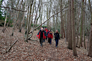
Hog Wood, near Danesfield Gardens Nursery.
Fourteen of us (including several visitors) met up on Saturday 18th December outside St Peter & St Paul Church in Medmenham for our last walk before Christmas. After taking the register (for track & trace purposes) the leader gave a short introduction to the walk, then one of our visitors mentioned that nearby Danesfield House had been used by the RAF during the Second World War as a base for their photographic interpretation unit. It turned out that the father of one of our members had flown photo-reconnaissance missions for them during the war. What a co-incidence!
We started the walk by heading uphill to Medmenham Camp, an Iron-Age Hillfort, which was hidden in woodland, and then made our way through Hog Wood to Pullinghill Wood, where there had been practice trenches during the First World War.
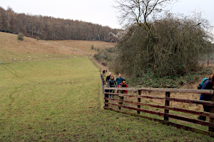
Shakespeare's Way, between Rogue's Plantation and Homefield Wood.
The military aspects of the walk gave way to the literary, as we joined Shakespeare's Way, a long-distance path from Stratford-upon-Avon in Warwickshire to the modern Shakespeare's Globe on London's South Bank. We didn't follow it for long, taking a parallel path into Hambleden, where we stopped to explore this picturesque village and to have our picnic lunch. Some also had tea and cake from the local shop.
We took a more direct route back, through farmland and woodland, emerging from Killdown Bank onto the main road into Medmenham. Then we followed a permissive path that took us away from the noisy road through countryside where we saw a small shooting party, hunting pheasants. The permissive path joined a public footpath leading us back to where we'd started, having covered 12.9 km (8 miles) with 520m (1700 ft) of ascent in total. Quite a hilly walk. See our route on Google Maps.
Thank you to Ruth for leading this walk.
Walk 489 - Whitchurch, Thames Path and Chiltern Way

A view of Whitchurch-on-Thames from Whitchurch Bridge.
Clare led a walk for us on Sunday 12th December exploring Whitchurch-on-Thames and Goring Heath. Fourteen of us (including a few from the Berkshire Walkers 20s & 30s group) met outside Pangbourne railway station before heading off to Whitchurch Bridge via a little alley-way that followed the edge of the River Thames.
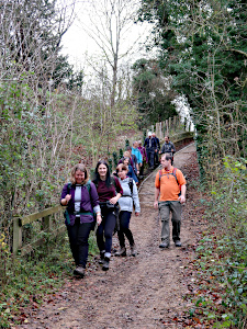
An undulating path through Hartslock Wood.
Crossing the toll bridge, we walked through Whitchurch-on-Thames on the High Street to Hartslock Bridleway. Here we stopped to remove some layers. The weather was surprisingly warm compared with the single-figure temperatures we'd had in recent days.
We had actually been on the Thames Path since leaving Pangbourne, but we only began to follow the river when we reach Hartslock Wood. The path was quite undulating on this, the Chiltern side of the Thames. We continued through this wooded section before leaving the Thames Path at Hattonhill Shaw via a very steep but short stretch onto a small hill with good views to the north.

Clambering up the steep side of Hattenhill Shaw.
So far, the route of this walk had matched a walk I've led here before, but now it was to take its own course into territory not familiar to me. We followed a narrow track up to Cockpit Plantation where we joined the Chiltern Way.
It wasn't long before we left the Chiltern Way at Coombe End Farm, heading through Cold Harbour and Blackbird's Bottom. We stopped for our picnic lunch in a field near Cray's Pond and the Oratory Prep School.

Some goats standing on things. Not sure why!
After lunch we made our way through Little Oaken Wood, which was both picturesque and muddy! Looping round, we exited the wood heading south through Goring Heath and Collins End. We passed several farms, one of which had goats that appeared to be playing that school-yard game Off Ground Chase, in which you can only be tagged if your feet are touching the ground.
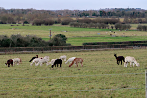
Lots of alpacas at Bozedown Farm.
At Collins End, we briefly re-joined the Chiltern Way to leave it again at Path Hill, where we crossed through Pathhill Farm and then descended though woodland to Boze Down. Here we found several fields of alpacas at Bozedown Farm.
Soon we were back in Whitchurch, where we stopped off at the Greyhound Inn for refreshment. It was then a matter of retracing our outward route across Whitchurch Bridge and back to Pangbourne Station. See our route on Google Maps. We'd done 17.5km (10.8 miles) and 628m (2050 ft) of ascent in total. A good work-out!
Thank you to Clare for leading this walk.
Walk 488 - Watership Down, Sydmonton and Ladle Hill
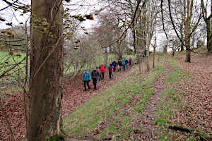
Descending the downs to Sydmonton.
It was a dull grey day and only 5°C on Sunday 5th December. It was windy, too; 15mph gusting to 30mph, making it feel much colder. Even so, eleven people (a mix of regulars and visitors) bravely gathered at the White Hill car park near Kingsclere.
We set off by following the Wayfarer's Walk over the tops of Cannon Heath Down and Watership Down, taking the full brunt of the wind. We stopped briefly by a young beech tree, recently planted on the spot of the old beech tree that was featured in the novel Watership Down, written by local writer Richard Adams.
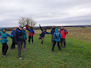
Re-joining the Wayfarer's Walk near Ladle Hill.
Leaving Watership Down for Nuthanger Down, we passed a strip of woodland which provided some shelter from the wind. Then we left the Wayfarer's Walk and made a long descent to Sydmonton, home of Lord Andrew Lloyd Webber. Passing through the estate, we could just glimpse Sydmonton Court, mostly concealed by trees.
Next we followed footpaths through farmland before heading uphill again along a tree-lined track. I had originally planned to stop for lunch on Ladle Hill, with its excellent views over Berkshire, but today's weather called for a plan-B. So instead, we stopped for lunch in the shelter of woodland before completing our uphill stretch.

Leaving Ladle Hill, an Iron-Age hillfort.
Our tree-lined path emerged into open fields where it joined the Wayfarer's Walk at a tee-junction. Turning left, we continued uphill a little longer before reaching Ladle Hill, an Iron-Age Hillfort. We began to circumnavigate the earthworks but our views were not quite as good as expected. It was clearly raining over Reading and the clouds were heading our way.
We cut across the middle of the hillfort and re-joined the Wayfarer's Walk heading east, toward Watership Down. Instead of retracing our steps from Nuthanger Down, we took a detour towards Ashley Warren Down and then re-joined our outward route at the Richard Adams beech tree. We picked up the pace as the rainclouds got nearer, and made it back to the car park with minutes to spare before the rain began falling. See our route on Google Maps. We'd walked 14.2km (8.8 miles) with 307m (1007 ft) of ascent in total.
Walk 487 - Walk Leader Training Day

Stopping for coffee and peanut butter cookies.
Sunday 28th November was one of those very cold but sunny days you often get in Winter. Four of us met up at Mortimer Fairground to do a Walker Leader Training Day. We'd done one of these in July, which had successfully encouraged and prepared a few more people to become walk leaders.
Before we started walking, Lee and I went through the types of things a walk leader should do before the start of a walk. Then we went through some basic map reading and route planning. We decided to take a fairly direct route to Calleva Atrebatum, the site of the Roman town near Silchester, and the first trainee planned a suitable route.
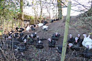
A turkey farm near the Roman town of Calleva Atrebatum.
We set off through Mortimer West End and out into the countryside.
After crossing West End Brook, we stopped for a coffee break. Everyone had brought their flasks of coffee and I provided some homemade peanut butter cookies I'd baked the previous day. (Bribery to encourage new walk leaders.)
At various points along the route, we stopped to check our location by matching features on the map with what we could see around us. One feature not on the map was an enclosure full of inquisitive turkeys that came over to inspect us.

Alpacas in a field by the Church of Saint Mary the Virgin.
Crossing through the centre of the Roman town of Calleva Atrebatum we passed a field of alpacas by the ancient little Church of Saint Mary the Virgin. Here we stopped for lunch by a wall of the church that was in full sun and sheltered from the wind.
After lunch we planned a longer route back that headed east along the course of a Roman road and then north to Stratfield Mortimer. This went well until we found that a footpath we were going to use was closed. Our route now had to be modified, which we did there and then, only making it slightly longer.
We reached Stratfield Mortimer by another Church of Saint Mary the Virgin. Crossing the main road, we continued north and followed footpaths that took us west through fields and woodland, finally emerging at north-east side of Mortimer Fairground, just as the sun was setting. Perfect timing. See our route on Google Maps.
Thank you to Lee for doing most of the training and thank you to the trainees for their interest in becoming walk leaders.
Walk 486 - Cholsey and North Wessex
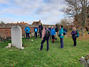
Standing by the grave of Agatha Christie at St Mary's Church, Cholsey.
On Sunday 21st November, thirteen trusting souls met the walk leader at Cholsey railway station on a cool and sunny morning. They were a mix of regulars, visitors and members of other ramblers groups. First stop was the impressive church at Cholsey where we were lucky to meet up with an amateur historian, with a great knowledge of the life and times of Agatha Christie. She is buried in the churchyard after living in the town for 42 years.
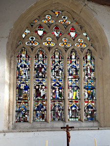
Stained glass window at the Church of All Saints, North Moreton.
We then headed north towards Mill Brook before diverting away from our planned walk and followed the Kibble Ditch and subsequently heading northeast towards Mackney Farm and then heading west to the very upmarket and historical village of North Moreton. There we visited the beautiful Church of All Saints with its 14th Century stained glass windows.

Stopping for refreshments at the Crown Hotel, South Moreton.
We then headed south to South Moreton where we had coffee, tea, beers and lunch at the outside tables of the very friendly Crown Hotel.
Next stop was the impressive Saint John the Baptist CoE and then onwards south towards the impressive villages of Aston Upthorpe and Aston Tirrold, complete with two marvellous old churches!
We then headed back towards Cholsey via a picturesque bridleway and then along a footpath that went right through a herd of impressive cattle. Walked was planned to be 9 miles but the additions took the length to 11+.
Thank you to Ian for leading this walk at short notice, for writing it up and for providing the photos.
Walk 485 - Great Bedwyn, Shalbourne and Wilton

Crossing a stream near Shalbourne Heath.
Ten of us, including three visitors, turned up at Great Bedwyn railway station on Saturday 13th November for one of Ian's walks. This walk promised a coffee stop and a few surprises en-route. We weren't disappointed.
Setting off from the station, we crossed the railway and the canal before turning into Frog Lane. Passing some thatched cottages and the village hall before turn right onto a footpath called Galley Lane. A series of bridleways and footpaths took us through farmland and woodland. On numerous occasions, we surprised pheasants in the undergrowth, who would suddenly take off, making that grating croaking noise.
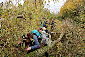
Navigating our way through a fallen tree.
Soon we were in the picturesque, and somewhat upmarket village of Shalbourne. Here we stopped at the local shop to get cups of tea and coffee, plus a few pastries from the bakery. We consumed these on the village green.
Leaving Shalbourne, we headed down a long straight footpath and encountered our first surprise. This was also a surprise to Ian. A tree had fallen across the path since he had done the recce. We had to climb through its branches to continue on the path.

Two of the emu at Wilton.
Reaching Starveall Farm, we were greeted by a couple of very hairy pigs that ran up to the fence like dogs that were pleased to see a familiar visitor. A much more pleasant surprise.
Joining the Mid Wilts Way we passed through the villages of Marten and Wilton. Several times we got views of the Wilton Windmill, but we didn't go up the hill to see it this time. Instead, Ian brought us to a small walled field full of emu. Another one of his planned surprises. These massive, flightless birds came over to investigate us.
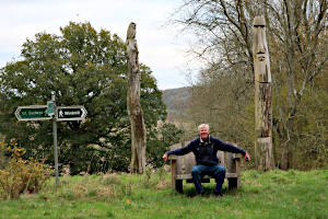
Ian on his throne, flanked by totem poles.
Leaving Wilton village, we followed a forest trail through Wilton Brail. We then crossed into Bedwyn Brail and took a long straight path through more forest. We could just make out something at the top of the hill but it wasn't clear what it was.
It was another of Ian's surprises. A large wooden chair flanked by two totem pole tree carvings - one of an owl and the other resembling an Easter Island head.
Leaving the forest, we crossed the canal and entered Great Bedwyn through the grounds of St. Mary's Church. (It was no surprise to visit a church on one of Ian's walks.) From there, it was a short distance back to the railway station. See our route on Google Maps.
Thank you to Ian for leading this walk.
Walk 484 - Sonning Common and Henley-on-Thames
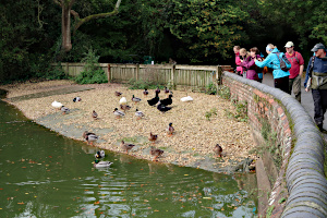
Several varieties of duck at Widmore Pond.
After a very unpromising start to Saturday 30th October, with heavy rain to add to the previous day's heavy rain, we were pleasantly surprised when the sun came out at 10:30, just in time for the start of our walk. The eight people who took the risk of venturing out on such a day, were rewarded with fine weather for most of the walk.
Starting in Sonning Common, we headed out eastward, passing Widmore Pond on the way. There is a floating duck house in the centre of the pond, proudly named Duckingham Palace. We stopped to look at the many varieties of duck inhabiting the pond before continuing along Blounts Court Road and then crossing Blounts Farm.

The Chiltern Way at Kings Farm Lane.
It soon became warm enough for us to need to stop and remove our waterproof jackets. There was no need for them now, anyway. After crossing more farmland and fields, we found ourselves in the suburbs of Henley-on-Thames.
At Henley Tennis Club, we took a footpath that led us back out of Henley-on-Thames, heading westward through open countryside and the occasional piece of woodland. An uphill stretch took us onto a ridge near Rotherfield Greys, where we stopped to eat our packed lunches while admiring the view.
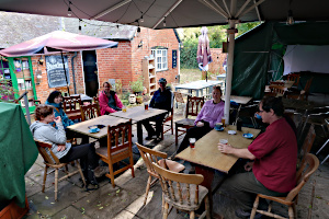
Stopping for refreshments at The Maltsters Arms in Rotherfield Greys.
After lunch, we stopped at the Maltsters Arms pub, which had been decorated for Halloween. They had really gone to town, with a skeleton playing a piano outside the pub, and all sorts of ghoulish apparitions inside. There was also a children's Halloween party going on inside, so we took our drinks into the back garden, where there was a covered area with seating and tables.
After we'd finished our drinks, we crossed a couple of fields and entered Crowsley Park Woods. Just passing the outskirts of Rotherfield Peppard, we descended into Stoney Bottom (which sounds like an uncomfortable ailment) and very soon found ourselves back in Sonning Common. See our route on Google Maps.
Thank you to Mike for leading this walk.
Walk 483 - Peasemore, Leckhampstead, Chaddleworth and Brightwalton

Crossing farmland on our way to Peasemore Hill.
On Sunday 24th October, we joined up with the Pang Valley Ramblers group for a nine mile walk around Peasemore, Leckhampstead, Chaddleworth and Brightwalton. Nine of us met up at Brightwalton Holt, which is barely even a hamlet. We set off up a footpath through farmland on Peasemore Hill.
Just as we reached the top, the leaders got a call from a couple of latecomers, who had got lost looking for the starting point. This gave us a nice breather while they caught up with us. So it was eleven of us (a roughly equal mix BWW and PVR members) that now made our way to Peasemore village.

Leaving Peasemore for Hill Green.
From here, we made our way along quiet lanes to the hamlet of Hill Green, where we got slightly confused looking for the footpath to Leckhampstead. We soon found it, and followed it through farmland into the village.
From Leckhampstead, we followed a quiet lane and then a series of footpaths through fields and woodland until we reached the village of Chaddleworth. Here we stopped for our picnic lunch in a field near Chaddleworth House. We sat under a large sweet chestnut tree. The prickly cases were opening and spilling their chestnuts onto the ground around us. After lunch, a couple of us collected some of the chestnuts in our empty lunch boxes and shared instructions on how to cook them.
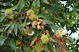
Chestnuts ready for the taking.
Leaving Chaddleworth, we passed Spray Wood and reached the village of Brightwalton. Looping round, we then passed through Brightwalton Green. The blue sky and white clouds we'd enjoyed throughout most of the walk were now being replaced by a threatening grey sky. The forecast had predicted rain in the afternoon!
Remembering a joint walk that Alistair and Pauline had led for us once before, when there was a terrific downpour just minutes after the walk had finished, we wondered if we'd finish this walk in time. We did. It was less than a mile to the end of the walk and in fact the grey sky was a bit of an empty threat as the rain didn't start until much later in the afternoon, long after we'd gone home.
See our route on Google Maps.
Thank you to Alistair and Pauline for inviting us to join them on this walk.
Walk 482 - Henley on Thames and Hambleden
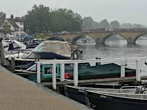
Henley-on-Thames in the mist.
On Sunday 17th October, thirteen ramblers left Henley station and walked along the river front passing an assortment of boats before crossing the stone bridge back into Berkshire. Passing through the grounds of the Leander club, we headed east and upwards into Remenham Woods and across open farmland to meet Remenham Lane. We wandered along the lane, admiring the turning of the leaves as summer changes into autumn, passing what looked to be a tree nursery before heading east between fields and woodlands with several pheasants running through the fields and a deer.

Lots of waterborne traffic in Hambleden Lock.
We proceeded downhill to meet the lane to the Flower Pot at Aston and the River Thames. Walking northwest along the Thames we crossed the lock with a variety of watercraft including kayaks, narrowboats and pleasure craft. Crossing the weir, we were able to admire the attractive Hambleden Mill and the boats moored up outside of it. At the same time, we experienced the contrasting ravaging waters of the Thames as it passed through the weir gates, which hadn’t deterred several ducks from standing in the fast-flowing waters, searching for weeds.

Some cottages in Hambleden Village.
We headed north across fields with views of gently rolling Chiltern farmland and woods, with red kites flying above us to the quaint village of Hambleden, considered to be one of the most attractive villages in the Chilterns. We stopped for a short break for snacks and to admire the cobbled buildings and flower filled gardens as well as the 12th century church.
We retraced out steps and headed up into Ridge Wood and down through a field of ponies, to Greenlands, home of Henley Business School. We returned to the Mill and picked up the Thames path back to Henley, where seven of us enjoyed a post-walk lunch at the Coppa Club. See the route on Google Maps.
Thank you to Alexandra from leading this walk, for writing it up and providing the photos.
Walk 481 - Wallingford, North and South Stoke, and Grim's Ditch
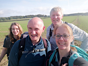
Four Ramblers.
On Saturday 16th October, four ramblers left the historic market town of Wallingford via the medieval road bridge across the River Thames, and proceeded south to join the Ridgeway, heading east along Grim's Ditch (a hardly noticeable earthwork). Along the way, our path took us between along a wooded section with a variety of autumn berries hanging from the trees. We noticed several waymarkers attached to the trees, which we later discovered were to guide runners participating in the Goring Centurion, a 100 mile running event.
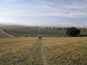
Icknield Way.
We latterly saw several runners and offered words of encouragement and expressed our admiration for their fitness levels and determination. As we walked along the Ridgeway, we noticed a large field of purple flowers which we didn't recognise. We discussed whether it might be to appeal to pollinators but discounted the idea on the grounds that an apiary wouldn't need such a large field of flowers! It turns out the flowers are Phacelia tanacetifolia, a purple flower grown to provide ground cover over winter, which is then ploughed into the soil to provide organic matter and nutrients prior to planting a new crop in spring. It is also appealing to pollinators such as bees and butterflies.

A fine display of dahlias.
At the junction with the Icknield Way, we headed south, taking us through beautiful open Chiltern fields with pheasants and red kites flying above us. Much of the landscape had been ploughed, providing an array of lovely colours and textures. We then proceeded to walk up a short, steep section which took us to a local high point, from where we could see several paragliders enjoying the blue skies and far reaching views. We descended to the picturesque village of South Stoke, ate lunch in the recreation ground and had a drink in the 17th century Perch and Pike pub. Feeling refreshed, we proceeded through the village, admiring the wonderful variety of cottages with thatched roofs, timber beams and/or flintstone walls with pretty gardens. We joined the River Thames path opposite Moulsford and made our way back to Wallingford via North Stoke with its historic church and more beautiful cottages and accompanying gardens with attractive displays of dahlias.
Thank you to Alexandra from leading this walk, for writing it up and providing the photos.
Walk 480 - Faccombe and the Three County Walk

The lychgate and church at Linkenholt.
Saturday 9th October started in typical Autumnal fashion, with mist and fog lingering until mid-morning, before the low sun broke through. Nine of us (including two visitors) gathered in the picturesque and privately owned village of Faccombe for a walk that promised three counties and several undulations. (I think that's Australian for hills.)
The walk started by heading west out of Faccombe to Netherton. On the way, we were passed by a procession of vehicles designed for off-road use, and a trailer full of people. The majority of the drivers and passengers were wearing green tweed hunting jackets and flat caps. It was clearly open season for pheasant shooting.
Soon we were passing through Netherton, part of the Faccombe estate, and admiring its topiary hedges. Then on to Linkenholt, where we stopped off at the church for a short break and to have a look around.
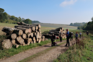
A log stack near Hart Hill Down.
Leaving the lanes, we struck out into countryside. Descending Hart Down Hill, we followed a track through fields and woodland, and found ourselves on the Test Way. This 44 mile long-distance path follows the River Test from Walbury Hill in West Berkshire to Eling, near Southampton, in Hampshire.
We followed it for a couple of miles to Gallows Down and Combe Gibbet. Here we stopped for our picnic lunch, with views to the north, including Inkpen, Kintbury and Hungerford. After lunch we passed the wooden gibbet, which has only been used once since it was erected in 1676, but remained there afterwards as a deterrent to criminals. The path now became the Wayfarer's Walk, another long-distance path, which covers 71 miles from Walbury Hill to Emsworth on the south coast.

The Test Way near Summer Hill.
We followed it for a couple of miles before joining the Brenda Parker Way, yet another long-distance path. This one stretches 78 miles across Hampshire, from Andover to Aldershot. Needless to say, we followed it for a couple of miles. I think there's a pattern emerging here. Anyway, it took us back to Faccombe, where we stopped at the Jack Russell pub for post-walk refreshments. See our route on Google Maps.
I'm often telling people that our walking group is a friendly one, and they certainly proved it today. Half-way round the walk, I developed an aching hip, which became quite painful towards the end of the walk. It slowed me right down. However, there was no shortage of help and advice from my fellow walkers. One person lent me her walking pole; I was also given some ibuprofen, and a drink was waiting for me when I finally reached the pub. What a nice bunch of people to go walking with!
Thank you to Ian for leading this walk and providing the photo of the lychgate.
Walk 479 - Nettlebed
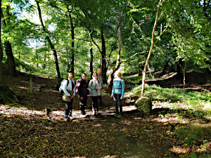
Keith's Nettlebed Walk.
Sunday 3rd October: Undeterred by the previous day's heavy rain and fuelling uncertainty, six of us assembled in Nettlebed for this ramble around the Chilterns and were eventually blessed with some blue skies and sunshine.
Heading north-west on well-trodden byways toward the Chiltern Way and then west to join the northward march of the Ridgeway provided some broad vistas as we headed to Swyncombe House, where we admired the 11th Century church and agreed to return in February for the Snowdrop teas.
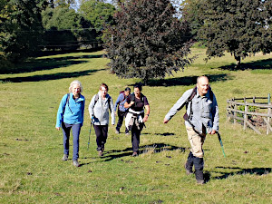
Keith's Nettlebed Walk.
Our lunch stop was by the pond at Russell's Water then on to Pilshill and a brief detour to admire another fine church complete with harvest-festival offerings.
The return south via the Oxfordshire Way gave us a chance to blow a bit on the slopes through imposing woodland and on to emerge at Bix Bottom and complete our hat-trick of churches at the ruins of St. James' church and its tranquil setting.
Thanks to all for their enthusiasm and good company.
Thank you to Keith from leading this walk and writing it up. Thank you to Ian for the photos.


