Walk 56 - Tan Hill Way and Vale of Pewsey

This was one of those walks where I wonder is it really worth driving for an hour and a quarter to walk seven miles. On this occasion the answer is most definitely yes.
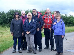
We met in the car park at Knap Hill for an 11am start. Five of us set off heading east along the Tan Hill Way. A quick glance at the map shows many closely spaced contour lines. However the path took us up a short, gentle slope to the top of the ridge.
One of our number was from Austria. He was investigating stones and Ley lines and was very interesting to talk to. I think we had met up with him quite by accident as one of us noticed his car number plates and took the opportunity to practise his German. After half an hour or so he left us to retrace his steps and continue his investigations.

We pressed onwards with magnificent views to both sides of the ridge. Skirting Gopher wood we took a drink stop at the crossing of many paths. The horse flies made their first appearance and a lone walker later in the day commented on now keen they were.
The Tan Hill Way and the White Horse Trail coincided for a while as we headed towards Martinsell Hill and then doubled back on ourselves. Stopping for lunch we could look northwards and trace the path we had taken earlier.
Refreshed we headed downhill, the only steepish section of the walk, towards Oare and a welcome pub stop.

At some point after lunch we passed through a field inhabited by a herd of very friendly, inquisitive young cattle. Our leader, safeguarding his group, was last to cross the stile. Pausing by the stile, one of us offered them handfuls of grass but they seemed more interested in nettles on the other side of the fence.
Onwards towards Huish, where we encountered an elderly local, walking his dog. He had lived in the area all his life. We chatted for a while, putting the world to rights and bemoaning the over reliance on computers and mobile phones. Stopping to chat like this is unusual when walking with a large group, but one of the things which at least for me enhances a walk. He told us about the less steep route to take to the top of the ridge, where we would also benefit from some shade.
At the top of the ridge I did not initially recognise that we had rejoined the Tan Hill Way. Retracing our steps we quickly returned to the car park at the end of a very pleasant walk.
Thank you to Christine for taking the photographs and writing up this walk.
Walk 54 - Peasemore and Chaddleworth
Eight of us joined the walk on Saturday 22nd June - a number diminished perhaps by the poor weather forecast. We were joined by two new people to our group, one travelled all the way from London and the other was the joint owner of the Fox Inn at Peasemore which had been advertised as a drink/meal stop after the walk.

We started the walk from the village of Peasemore by the village pond and so it was very appropriate with a heavy shower at the start of the walk that a duck and a gaggle of ducklings were spotted at our departure time.
We headed off along Hillgreen lane and passed The Fox Inn, the final destination of the day.
During the walk many of us learnt quite a bit about the recent history of The Fox Inn from the joint owner. It has now been re-opened for 3 months after an extensive make over and is doing very well which is nice to hear when so often country pubs are heard to be struggling.

We proceeded along Peasemore Hill Lane and into Eastley Copse which earlier in the year is a good place to see Bluebells. Exiting the copse we normally would have a good view point westerly to Chaddleworth but following the rain it was rather overcast, we headed down the hill and alongside a field boundary that proved quite a work out since the grass was now fairly long and very wet. During this part of the walk the rain turned fairly heavy and we looked quite a wet sight.
After crossing a road with care we next passed Cotswold Farm and continued heading west through a stable block towards Chaddleworth. By now the earlier rain had passed through much to the relief of those walking.
We walked along several fields before arriving at a road for a drink stop and then proceeded along a private driveway with path to Oak Ash farm. This drive way is a good place to view Daffodils when they are in season. Crossing a footbridge over a pond we then ventured through a large field being met by a playful small dog and arrived at the village of Chaddleworth.
In Chaddleworth we went down into the village passing the school and Ibex Inn which is now sadly closed before heading east at Nodmore on our return journey. Our return was along a wide track called Wick Lane and then over to Manor Farm.
Manor Farm can provide a very good point with views south facing as far as Walbury Hill and Combe Gibbet however on our walk as seen here the view was rather more lacking following the earlier rain.

Very conveniently there is a bench by the grass bank to rest and admire the scenary so we stopped briefly here for another drink stop.
We continued our eastwards track passing the church at Leckhamstead and up the one reasonable hill of the walk to Hillgreen where a very attractive cottage and well maintained hedge was seen.
From Hillgreen the leader decided to follow the Prince's Lane rather than cross what may have been a muddy field back to Peasemore.
After a change of footwear six of the eight went to The Fox Inn where we were joined by the owner for a well-deserved enjoyable drink and lunch together with Alison who could not joint lead the walk as originally planned.
Thank you to Mike for leading the walk, taking the photos and writing it up.
Walk 52 - Hartley Wespall and Stratfield Turgis
Twenty of us set off from the Jekyll and Hyde pub on Saturday 15th June on this joint walk with the Berkshire Walkers 20s & 30s group. There was a pretty even mix of members from both groups.

After a brief stretch of road walking, heading south along the A33, we turned off through what appeared to be a hole in the hedge. Only as we passed through it did we see the wooden footpath sign, which we could have so easily missed. This took us westward into a large field and away from the busy road and toward the River Loddon.
For much of the first half of the walk we were following the approximate course of the River Loddon, although it wasn't in view much of the time as the footpaths weren't always that close to the bank. The weather had been forecast as sunny, windy and rainy, which was pretty accurate. We were putting on, and taking off jackets throughout the walk.
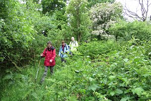
Having left the course of the River Loddon, we found a nice dry field in which to stop for our lunch. The rain waited until we'd finished eating before showering us as we continued with the walk. The second half of the walk included a variety of terrain and associated challenges.
At this time of year everything is growing like mad, including the nettles and brambles, so some of the paths were quite overgrown. With low hanging branches and creepers, we were alternately ducking down and stepping over vegetation. We also had a few ditches to jump across on this adventure route.
As we crossed one of the fields, some curious heifers began following us. One or two members of our group don't get on with large animals, and didn't enjoy the attention that these young cows were paying us.

Escaping from the field via a couple of styles into the next field, we encountered some adult cows that were just as curious and they followed us right up to the gated exit of this field. Although these docile creatures didn't represent any real danger, certain members of our group couldn't wait to get over the style and back onto the enclosed woodland footpath.
The last stretch took us along a minor road onto the A33, and passed a cricket pitch where a match was in progress, despite the rain. The walk ended at the pub, where most of us stopped off for some liquid refreshment.
An advantage of having the pub-stop at the end of the walk is that those not wanting a drink could go straight home. Also it meant that we could change out of our muddy boots before going inside. You can see our route on Google Maps.
Walk 51 - Knowl Hill to Coppid Beech
Thirteen of us met up on Sunday 9th June to do the second part of the Wokingham Way. The weather was not quite as warm and sunny as the forecast had led us to believe, but quite pleasant weather for walking.
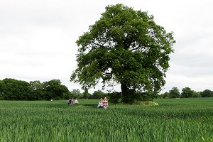
The walk started at Know Hill, where we had finished part one. We headed south across a golf course and then through farmland to the picturesque village of Waltham St Lawrence. After a quick stop in the village to divest ourselves of fleeces and coats, for it was warming up a little, we left on a footpath going westerly.
In less than a mile we were heading south again, through West End Farm and Bluey's Farm Polo Club. We caught a glimpse of some activity going on in a hedged field, which we assumed was some kind of practice event as there weren't any spectators.
Our route joined the B3018 heading east into the village of Shurlock Row, where we stopped at the Shurlock Inn for a pre-lunch drink. This is slightly unusual for us as we don't normally have a pub stop until later in the walk, but as we wouldn't be passing any other pubs on the route, and the pub had just opened, we went in.
On leaving the pub, we continued south, crossing farmland and the M4 motorway to Billingbear Park were we stopped in the shelter of some oak trees by a polo field for our picnic lunch. After lunch, we continued through Billingbear Stables and past the golf course, out of the park and on to the Straight Mile road.
Further road walking took us past Binfield Dog Rescue. It was open to visitors so some of us went in for a look and had a chat with one of the volunteers working there. I'm not really sure whether this was such a good idea, as I was quite saddened by the experience. All these dogs need new homes because they're unwanted or have been abandoned by their previous owners. Some had clearly been neglected or mistreated in the past and would need very patient care by responsible new owners, if they can be found.
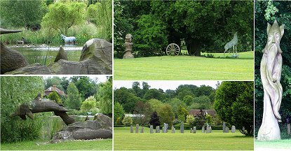
Anyway, on with the walk. We followed a bridleway and then roads into Binfield, where we stopped briefly by a pond in a fairly modern housing estate. Moving on, we followed more roads out of Binfield and then a narrow footpath that passed a huge garden full of interesting sculptures. A dolphin, a crocodile and a hippopotamus are in and around the pond. Other parts of the garden contained a splendid statue of a stag, a miniature stone circle and various unusual wood-carvings. The garden was hedged in, but with occasional gaps where we were able to look in. (Don't worry. There was no one about to have their privacy spoiled by our curiosity.)

After the narrow footpath, we crossed a wide field to join a footpath that ran parallel to the slip-road off the A329(M) onto the roundabout with the B3408. Motorway signposts look enormous close up! A short walk along the dual carriageway of the B3408 took us to the end point at Coppid Beech.
The Wokingham Way was created last year by the Loddon Valley Ramblers group. It follows the boundary of the borough of Wokingham as closely as practicable, and is divided into ten sections. We have been doing two sections at a time and today we did sections three and four. You can see our route on Google Maps.
Walk 50 - Pullen's Pond and Starvale Woods
Setting off from Burghfield Common on Tuesday evening 4th June, twelve of us weaved our way through the side roads and alleyways of the village, into the woods on Wokefield Common.

Passing Pullen's Pond we emerged into sunny open countryside, following footpaths through Wokefield Farm, Headlands Farm and Mann's Farm, crossing a few contour lines on the way.
We skirted Mortimer village, passing a circus that was just setting up on the green, before turning back toward Wokefield Common.
The recent mix of rainy and sunny weather meant that there was an abundance of greenery. In particular, the trees in the woods formed a thick canopy and the verdant vegetation at ground level meant that parts of the route were barely recognisable to the walk leader, who had recced this walk several weeks ago.
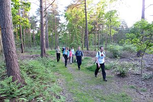
After a wrong turning in Starvale Woods there was moment of confusion before we re-joined the planned route and were on our way through the woods on Wokefield Common.
Back safe and sound before sunset - and more importantly, before the car park closed - we finished the walk where we'd started, in Burghfield Common. A number of us without any other commitments for the evening went on to the Cunning Man pub for a post walk drink.
What a pleasant way to unwind after work and to make the most of the long evenings. The weather made all the difference on this, our second evening walk. The first one (our 46th walk) was rather different, with heavy rain all evening!
Walk 49 - Thames Path, Henley to Marlow
I didn't quite make this one, although I had intended to. I overslept! I've pieced together this description from an email sent to me by Christine (the walk leader) after the walk. She also provided the photos.
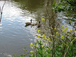
Christine told me that she only met two other walkers on the train to Henley-on-Thames and was worried that there might be a poor turn-out. However, she was greeted at the station car park by a party of walkers, making a total of twelve people (and a dog).
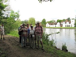
Two of them were locals, which was fortunate because they were able to inform those choosing to park in Henley of the local bus service. The return journey from Marlow to Henley by train, involving the two branch lines, would have been very tedious.
This walk was a repeat of the one led by Jean-Paul in January when we had snow. Today was quite different, with dry and bright weather. The post boxes in Henley, which had been painted gold during last year's Olympic Games, looked resplendent in the glorious sunshine.
The marquees on the bank and structures in the river (presumably for the regatta) were more advanced, than when we did the first leg of the Wokingham Way, but were still far from complete.

The river was a hive of activity with rowers, pleasure craft and even one working barge. On the wildlife front there were grebes, unusually close to the bank, many ducks, geese and swans accompanied by their young, and one solitary heron just after the lock at Mill End.
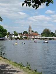
The group stopped at the lock for a tea break and a quick rest.
On the approach to Hurley, the grass had been selectively mown so that we had short grass to walk on but there was a riot of colour with wild flowers in the longer grass.
Our lunch stop was on the grass at Hurley lock, and some of us were able to take advantage of the benches. Then onward to Marlow and the second gold post box.
Three of the group returned by train, although there was a replacement bus between Marlow and Maidenhead. There is no ticket office or ticket machine in Marlow. The bus driver was not paid to collect fares and there was not the usual guard to come round collecting fares, so despite their intention to pay, they weren't able to. (Oh dear! Never mind!)
Walk 48 - Hook, Greywell and North Warnborough
Bank Holiday Monday 27th May saw sunny (but windy) weather - much better than the predicted rain. This may explain the turn-out of 30 people for this joint walk with the Berkshire Walkers 20s & 30s group.

We set off from the station walking through Hook, past the shops and the war memorial before leaving the village for countryside. We followed a footpath through Owen's Farm, heading west towards Newnham, but before reaching it, we turned south to King's Bridge, crossing the railway and emerging from woodland beside a hotel on the A30.
Crossing the A30 we continued south along a lane that bridged the M3 motorway and took us through more woodland down to Eastrop Bridge over a disused stretch of the Basingstoke canal to the west of the Greywell Tunnel.
The tunnel was closed in 1932 due to the collapse of the roof, and has since become home to a number of species of bat. During the restoration of the Basingstoke Canal in the 1970s the inhabitants of tunnel were left alone and the tunnel was designated as a nature reserve.
Most of the canal to the east of the tunnel is now navigable except for a few hundred metres leading to the east entrance of the tunnel. The canal to the west of the tunnel was not restored and this is part we were crossing. We followed the approximate path of the tunnel on footpaths through the woods above it, taking a small diversion to walk down to the west entrance of the tunnel and have a look.

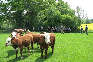
We left the woods for fields on Greywell Hill where we were slowed down by a herd of cows congregating by the exit of the field. Gentle persuasion was required to move them away from the gate so we could continue our walk.
After crossing the road through Greywell, we joined the towpath along the canal at the east entrance to the tunnel. The water was quite clear here and we could easily see the bottom and the plants growing from it. There were a number of ducks and a pair of swans with their signets.

We continued along the towpath, passed the aqueduct, where the River Whitewater passes under the canal, and then we stopped to look at the ruins of King John's Castle (also known as Odiham Castle). After looking round the ruins we stayed there for our picnic lunch.
After lunch we carried on following the canal until we reached the swing-bridge, where we turned off and followed a quiet road that forded the Whitewater. The road is now blocked off by the ford, probably due to too many cars coming to grief in the deceptively deep water. We used the footbridge next to the ford!
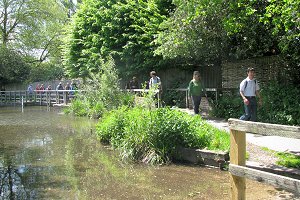
Crossing the B3349 road that goes through Hook and North Warnborough, we traversed a field that was shared by the Whitewater and a nesting swan, who eyed us suspiciously as we passed. We exited the field, passing under the Odiham by-pass road and onto the service road for the Newlyns Farm shop.
We followed this road away from the farm shop and toward the Lord Derby pub on Bartley Heath, where we stopped for a drink. The young barman was somewhat unnerved by 30 people turning up at once, but was relieved that we weren't also ordering food!
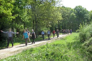
Tearing ourselves away from the relaxing environment of the pub garden, we followed a footpath to the north through the woods and over the M3 on a footbridge. I made a slight navigational error as we left the pub and led us down the wrong path to start with, but we soon found our way onto the right one.
Continuing on footpaths through Bartley Heath, north of the M3, we emerged on the southern edge of Hook village, by the business park. It was a short walk from there back to the railway station car park, where we'd started the walk four hours earlier. See our route on Google Maps.
Walk 47 - Brimpton and Wasing Park

Sunday 19th May saw 12 of us congregating at the car park by the Rowbarge on a cloudy but warm day for a walk led for us by Christine, who has lead many walks for our group.
We set off southward, along a footpath that followed the road before heading east past the old sand and gravel pits that are now lakes in a nature reserve. Turning southwest, we left the nature reserve and headed toward Brimpton village. Passing the Three Horseshoes pub and St Peter's Church, we left the village going south-west through a field of oilseed rape toward Upper Hyde End Farm.
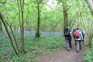
Walking through Hyde End we then followed a footpath that ran along the edge of the River Enborne. We crossed the river on a footbridge into Inwood Copse, where we followed a footpath through the wood, which was populated by bluebells.
Coming out of the woods, we crossed some rather wet, boggy, open land into the hamlet of Ashford Hill. This land must be boggy most of the time as it was full of reeds. There were also a number of planks strategically placed in the wettest areas.

Crossing the B3051 we continued across slightly boggy ground (although the footpaths were surprisingly dry) until we turned north-east into Redlands Copse.
Taking the uphill path through the woods, we stopped off for our picnic where there were some convenient logs to sit on. After lunch we carried on through the wood, emerging into open heathland where the gorse bushes were in full bloom.
The gorse bushes were accompanied by their familiar scent, which always reminds me of those NICE biscuits we used to have when I was a child. I don't know if you can still get them. Other people have said that the aroma reminds them of certain brands of sun cream. Anyway, I think it's quite a pleasant smell.

The path stopped at the road through Brimpton Common, which we followed as far as the Pineapple pub. It seemed rude to walk right past without stopping to have a drink, so we stopped and had a drink. The pub had a lovely old-world feel, with its thatched roof, oak tables and open fire. As the weather was nice, we sat outside on the rather more modern-looking decking.
There is a footpath directly opposite the Pineapple, which we took. This led us through Brimpton Common and in to Wasing Wood. We followed a footpath that skirted the western edge of the wood, before leaving the wood and heading across open fields to Wasing Farm.

Continuing north-west through the mixture of woodland and fields that is Wasing Park, we emerged at Shalford Bridge, where we then followed a route past the large ponds, which probably used to be gravel pits just like the ones we passed at the start of the walk.
This route followed the road to Woolhampton, on footpaths either side of the road. Lee (a member of our sister group, the Berkshire Walkers 20s & 30s) was able to advise Christine of one of these paths, which hadn't been on her original route, and saved us a bit of road walking.
It wasn't long before we were back at the Rowbarge by retracing the first section of our outgoing route. We continued to enjoy the warm weather in their beer garden, sipping drinks and watching a number of barges stopping to operate the swing bridge across the Kennet and Avon canal. See our route on Google Maps.
Walk 46 - North Street and Englefield Estate
This was the first of a handful of evening walks that we're doing to make the most of the light evenings. Although the majority of our members are at work during week days, in the summer months there is enough daylight to have the occasional walk after work.
I didn't make it to this walk as I was representing the Berkshire Weekend Walkers at the Ramblers Berkshire Area Committee meeting. In some ways I was grateful to be indoors as the weather was terrible! Torrential rain lasted the entire evening.
The leader told me that six brave (or were they foolhardy?) people turned up for the walk, which started in Theale. Three were regulars and three were local to Theale and trying out our group. Unfortunately for the newcomers, this was the heaviest rain we'd seen for a long time and they weren't really prepared for it. Two of them left the walk before the end, having braved it out for longer than anyone could reasonable expect. What a shame their first experience of our group was under such awful conditions. I wonder if we'll ever see them again!
Post script: Our second evening walk was much more successful. (See the description of our 50th walk.)
Walk 45 - Windsor Great Park
I wasn't able to go to Peter's walk in Windsor Great Park but Peter has supplied some photos and written the entry for the scrapbook himself. This is the first walk that Peter has led for us, and it went very smoothly by all accounts.

On Sunday 12th May 18 people enjoyed some of the glories that is Windsor Great Park. This was a joint walk with the Windsor group, but only one of their members was able to join us, and she has to leave us after about an hour as she had chores to do at home! Two of our group were potential new members, and one from another group.

The day started out sunny but quite cool. Fortunately the threatened rain held off until after we had finished the walk, although a few spots were felt while we were sitting in the pub.

We started our walk going up Queen Anne's ride, at the top of which we met a group of Irish terrier breeders who were also walking around the park.
Pausing to let them get ahead (and so we didn't get tangled up in their leads!) we stopped for our first drinks stop with our initial sight of the copper horse, a view of the rear of the Royal Lodge (which is now the official residence of Prince Andrew) and a very interested herd of cattle.
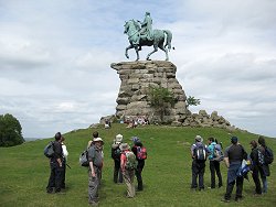
Passing the Ox Pond we then headed off to walk round Smiths Lawn where the Guards polo club is based. It's not every walk where the walkers get the opportunity to watch a polo match in progress!
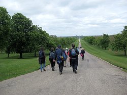
Completing our circle of the lawn we passed the obelisk (George II's tribute to his son the Duke of Cumberland's victory at Culloden) and the valley gardens before stopping for lunch by the Cow Pond.
The final leg of our walk took us to the copper horse. Having enjoyed the glorious views of the castle and parts of London we then set off down the Long Walk towards Windsor.
Five of our party left the walk at this point and headed back to their cars. The remaining 12 of us headed to the Windsor Castle pub for a drink before returning along Kings Road to our cars.
Walk 44 - Shiplake to Knowl Hill
Sunday 5th May saw the start of a series of walk we're doing that follow the Wokingham Way. This long distance walk mostly follows the boundary of Wokingham Borough and has recently been set up by the Loddon Valley Ramblers group.

They have divided the 55 mile route into ten sections, which they have published as a set of ten short walks, each with written directions and a map. They are also in the process of putting waypoint markers along the route so that it can be followed more easily.
Jane, one of the founder members of our group, has decided to lead the Wokingham Way for us as a series of five long walks rather than the published ten short walks, so today 20 of us followed the section from Shiplake to Mill End and the section from Mill End to Knowl Hill as a 12 mile walk. In fact we only had 18 when we started the walk from Shiplake as two of our group had overslept and arrived late. However, they managed to catch up with us at Henley-on-Thames, less than 2½ miles into the 12 mile walk.
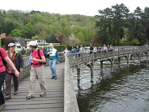
From Shiplake railway station we followed the signs for the Thames path, which took us through the village and on to the towpath by Sheephouse Farm. At this point we passed another group of ramblers going the other way. We recognised a few of them and think their group may have been the East Berkshire or South-East Berkshire Ramblers.
We soon got to Marsh Lock where we followed the route over the two wooden footbridges that took us across to the Lock and back again. Continuing north on the Thames Path, we reached Henley-on-Thames.
After stopping to use the facilities, we crossed Henley Bridge over to the west side of the Thames. Preparations for the Henley Royal Regatta were in progress along Henley Reach, with wooden lane markers in the water and the skeletal frames of marquees being erected on the bank.
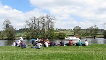
We carried on following the Thames Path to Hambleden Lock. If we were following the published first walk, we would have crossed the weir to Mill End, where the first walk ends and the second begins. Instead we continued on the Thames Path (still following the Wokingham Way) for a short way before stopping for our picnic lunch.
We sat on the bank munching our sandwiches and watching the boats go by before heading away from the water and into the hamlet of Aston to visit the Flower Pot pub. Needless to say, the pub was packed with people enjoying the warm Bank Holiday weekend weather. Luckily the pub had plenty of outdoor seating.
We were only half way through the walk as we set off from the pub, through woodland and fields looking down on the Thames. We passed the imposing Culham Court and through Lower Culham Farm before rejoining the tow path.
Leaving the Thames Path at Frogmill Farm we headed south, crossing the A4130 Henley Road, and up hill through a beautifully maintained Stud Farm. At the top of the hill when we stopped to let everyone catch-up, we realised that three of our walkers were missing! A mobile phone call established that they'd missed a turning about 250m back and were now following the Chiltern Way, so we waited there while our leader went back for them.

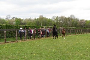
As we passed through the stud farm we saw some horses with their foals. We left the stud farm on Rose Lane, and turning left at Holly Cross, we followed Hatch Gate Lane up Bowsey Hill. This narrow lane went steeply uphill into High Knowl Wood.
Bowsey Hill was the highest point on today's walk at 140m (460ft) compared with the flat 30m (100ft) of the Thames Path. There are a few cottages at the top of the hill where the Wokingham Way crosses the Chiltern Way. The rest of the route was an easy down-hill path through woodland, emerging into Knowl Hill village where the walk ended.
This walk contained a good mixture of man-made and natural scenery, including locks, weirs, bridges, the river, meadows and woodland. It also had an even mix of flat and hill walking. See our route on Google Maps.
Walk 43 - Fleet Pond and Pyestock Hill
Saturday 27th April was rather colder than expected. During the week we'd had temperatures of 20°C but today it didn't make it into double figures. Unperturbed by the weather we had 13 turn up for this easy 6½ mile walk in north Hampshire. Two were from another walking group and we had the usual mix of regulars with one or two new people trying us out.

We set off from the railway station car park and skirted along the northern edge of Fleet Pond. We were soon past the pond and into the woods on one of the many nature trails in that area. Following a path that ran parallel to the railway, we continued east into open fields edged by woodland.
This "managed access" MoD land has occasional signs warning of the potential dangers of finding old ordnance. However we found quite a different hazard. Highland cattle - blocking our path! One of our regulars tried to brave it out using the philosophy of they're more afraid of us than we are of them. It didn't take long to disprove this, so we took an alternative route.
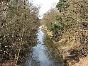
Heading south, then west, then south again, we followed established footpaths that diverted us around an aerospace factory as we headed off to Pyestock Hill. It wasn't really a hill but more of a gentle slope. We emerged from woodland on to a roundabout on the A323 that also crossed the Basingstoke Canal. Crossing the road and the canal we entered Norris Hill, part of the Forest of Eversley.
Our route took us south-west toward Brock's Hill, where we stopped for our picnic lunch before visiting the Foresters pub for a drink. One of our guests from the other walking group knew of a back route to the pub that avoided walking along the busy Aldershot Road, which has no pavement.

The pub was packed with people in suits. At first we thought there might be a wedding on, but once we noticed how sombre the dress code was, we suspected that there had been a funeral. We decided to respectfully take our drinks outside. In the pub garden, the weather began to change. First with fine rain, then becoming heavier and for a brief period, hailstones!
The rain eased off and stopped on our return journey, which took a straight line across the forest, emerging onto another point where the Basingstoke Canal and A323 meet. We followed the towpath along the canal, going east toward Pyestock Hill.

There was plenty of wild life on the canal, including the usual Mallard drakes and ducks with ducklings in tow. We also saw a heron, which had caught its lunch from the canal.
Leaving the canal at Pondtail, we followed a stream that led us back to south-east edge of Fleet Pond. Following the well maintained footpaths and boardwalks round the circumference of the pond, stopping occasionally to read the information boards, we made our way back to Fleet railway station.
Today's walk was a good taster for potential new members as it had a little bit of everything - woodland, heathland, canal towpath, sunshine, rain, hail and a variety of wildlife - and all in only 6½ miles. See our route on Google Maps.
Walk 42 - Moss End and Holyport
From Frost Folly Country Car Park we headed east, passing recently laid hedges, towards Warfield. A large church for such a small village, supposedly founded when monks from Hurley got tired of their monastery being flooded by the river Thames.
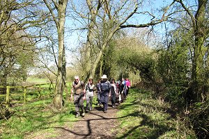
There were many delights on this walk, all the more appealing because of the warm, spring sunshine. The next two fields were home to a number of Shetland ponies; too busy eating the grass to take any notice of sixteen walkers passing through.
Wane Bridge brought our first muddy field, churned up by animals between the two gates. Onwards to Brock Hill farm where we saw calves.
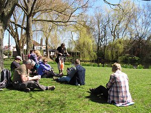
Some road walking via Whitelock's Farm brought us to Hog Oak Lane - one of the places where there was an abundance of primroses and violets. There were also views of Windsor Castle and Slough Power Station. We were also fortunate to see some butterflies. Sadly, the abandoned fridge freezer is still there becoming more vandalised as the months go by.
Crossing the Drift Road we passed Mount Skippets Farm and saw a field of lambs. Crossing the road we took the right hand of the two paths and made our way to Holyport where we had lunch on the green.

Some of us sat by the village pond and others made use of the seats near the War Memorial, before visiting the Belgian Arms, one of the pubs in Holyport.
Refreshed we made our way past Old Beams kennels, Long Lane Farm and on to the busy A330, which we crossed with care before heading down Sheepcote Lane.

Near Windmills, none now visible, we headed across the fields once more, crossing the Drift Road for the second time.
More fields, not too muddy and having a wide grassy headland, brought us to the ford which some of our number used to clean their boots.
Heading down Hazelwood Lane, one of my favourite old lanes, the end was in sight for those of us who were weary. At Tickleback Row we headed East to Moss End and the Frost Folly car park.
Big thank you to Christine who not only led the walk but wrote it up and took some of the photos.
Walk 41 - Ashmansworth and Wayfarer's Walk

Nineteen turned out for this walk on Sunday 14th April. This included quite a few newcomers. Forecast to be the warmest day this year, it didn't seem like that once we were up on the ridgeway in the blasting wind.
Starting from the little village of Ashmansworth, we joined the Wayfarer's Walk heading south-east. The Wayfarer's Walk is a long distance path that covers about 70 miles from Walbury Hill (near Combe Gibbet) to Emsworth (near Chichester).

We followed the Wayfarer's Walk for about three miles, crossing the A343 and ascending Sidown Hill, from where we had good views of Highclere Castle, Beacon Hill and the Hampshire Downs.
Along the way we saw a bizarre sight - a fox apparently inside a hen coop! On closer inspection the fox was in a separate enclosure from the hens. Both the fox and hens looked quite relaxed despite their close proximity. Very odd!

After descending Woodcott Down, we left the Wayfarer's Walk, turning south-west to Woodcott and crossing many contour lines through this rolling landscape. The footpath stopped at Lower Woodcott Farm and we walked up a steep but quiet road to Upper Woodcott Farm, where the route flattened out again.
Heading north-west, we left the road and followed footpaths through fields to the hamlet of Crux Easton, this time with views to the west.

As we approached Crux Easton we saw an old metal sailed wind engine. We stopped at a little green in Crux Easton for our picnic lunch, during which time a few of us went and investigated it.
Apparently this prairie style wind engine was built around 1891 and was used to pump water and grind corn. It has 48 sails in a 20ft wind-wheel atop a 32ft tower. The pitch of these sails is adjusted to regulate the speed under differing wind conditions. Although no longer operational, it is open to the public for a fee.
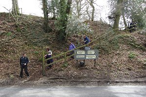
Having finished our lunch, we set off across a couple of fields and then the footpath stopped when it reached the A343, which is in a cutting at that point. The footpath descended onto the main road and although there was a wooden hand-rail, there were no steps on the steeply sloping path.
From there we took a quiet side road back into Ashmansworth. As we entered the village, we passed an old building that used to be the village pub. Sadly, it's not a pub anymore, so this has been one of those rare (for us) walks without a pub-stop. A good walk nonetheless. See our route on Google Maps.
Walk 40 - Thames Path, Reading to Pangbourne

Third time lucky! We finally got to do the Reading to Pangbourne linear walk. Originally planned for January, it was postponed due to flooding. (See first picture.) Rescheduled for Easter, it was postponed again due to the reconstruction work at Reading Station.
Saturday, 6th April, the trains were running, the ground was dry and the sun was out. Sixteen of us set off from Reading station, weaving through the road-works before crossing Reading Bridge into Christchurch Meadows.
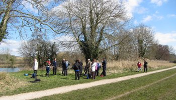
After following the towpath as far as the War Memorial, we crossed back to the south side of the river at Caversham Bridge. From there we passed Reading Rowing Club and continued following the Thames Path westward. This section of the Thames Path is mostly tarmac, concrete and other hard surfaces. No sign of any mud yet.
As we got further out from Reading, the route began crossing open fields and the path was now gravelled, but still no mud! Lots of other people were out, walking, jogging, cycling and generally enjoying the sunny weather. It wasn't exactly hot, but certainly warmer than it has been during the past week.
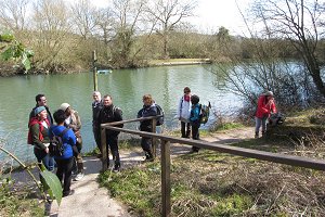
The Thames Path takes a diversion just west of Tilehurst railway station. We crossed the railway line on a footbridge that brought us on to the A239 Oxford Road. This was the first bit of ascent on this largely flat walk. We then followed the Thames Path into an up-market housing estate in Purley-on-Thames.
The route crossed the railway line again on a road bridge before heading up Mapledurham Drive to Mapledurham Lock. We stopped for our picnic lunch on a bank facing the lock and watched a couple of boats going through.

After lunch, we wandered around the lock, with some of us taking advantage of the cafe, ice-cream shop and toilet facilities. We then continued westward on the Thames Path on the last leg to Pangbourne.
On the way, we found some mud! There is a section of the path that is intersected by a stream leading into the Thames. This part of the path is always a bit muddy and today it was no more muddy than usual.

You might get the impression that I am obsessed with mud. I'm not really, but we've seen so much of it one recent walks that I was expecting more of it today. (I'm not complaining!)
The last part of the route goes through Pangbourne Meadow and recreation ground. This was the part of the walk I was most concerned about, having seen it all underwater only a couple of months ago. I needn't have worried. It was absolutely fine. (Compare this picture with the first one.)
We entered Pangbourne, taking the alleyway that goes behind Waterside House and emerges onto Shooters Hill. This is where the walk finished, opposite Pangbourne Station and next to the Swan pub. Decision time! A few decided to catch the next train while the rest of us went to the pub for a drink and caught a later train. See our route on Google Maps.


