Walk 526 - Odiham, Greywell Moors and Basingstoke Canal

Crossing a field of barley on Adam's Farm, near Odiham.
On Sunday 26th June, twelve of us met up in Odiham High Street for a six mile walk around Odiham, Greywell Moors and the Basingstoke Canal. Although I'd already been on the previous day's walk, I thought I'd do this one as well because it was so close to where I live. I'm glad I did, as part of the walk went somewhere I hadn't been to before - Greywell Moors.

Greywell Mill, on the River Whitewater in Greywell Moors.
We set off by heading west along the High Street and then along West Street as far as Robert May's School. We then took a footpath across Hockley Farm, and over the road into Adam's Farm. Crossing a field of barley and then one of oil seed rape (or canola, as Australian Ian calls it) we reached Greywell Moors. After a slight wrong turning, we were heading south-west along the edge of the moor.
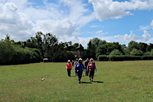
Leaving St Mary's Church on our way to the canal.
A hair-pin turn took us north-east through the moor, passing Greywell Mill on a stretch of the River Whitewater. In the clear water we saw a few fish and a sinister-looking freshwater crayfish. We also saw a frog and a few damsel flies.
A long and winding boardwalk led us through marshy woodland by the Whitewater, allowing us to see much of this nature reserve while limiting our impact. At the end of the boardwalk, a path brought us out behind St Mary's Church in Greywell village.
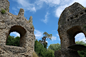
Part of the remains of King John's Castle aka Odiham Castle.
Crossing a field and a lane, we joined the Basingstoke Canal by the Greywell tunnel. We followed the canal towpath to the remains of King John's Castle (aka Odiham Castle). Here we stopped for our picnic lunch and explored the remains of the 13th century castle.
After lunch, we continued along the canal towpath through North Warnborough to the far end Odiham. Leaving the towpath, we made our way to The Waterwitch pub for a drink in their canal-side beer garden. Suitably refreshed, we finished the walk by following Colt Hill and London Road back to the High Street. See our route on Google Maps. Only a short walk, but with lots to see.
Thank you to Sue H for leading this walk.
Walk 525 - Great Bedwyn and Shalbourne
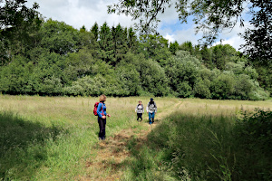
Passing through the Burridge Heath Plantation.
There was a rail strike on Saturday 25th June, which prevented or deterred many people from attending Ian's 10 mile walk from Bedwyn station. We only had four people on the walk. Ian doesn't have a car and all his walks start from railway stations, so I took a detour into Reading to collect him and drive him to the walk.
Apart from one heavy shower just before the walk started, the weather was kind to us and we had a very enjoyable walk in some lovely countryside.
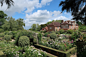
Mount Prosperous and it walled garden.
Heading east from Great Bedwyn, we crossed fields and woodland, passing through the Polesdon Estate to the hamlet of Bagshot. Here we found a house that had recently been converted from a chapel.
Now heading south-eastwards, we cross more farmland and woodland of the Prosperous Estate, stopping at Mount Prosperous - a country house with beautifully kept walled gardens. The owners of which have kindly built a small publicly-accessible viewing platform to show off their efforts.

Inside All Saints Church in the hamlet of Ham.
Next stop was the tiny village of Ham. Here we stopped at a picnic table on the green to have our packed lunches accompanied by a cups of tea from the local pub. After lunch we had a look inside the little church next to the manor house in Ham.
It was short distance to Shallbourne, where we have stopped on past walks at the Post Office and Bakery for tea and cake. We didn't stop this time, but pressed on to Newtown Farm, where we met a fellow teacher from Ian's school, who was marshalling a Duke of Edinburgh event. A short while later, we met some of the pupils who were taking part in the event and helped them with directions.
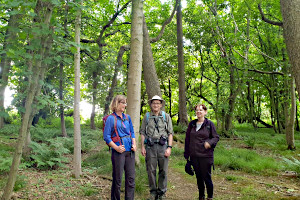
Having a laugh at me trying to look tall, standing on a tree root.
Returning to Great Bedwyn via Bedwyn Brail and Brail Farm, we crossed the canal and the railway line to emerge behind St Mary's Church. We popped in to this impressive church and had tea and cake, being sold to raise money for the church fund. Visiting churches, and finding places to stop for tea and cake are regular features of Ian's walks, but here is an example of us doing both at once.
Suitably refreshed, we finished the walk in the centre of Great Bedwyn. See our route on Google Maps. The 11.3 mile walk included 525m (1700ft) of ascent in total, so there was no guilt about our consumption of tea and cake. Some of us also went to The Three Tuns pub for a quick drink before heading home.
Thank you to Ian for leading this walk.
Walk 524 - Caversham Outskirts

Wheat fields on Crowsley Park Farm.
Sunday 19th June was a good day for walking, with a welcome break in the recent hot weather (which was over 30°C on Friday). Twenty-two people attending this joint walk with the Pang Valley Ramblers. We had quite a few Berkshire Weekend Walkers, some Loddon Valley Ramblers and a few East Berks Ramblers joining the PVRs for this seven mile walk around north Caversham, Crowsley Park and Chalkhouse Green.

Crowsley Park. Satellite dishes can just be seen in the distance.
George, our leader for this walk sensibly decided that with this size of group, we needed a back-marker to keep an eye on the tail end of the party. I volunteered for this job, which is why most of the photos have are taken from the back of the group. We started at the Clayfield Copse car park and headed north-east on well-established footpaths through fields and woodlands towards Littlestead Green.

Another wheat field on Chalkhouse Green Farm.
Next, we headed northward towards Crowsley Park, crossing through wheat fields and other crops in Bishoplands Farm and Crowsley Park Farm. Crossing the open heathland of Crowsely Park itself, we could just see the large satellite receiving dishes of the BBC monitoring service.
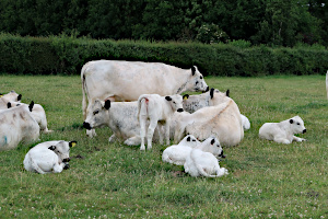
Some British White cattle with their calves.
We stopped for our picnic lunch on the Millennium Field on the edge of Sonning Common before heading south, through more wheat fields and pastures to Chalkhouse Green. We passed a few horses and a field of British White cattle with their calves. A breed of cattle we don't see that often on our walks.
Following a track called Chalkhousegreen Lane, we headed south-east and gradually uphill back to Cavesham. Weaving our way through a small housing estate and crossing some playing fields, we returned to the car park. See our route on Google Maps. An excellent walk enjoyed by a varied group of walkers.
Thank you to George of the Pang Valley Ramblers for leading this walk
Walk 523 - Reading University Evening Walk

Exploring the formal borders in the Harris Garden.
We often have week-day evening walks at this time of year to make the most of the long days and warm weather. On Thursday evening 16th June, we met up in the campus of Reading University for a 4-mile walk and a drink at the Park House bar.
The campus grounds are surprising large and very green, with plenty of woodland, cultivated gardens and a lake. Before the university moved here, the grounds belonged to the 5th Duke of Marlborough, who imported a large number of trees of different varieties not native to the UK. Some of them quite rare. Years later, five large Victorian houses were built here, each having a portion of the land.
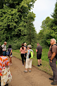
Ian showing us the very rare Wollemi Pine tree.
Exploring the Harris Garden and its many unusual trees, our leader Ian was keen to show us a Wollemi Pine - one of the worlds oldest and rarest varieties of tree. These prehistoric trees were completely unknown until they were discovered in the Greater Blue Mountains area of Australia in the late 20th century. There are only a few hundred of these trees in existence.
As well as the woodland trails and meadow areas, there are more formal parts of the garden, with herbaceous borders and hedges tended to by volunteers. We explored most of these areas before leaving the Harris Garden and returning to the more built-up areas of the campus. As a diversion, Lawrence, who was also on this walk, showed us the secret nuclear bunker, built during the cold war.

Ian's Titanic pose, on the edge of Whiteknights Lake.
Next, we followed a woodland trail around Whiteknights Lake. This artificial lake was created in the 18th century and is home to a variety of wildlife. While passing the top of the lake, Ian was persuaded to re-enact the scene from the film Titanic where Rose leans over the bow of the ship, pretending to fly.
The walk finished by Park House, one of the five Victorian houses, which is now a bar and restaurant. Some of us decided to have a post-walk drink here before heading home. We sat outside, amongst the students and staff, as the sun was setting.
Thank you to Ian for leading the walk.
Walk 522 - Twyford Brook and Charvil Country Park

Ponies near Stanlake Bridge.
On Saturday 11th June, we had a social event at the Twyford Beer Festival, which raises money for a male cancel charity. As with previous years, we've combine the social event with a walk - the walk coming before the beer festival, for obvious reasons!
Australian Ian, who leads many walks for us thought that combining a walk with a few beers sounded like his sought of thing and volunteered to lead the walk. Ian's walks are generally 10 - 15 miles long, so it was quite a change for him to lead a short walk (6 miles) so that there would be plenty of the afternoon left for the festival.
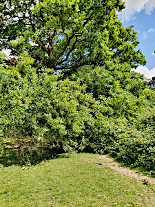
The ancient oak tree.
Starting from Twyford railway station, thirteen of us followed Waltham Road, past Stanlake Meadow recreation ground, where the beer festival marquees could be seen.
A footpath through a small housing estate brought us out into countryside. Ian seemed to be very popular with the local ponies! We came across an ancient oak tree, which could well be over 1000 years old, judging by the diameter of the trunk. A branch had very recently broken (since Ian had done the recce for the walk) and was blocking the path. A small detour was required. After following Hogmoor Lane, we reached Whistley Bridge, where we crossed the River Loddon.

Crossing a wheat field near Hogmoor Lane.
Now in Charvil Country Park, we were surrounded by water. We followed the 'Old River', which is a branch of the River Loddon, as it weaved its way past many ponds and lakes. Sensibly, we avoided the ford at Giddy Bridge, taking a detour to use a footbridge.
We stopped for our picnic lunch in a field before crossing under the railway and entering Loddon Nature Reserve, which also had its fair share of lakes and ponds. We emerged from the nature reserve onto the Old Bath Road, which we followed back into Twyford and returned to the station. Some went home at this point, whereas the rest of us, having worked up a good thirst, walked the short distance to the beer festival where we met up with some other BWWs who had not been on the walk.
Thank you to Ian for leading the walk.
Walk 521 - Compton and East Ilsley

Posing for a group photo.
Eight of us completed the Pang Valley Ramblers and Berkshire Weekend Walkers walk on Sunday 6th June. The group consisted of four members of the BWW, two Pang Valley members and visitors from other Ramblers groups.
The conditions were next to perfect for walking. The rain did not eventuate, the temperature was cool and refreshing and there was a light wind. The walk was predominately along footpaths, byways and bridle paths.

Crossing crop fields on the Ridgeway.
Starting from the cute village of Compton we walked towards Crows Foot and then turning north and meeting up with the Ridgeway, which we then followed for some time. The tracks and paths were devoid of other walkers and were also gentle underfoot which was pleasing.
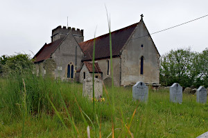
Saint Mary's Church, East Ilsley.
We then stopped at a railway bridge over the now closed Southampton to Didcot Railway line. This line was important for munitions transport during WWII but fell out of favour in the 1960s.
We then left the Ridgeway and headed NNE before turning south east to East IIsley for our lunch stop overlooking a pond which had excellent seating surrounding it. Next we headed south towards Warnham Lane and back to Compton via Mayfield Farm. All in all a very pleasant walk in fine company.
Thanks to Peter for leading the walk and providing us with information along the way.
Thank you to Peter for leading the walk and to Ian for writing it up.
Walk 520 - Finchampstead and Coalpit Copse
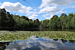
A view across Heath Pond.
On Sunday 29th we did a short (6½ mile) walk with lots of variety, and with eighteen people - a good mixture of visitors, regulars, and a few people I'd not seen for quite a while. The walk was one that Sue B had created out of the many solo walks she'd done during lock-down, as she lived in that area at the time.
We began by following Duke's Ride and then Heath Ride, which turns from a footpath to a lane where it intersects with Roman Ride. At this junction, we took another footpath that brought us out by Heath Pond. Skirting round the north and west edges of the pond, we then headed south-east to Coalpits Copse and Ambarrow Farm.
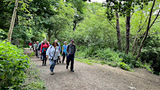
The Three Castles Path through Moor Green Lakes nature reserve.
Here we joined the Three Castles Path, a long-distance path linking Windsor Castle with Winchester Castle, which we briefly followed past Horseshoe Lake and through Moor Green Lakes nature reserve. Leaving the Three Castles Path, we headed north to Moor Green Farm and followed Lower Sandhurst Road east for a short while.
Next we turned north and followed a track up to Ambarrow Hill and then briefly touching our outward route, we branched off to the west and to Finchampstead Ridges. We found an open area in the woodland where we stopped for lunch.
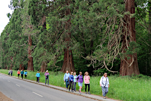
A walk down Wellingtonia Avenue.
After lunch, we returned along Wellingtonia Avenue. This road was much less busy than usual as it was closed to passing traffic - access only from the east - due to subsidence on The Ridges to the west. The road has been closed for over a year while they work out how to repair it and who is going to pay!
This road is lined with over one hundred giant sequoia trees, planted in the 1860s and known at the time as Wellingtonia. At 160 years old, these trees are still young compared with their Californian cousins, some of which are over 3000 years old!
The road ended at the roundabout with Lower Wokingham Road and Duke's Ride. It was then a matter of retracing our outward route along Duke's Ride to return to Crowthorne railway station. See our our route on Google Maps.
Thank you to Sue B for leading this walk.
Walk 518 - Cholsey, Ridgeway and Lowbury Hill

Sheep and their lambs at Starveall Farm.
Saturday 21st May started off a little cool and cloudy but soon warmed up as five of us set off from Cholsey railway station on one of Ian's walks. We briefly had six on our walk as another walker, who's route merged with ours, joined us for a short while.
Heading under the railway, we made our way to Westfield Farm where our sixth walker went his own way as we continued south-west to Lollingdon Hill and then south-east towards Moulsford - a place name that Ian seemed to struggle to get right.
Stopping short of Moulsford itself, our route now took us through fields of wheat and barley. We spent much time debating which was which until Anderson settled the matter using an app on his phone that identified the crops by way of the camera in the phone. Very clever! What will they think of next?
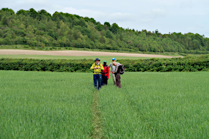
Crossing through Unhill Bottom.
Next we joined the Fair Mile which we followed for slightly too long, having to double back to take a turning down to Starveall Farm, where we closely observed by some sheep and their lambs. Then we began to cross a field of peas. The crops were quite new and easily trodden on, so we did our best to follow a path of least damage. These turned out to be tractor tracks and not the actual footpath, so corrections had to made a couple of times as we crossed through Unhill Bottom.
Next came a steep uphill lane, which led to Town Copse on the edge of Unhill Wood. We stopped at the top to admire the view (and get our breath back) before entering Town Copse and finding a place to have our packed lunches. A handy fallen tree made a good bench for us to park ourselves.
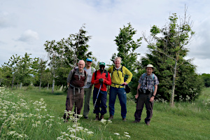
Posing for a group photo near Town Copse.
After lunch, we joined The Ridgeway for a short distance before leaving it to head up Lowbury Hill. It is believed that a Roman temple once existed on this hill, and if you look closely at the Google Maps aerial view of the hill, you can just make out a slight discolouration of the ground in the shape of a large rectangle. Roman coins and pottery have been found at this site.
Heading north, we were back on the Fair Mile, at the other end this time. Following it westward for a short distance, we turned north-east to cross the Aston Upthorpe Downs, Oven Bottom (ouch!) and Langdon Hill. A zig-zag in our route swapped from one footpath to another, leading us toward Aston Tirrold.

On the top of Lowbury Hill.
Crossing the main road into Chalk Lane, we saw a car that was awkwardly parked and the driver was standing in front of it with a gloomy look on his face. We asked if everything was okay and he directed our gaze to the front of his car. He'd misjudged the turning and buckled the nearside wing and front valence on the bank. He had our sympathy.
Taking a short-cut across a recreation ground, we were heading away from Aston Tirrold on a bridleway, having barely entered the village. This long path was the same path that we'd originally used at the start of the walk, but to add variety, we left it at Lollingdon Farm and took a footpath to the north. This led us back into Cholsey at a point further north-west, so a bit of road walking was required to get us back to the station. See our route on Google Maps.
Thank you to Ian for leading this walk.
Walk 517 - Reading to Pangbourne via Mapledurham

Lawrence explaining about the filming of The Eagle has Landed.
I didn't make it to the walk on Sunday 15th May, but thirteen other people did. Despite the changeable weather, most of the walk escaped the rain.
This ten-mile walk started at Reading railway station and finished at Pangbourne railway station following a route mostly to the north of the River Thames.
Starting from Reading, the route passed through Caversham Court Gardens and Mapledurham, where they stropped for lunch in the grounds of St Margaret's Church. This is where the 1976 second world war film The Eagle has Landed was made. The route continued to Whitchurch-on-Thames and then Pangbourne.
As the weather had deteriorated in the afternoon, the pub stop in Pangbourne was abandoned in favour of getting home.
Thank you to Lawrence for leading this walk.
Walk 515 - Pewsey, Pewsey Hill and Pewsey White Horse
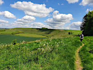
Pewsey Hill and Fyfield Down.
Saturday 7th May: After a delay due to a cow on the train line, five of us set off on our trip on the Whitehorse trail. The sun was shining and the walkers were full of energy after dropping into the local bakery whilst waiting for the train. After quickly leaving Pewsey we headed towards Manningford Abbot on footpaths and quiet lanes. First stop was an old mill on the River Avon. The mill is now a very impressive 4 story residence. Next stop was at the little church that was next to the impressive Manor House. We then started our gradual climb to Pewsey Hill with the sight of many new born lambs, including triplets.
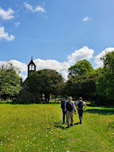
The little church at Manningford Manor House.
We then made our way to the Pewsey White horse, one group taking the easy route and another group climbing up the sharp hill to the whitehorse. Lunch was had overlooking the Pewsey Whitehorse and the Pewsey Vales. Wonderful views were enjoyed as we munched our vegemite sandwiches.

The church at Milton Lilbourne.
We then headed towards the long barrow and we had great views of red kites, below us, soaring in the drafts and with the sun highlighting the colour of their plumes. The long barrow was covered in bright purple orchids and fortunately the cows, which like to stand on the barrow, were nowhere to be seen. We then started our descent towards Milton Lilbourne where we checked out the marvellous old manor houses and had a quick visit to the 12th Century church.
After checking out the church we made our way to Pewsey where we finished our walk at the community cafe where we enjoyed our afternoon tea; well worth a visit if you like home made cakes.
Thank you to Ian for leading this walk and writing it up.
Walk 512 - Streatley, Moulsford and the River Thames

Taking a break, sitting by the Thames.
On Sunday 24th April, nine of us gathered at the top of Streatley Hill for a 10 mile walk on a beautiful, sunny day. There was a mix of familiar and new faces. The bright, clear day meant that we were able to enjoy the wide, open views as we strode over the Berkshire downs.
We then descended into the Thames valley at Moulsford for the final third of the walk which was along a very pretty stretch of the Thames.

Yomping up the steep slope of Lardon Chase.
There was an option for a break at the Coppa Club by the bridge at Goring and it was unanimously agreed to drop in for drinks and ice cream.
We found a great table in the shade by the riverside.

The view of Goring and Streatley from the top of Lardon Chase.
Following this stop, we were all so full of energy, we practically bounded up the hill at Lardon Chase to the final (and arguably, best) view of the day.
Some of the newcomers were a bit concerned that they may struggle with the longer distance. However, they found the pace, combined with the occasional stop and beautiful views meant that they barely noticed the distance.
It was a lovely day and I very much enjoyed leading such a friendly, happy group of people.
Thank you to Rosy for leading this walk and writing it up.
Walk 511 - Middle Assendon, Shepherds Green and Bix
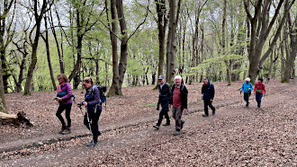
Walking through Wellgrove Wood.
On Saturday 23rd April, nine walkers including an assortment of visitors from other groups and some regulars joined us today for this enjoyable walk.
We took the quiet road up to Bix Bottom before turning left to pick up the Chiltern Way just before the ruined St James’s Church. We then headed up through Wellgrove Wood where it was lovely to see the pale green of the freshly emerged leaves on the Beech trees.
We continued on down to Crocker End with its pretty cottages and then walked through Lowercommon and Highmoor Common Woods.

Plenty of bluebells on display at Lower Highmoor.
At Lower Highmoor and Holly Grove woods we saw plenty of bluebells with their wonderful intense blue stretching out amongst the trees.
We took our lunch stop at Shepherd’s Green and then walked through the countryside leading to Greys Court where we stopped briefly.
More bluebells just beyond Greys Court were admired from a distance before progressing through farmland to Bix and Bix Common and before long we reached White Lane and back to the start of our walk where we said our goodbyes. See our route on Google Maps.
Thank you to Julia from leading this walk and for for writing it up.
Walk 510 - Wayfarer's Walk, North Oakley and Hannington

Following the Wayfarer's Walk through Frith Wood.
Easter Monday saw nine of us (eight regulars plus a visitor) enjoying the surprisingly good Bank Holiday weather on a walk around Hannington. We started by following the Wayfarer's Walk heading south-east from the White Hill car park. It was uphill to start with and then downhill from Walkeridge Farm to North Oakley.
Uphill again from Manor Farm to Fremantle Farm and then downhill into Frith Wood, where the bluebells were out and nestled on the woodland floor amongst the wood anemones and even some wild daffodils.
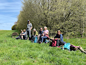
Lunch stop at Warren Bottom Copse.
We left the Wayfarer's Walk as it crossed White Lane, which we followed White Lane to the junction of Hannington Road. This then took us to Warren Bottom Copse and the Welly Boot Corner Walk. The start of this path had an actual wellington boot on the wooden signpost!
There were plenty more bluebells to be seen in this woodland. Emerging from Warren Bottom Copse, we found some long thin logs by the edge of a field where we could sit and eat our packed lunches in the sunshine.

Checking the view from Cottington's Hill.
After lunch we continued to follow the Welly Boot Corner Walk to the picturesque village of Hannington. Crossing the green and passing the church, we took a footpath leading to Meadham Lane, which we followed westward for a short while before heading north on an unnamed lane to Cottington's Hill.
Atop Cottington's Hill is a small caravan park and large television transmitter mast. The mast could be seen from many parts of our route, but it dominated the view as we walked up this lane. The view from Cottington's Hill was quite impressive, with large parts of Berkshire and North Hampshire visible.
It was downhill back to the car park, having covered 14km (8.7 miles) which included 457m (1,500ft) of ascent in total. See our route on Google Maps.
Thank you to Julia for taking the photographs while I led the walk.
Walk 509 - Crazies Hill, Hurley and Culham
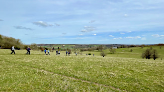
Walking through Culham Deer Park.
Sunday 10th April: On what turned out to be a glorious April day, thirteen walkers attended our walk including BWW regulars a potential new member and visitors from neighbouring groups. We set off from Crazies Hill through paths alongside a farm with chickens and Alpacas before reaching Cockpole Green.
We then picked up the Chiltern Way heading through more farmland at Upper Culham and Middle Culham before arriving at Remenham Hill. Stopping for a drink break we all admired the sweeping views of the estate at Culham House and the different herds of deer. The white deer were particularly striking this day!
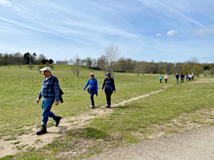
Walking down to the Thames Path from Culham House.
Continuing through the estate we soon arrived at the Thames Path near Lower Culham Farm where we saw some wonderfully cute lambs that were nestled in the grass with their mothers. On the river we noticed how the Canada Geese were honking loudly and seemed quite insistent for some reason!
Soon we reached Frogmill and noticed some of the interesting riverside dwellings and their gardens as well as impressive views up towards Danesfield House Hotel. Heading along a little further we settled on some convenient riverside benches for our lunch before pressing on towards Hurley lock and turning down into the picturesque Hurley village.

Lambs at Lower Culham Farm.
Some went to explore the church whilst the rest of the group popped into the village shop for ice creams! What a perfect addition on such a lovely day.
After this we continued along Shepherds Lane back towards Frogmill Farm before heading along the path where the Hurley Chalk Pit nature reserve is situated (the site of beautiful rare orchids later on in the year) and saw primroses and signs of delicate cowslips coming into flower.
Turning up towards Juddmont Farms (stud farm) with its immaculate and extensive grass fields we saw some handsome thoroughbred horses who came to greet us. Then, before long we were back at Crazies Hill and said our goodbyes, all agreeing on what an enjoyable walk we had shared. See our route on Google Maps.
Thank you to Julia from leading this walk and for for writing it up.
Walk 508 - Fleet Pond and Pyestock Hill

Standing on a jetty by Fleet Pond.
Having diligently pre-walked each of the walks I've led this year, I led the walk on Sunday 3rd April without first doing a recce. Due to time constraints I was unable to walk through the route beforehand, and in any case, it was a walk I knew well. However, the path from the station to Fleet Pond was closed due to maintenance, which cut off the starting and finishing legs of my planned route. Ooh err!
So we started by walking away from Fleet Pond and into town in order to approach the pond via an urban route. Once we were back on the intended route, we followed the path down the west side of the pond, stopping at one of the jetties to watch the ducks and geese squabbling amongst themselves for dominion over the pond.
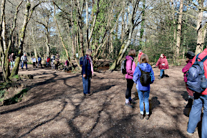
Ramblers and dog walkers mingling by Gelvert Bridge.
At the south of the pond, we then followed Fleet Brook - or Gelvert Stream as that section is also called. We crossed it at Gelvert bridge and continued to follow the stream until it reached the Basingstoke Canal. Here we followed the towpath towards Fleet, stopping at Pond Tail to cross into the Forest of Eversley, which confusingly is not near Eversley village.
Crossing heathland, we found a suitable spot for our picnic lunch. Although it was only 7 or 8 °C, the sun was out and the wind was low, so we didn't feel too cold. After lunch we crossed through the forest to Norris Hill, and after crossing the main road and then the canal, through Pyestock Hill. These woodland paths brought us back to Gelvert Bridge. Here we headed off north-east to form a figure-of-eight route.
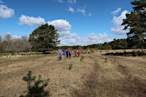
Heathland on the edge of the Forest of Eversley.
My original route would have brought us back to the station along the northern edge of Fleet Pond, but the path closure meant we needed to traverse the eastern, southern and western edges of the pond before retracing our outward diversion. I certainly felt under pressure while leading seventeen people on a route I was making up as I went along. A couple of wrong turnings added to the already extended mileage, but the varied scenery looked good in the sunny weather. See our route on Google Maps.
Although the last part of our walk was retracing our outward steps, things always look different when going the other way, and a few people at the back of the group got lost. I'm sorry to say I was unaware of this until someone (not the back-marker, who wasn't at the back) pointed out they were missing. Luckily they were found in a matter minutes. All in all, I have to say this wasn't my finest hour as a walk leader, but everyone was very understanding.
Thank you to Julia for providing the photo of us on the jetty.
Walk 507 - Pewsey and the White Horse Trail
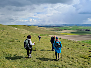
On our way to the White Horse hill-figure.
On a bright sunny morning we started our walk from Pewsey Station. The day was certainly a lot better than a quite miserable Friday. After heading along a bridle-path, and across a few fields, we began our steep climb up to the trig point at the top of the ridge. We were greeted with spectacular views across the vales and very little wind.
After catching our breath we then headed along the ridge to Martinsell Hill lookout and further extended views eastwards. Martinsell is an old iron-age fort and the moat like structures were clearly evident, as well as ancient oak and beech trees.
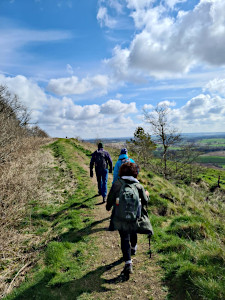
Heading up Martinsell Hill.
After feasting on our snacks we headed off towards Huish Hill and then Gopher Wood before heading north towards the Wansdyke trail.
After lunching at a suitable spot along the footpath (no brambles/nettles and warming sunshine on our backs), we continued our undulating trek before reaching Wansdyke Path. The dyke is a sight to behold and always amazes me at the amount of manpower necessary to build such.
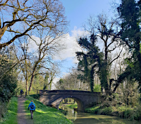
The Kennet and Avon Canal near Wilcot.
We then turned off the dyke and headed to Milk Hill, the highest point on our walk, before descending down past the Alton Barnes White Horse hill-figure and then to Adams Grave, an ancient long barrow.
We continued our downwards trip eventually reaching the Kennet & Avon Canal at Wilcot, which we followed to Pewsey Wharf. It is a particularly pleasant part of the canal. We reached Pewsey Station at 4:05pm, leaving enough time for a quick visit to the Ale Shed in Pewsey.
Listed as a challenging walk, the length ended up at a touch over 14 miles. The weather was very kind, apart for a short snow shower mid afternoon.
Thank you to Ian for leading this walk and writing it up.


