Walk 538 - Peasemore and Chadleworth

Stopping for a drink at the Ibex Inn, Chaddleworth.
On Sunday 25th September, I was fortunate to catch a lift from the walk leaders, so many thanks to Mike and Alison. As we headed towards Peasemore we were considering the possibility that we would be the only walkers, such was the traffic problems that occurred over the weekend due to work on various roads. We were therefor pleased to see a number of cars pull up just after our arrival. Our group consisted on nine walkers in total, largely BWW, but with a few trying us out.

Walking from Leckhapstead to Peasemore.
We headed off down Hillgreen Lane and up past The Fox at Peasemore. We were going to have a drink there at the cessation of the walk but it is closed for two weeks for renovations. We then ventured past the impressive cricket ground towards Brightwalton Holt and onwards to Chaddleworth where we stopped for tea and coffee at the Ibex Inn.
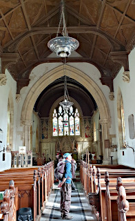
Looking round Saint Barnabus Church, Peasemore.
We then continued our walk towards Leckhampstead before stopping for lunch at a location that presented us with sweeping views of the Wayfarer's Walk in the distance. Try as we did we could not spot the Combe Gibbet but did spot the huge wind turbine that is on the outskirts of Faccombe.
After lunch we moved on to Leckhampstead and managed to get Mike to stop at the impressive Saint James Church. Despite its relative youth, built in 1859, it is truly a marvel to behold and well worth a visit.
We then continued our walk along a few gentle undulations before returning to Peasemore where some of us visited Saint Barnabus, an 18th century church built on the remains of a Norman church. Once again this was an impressive building, especially considering the size of Peasemore.
All in all a lovely walk on a beautiful autumn day. Thanks for Mike and Alison for leading the walk.
Thank you to Mike and Alison for leading the walk and Ian for writing it up.
Walk 537 - Kintbury, Lower Green and Inkpen

St Mary's Church in Kintbury, decorated for a wedding.
A near perfect day for walking greeted us on Saturday 17th September. Six hardy souls set off from Kintbury and the only concern was that the intrepid leader had forgotten his map in the rush to the station - he was watching an Aussie rules footy match on the TV! No problem as he had locked the route into his mind when doing a recce a few months ago.
After moving through the grounds of St Mary's Kintbury we headed down Wallington's Road before turning off into Winterly Copse. Whilst called a copse in reality the privately owned property is a wonder to walk through and is made up of a mixture of fully matured trees in excellent condition.

Stopping for a group photo at Balsdon Farm, near St Cassian's.
We then did an abrupt turn and headed through Cotmore Copse. The path was dry but I would suffice to say very muddy in winter. We then entered the impressive grounds of St Cassian's before heading towards Hungerford before quickly turning south through one of the many horse studs in the area. It was here we ran into a group of students on a Duke of Edinburgh hike - one of quite a few we would encounter over the day.

Inside St Michael's Church, Inkpen/Lower Green.
Heading south through various sheep and horse paddocks we were able to glimpse the Wayfarers Walk and Combe Gibbet in the distance. As we neared Lower Green we stopped at the magnificent St Michael's in Inkpen and were lucky enough to find it open - a rare treat.
We decided to press on to the Crown and Garter pub for lunch and thoroughly enjoyed our tea and coffee and toilet stop at the Honesty Café that sits next to the pub. We then ventured along further paths that are new to Kintbury walks and encountered a couple of decent "undulations" before coming across a super large 1970's house with an impressive Rolls Royce parked outside. We then made our way back to Kintbury via further new footpaths.
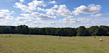
The Wafarer's Walk passing through Northcroft Farm, near Lower Green.
As we moved through Kintbury we encountered a wedding at the Church. I was keen to see the bridal party, the minister had suggested it as well, but she was running a bit late, and the wedding organiser was not that keen on us being anywhere in the vicinity, so we moved on. I love a wedding. The walk took just shy of five hours including an extended lunch stop. Distance was just a tad over 10 miles and within the 10% margin of error allowed!
Thank you to Ian for leading this walk, writing it up and providing the photos.
Walk 536 - Odiham Wharf and the Dogmersfield Loop

The three-gabled façade of Odiham Hunting Lodge.
The walk on Sunday 11th September had been added to the programme at very short notice after a strange week in which we'd had more rain than we'd had in the previous four months, we'd changed our Prime Minister, and had lost a much-loved Monarch.
Eight of us met up for this walk, which was based on half of a figure-of-eight walk I'd led years ago, but with some new sections added to break up the long section of canal towpath and add some extra variety to the walk. Starting from Odiham Wharf, we followed the towpath of the Basingstoke Canal as far as Wilk's Water, a fishing pond, where we diverted into Odiham Common.

Crossing Odiham Common.
Here we stopped to look at King John's Hunting Lodge, with its impressive three-gabled façade. It is thought to have been built in the 1730s as a house for the gamekeeper at the nearby Dogmersfield Estate. (A bit fancy for a game keeper's cottage!)
Our route took us round the side of this building, which is much less impressive than the front, and then across the common to Bagwell Lane. This we followed for a short distance before crossing two open fields and following the edge of some woodland at Swan's Farm.

Giving a wave from Sprat's Hatch Bridge.
Before we re-joined the canal, we came across a military pillbox - a hexagonal blockhouse with a gun hole in each side. This one was in good condition so some of us took a look inside. We then discussed why this mini fortress should be defending the canal. No one had a good answer. We crossed the canal on Sandy Hill Bridge and followed a woodland footpath above the canal for the short distance to Sprat's Hatch Bridge, which we crossed and descended to the canal towpath.

Lots of geese and ducks on Tundry Pond.
Following the towpath for about half a mile and under two more bridges, we left the canal at Stacey's Bridge and crossed a field into woodland. Turning right at Hellet's Copse, we crossed more fields before rejoining the canal towpath near Barley Mow Bridge.
After a mile and a half, we left the canal and entered Dogmersfield Park, stopping by Tundry Pond to have our picnic lunch. There were a lot of geese and quite a few ducks on the water, and we noticed two or three herons at the water's edge.

Enjoying a drink in the garden of the Waterwitch pub.
After finishing our lunch, we crossed Dogmersfield Park and then Forest Park, where a twisty woodland path brought us to Broad Oak - a tiny hamlet of very expensive-looking houses. We followed Broad Oak Lane to Broad Oak Bridge, back on the Basingstoke Canal again. It was then a matter of retracing our outward route along the towpath, back to the car park where we'd started. See our route on Google Maps.
Most of us opted for a post-walk drink at the nearby Waterwitch pub, whose large beer garden backs onto the canal. After the drinks, we said our goodbyes, some going home while others went to explore the picturesque village of Odiham.
Walk 535 - Chapel Row, Bradfield and Stanford Dingley

Entering the grounds of Bradfield College.
The weather on 21st August was perfect for a seven mile walk and considerably more comfortable than the heatwave of the previous weekend. Fifteen of us, including two members from the Pang Valley Ramblers and two from the Berkshire Walkers met outside the Bladebone Inn in Chapel Row. The sign at the entrance to the inn is most unusual and local legend would have you believe that it was from a mammoth which terrorised the local inhabitants until as one, they trapped and killed it, burying the beast on the banks of the river. However, the bone is actually from a whale that was found at the beginning of the 17th century in the Kennet valley and the bone is now encased in copper. The fact that it is hanging outside the inn is a mystery, but might suggest that the inn sold whale oil which was used in the 19th century as oil for lamps.

Walking past Bradfield College.
Before starting the walk, we learnt a few interesting facts about the area. The road to Chapel Row from Bradfield is lined with huge oak trees, which were planted to commemorate the visit of Elizabeth I to Bucklebury in 1568. Additional trees have since been planted in celebration of victory at the Battle of Waterloo in 1815 and again in 1972 to welcome Queen Elizabeth II. More recently Princess Anne planted an oak as a birthday present to the Queen Mother on her eightieth birthday and further rows of oaks were planted to commemorate the Millennium and to mark the marriage of Prince William to Catherine Middleton.
For the first section of the walk, we headed northwest along the edge of Chapelrow Common to take a path northwards, past St Anne's Farm and St Crispin's Farm, enjoying lovely views over the Pang Valley. After passing a wonderful row of poplar trees, we then headed east, crossing a field to follow the path up through Kings Copse.
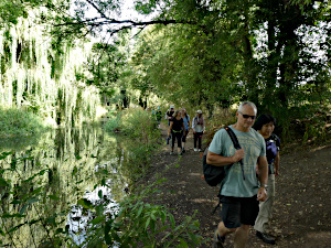
Walking along the River Pang.
On leaving Kings Copse, we passed some pretty cottages before continuing downhill along a shaded path. We soon arrived at a road, from where we headed east and then uphill through Jennetshill Wood, which is reputed to be haunted by a veiled woman who walks under the shelter of the trees. We soon arrived at a small cluster of houses in the picturesque hamlet of Rotten Row. Leaving the hamlet, a short but steep ascent led to a pathway between banks, creating the impression of walking through a tunnel.
Continuing through fields, we then reached the extensive grounds and golf course belonging to Bradfield College, which dominates the centre of Bradfield and village life there. A footpath led us through woodland and an avenue of large trees, before joining the road into the village.

Miniature settlement outside Bradfield College art dept.
At the crossroads we made two left turns and passed by the art department where we paused momentarily to admire a lovely display of miniature clay houses, arranged as a small settlement. Just past the village church, our route then took us along the River Pang, where we enjoyed a pleasant lunch stop. Continuing to follow the river and following paths along the edges of fields past Bradfield Hall Farm, our next stop was for very welcome refreshments in the garden of the Old Boot Inn in Stanford Dingley.
From Stanford Dingley, we followed the road to the west before taking a footpath south. A short stretch across fields took us back to the Bladebone Inn along the bridleway from which the walk had started. By the time we arrived back at Chapel Row, it was several degrees warmer than when we set off and we were all grateful that the majority of the walk had been through woodland and under the shade of tree lined paths. See our route on Google Maps.
Thank you to Sue from leading this walk, for writing it up and providing the photos.
Walk 533 - Silchester, Bramley and Pamber Forest

Some pygmy goats at the farm near Barefoot's House.
Saturday 6th August was a warm, dry, sunny day. Twelve people and a dog met up in the English Heritage car park by the remains of the Roman town of Calleva Atrebatum, near Silchester. We have led several walks from this location, but this 10½ mile walk is a new one, created by Pat and is loosely based on the Silchester Trail, but extended to include Pamber Forest.
We started by crossing the Roman Town to the 12th century church of St Mary, which we looked inside, and then made our way to the Roman Amphitheatre. Next, we joined the Brenda Parker Way heading south-east and left it again at Clapper's Farm. Footpaths through farmland took us to the village of Bramley, at one point passing a farm with some brown and white pygmy goats.
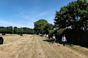
Us, crossing some farmland at Latchmere Green.
We stopped at the Bramley Village Bakery for coffee and cake. I had a Chelsea bun and a cappuccino. Suitably refreshed, we crossed the local playing field and followed a lane towards a large electricity substation, hidden in Bramley Frith Wood. The substation was practically invisible as we followed a footpath through the wood.
Leaving the woodland, we crossed open farmland to Latchmere Green and then Little London. Here we stopped for our picnic lunch at the shaded end of a large field.
After lunch, we crossed the field and entered Pamber Forest at King's Hogsty Copse. We followed a very long and very straight path through the forest, and speculated whether it had once been a Roman road.
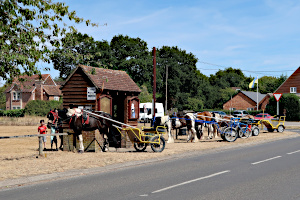
Some horses and traps, parked outside the pub in Silchester.
After about a mile, we left the straight footpath at Beggar's Bridge Copse and re-joined the Brenda Parker Way. This took us down to Silchester Brook, which was unusually dry, due to the recent long dry spell we've had. We didn't even need to use the boardwalks or bridges.
An uphill stretch of path took us through Silchester Common and brought us to Silchester village, close to the Calleva Arms pub. Outside the pub, a number of horses and traps were parked. After a show of hands, it seemed most of us wanted to stop for a drink. The few that didn't were given details of how to complete the last mile of the walk, which was quite straightforward. They messaged us once they'd reached the car park as we were finishing our drinks and about to follow them. See our route on Google Maps.
Thank you to Pat for leading this walk.
Walk 532 - Hurley and Burchett's Green
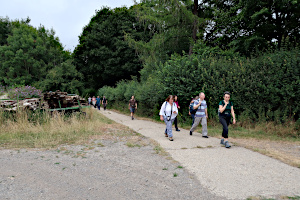
Part of the Knowl Hill Bridleway Circuit near Ashley Hill.
Eleven of us met up in Hurley village car park on Sunday 31st July for an 8 mile walk that would include Ashley Hill, Burchett's Green and a bit of the Thames Path. The day was warm and humid, but with a pleasant breeze.
The walk started by joining the Thames Path heading west out of Hurley. This we followed until we reached Frogmill Farm, where we turned south and began a gentle but prolonged ascent along a deep, trench-like path. We branched off onto the Knowl Hill Bridleway Circuit where a much flatter forestry path took us south-east through mixed woodland.
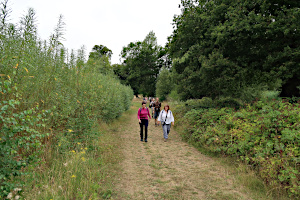
Part of the Chiltern Way near Burchett's Green.
The last of the uphill stretch became much steeper as we reached the top of Ashley Hill. Now a gentle downhill stretch brought us out of the woodland on the Chiltern Way and onto land owned by the Berkshire College of Agriculture. This took us to the village of Birchett's Green.
Turning north-west, we headed across fields into the grounds of the Berkshire College of Agriculture, passing the grandiose Hall Place before weaving our way through the more functional looking complex of buildings that make up most of the college.

A picnic table at the edge of High Wood on Prospect Hill.
On previous walks through the college, we were able to see their menagerie of exotic animals, but these are now inaccessible to the public unless you pay to visit their zoo. I suppose the college needs to make a bit of extra money this way to help support itself. We followed the prescribed route through the college.
We headed north up to the High Wood on top of Prospect Hill. Some way along a footpath there was a large picnic table overlooking the land to the north of the hill, with views of Hurley and Danesfield House on the other side of the river. The table wasn't quite large enough for all eleven of us to sit around, so some of us found some fallen branches to sit on while we had our picnic lunch.
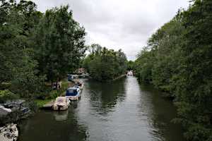
The approach to Hurley Lock on the River Thames.
After lunch, we descended the short but steep footpath down to Hurley. Following the road into the village, we took a footpath to the east and joined the Thames Path at Hurleyford Park. We followed the river to Hurley Lock. The path crossed part of the river on a large footbridge to an island that separates the lock and the weir.
There is a tea shop by the lock, which also sells ice creams. Ice cream seemed very desirable at this stage in the walk as we'd covered seven and a half miles by now and the day was heating up. They were closed! Sue, our walk leader, had included an ice cream stop in her walk description, so there were a few disappointed faces.
Crossing back on another footbridge, we were soon back in Hurley village, where we'd started. See our route on Google Maps. Luckily, the village shop had an excellent selection of ice creams on offer, so Sue's reputation was saved.
Thank you to Sue for leading this walk.
Walk 529 - Old Windsor and Runnymede

The Air Forces Memorial on Coopers Hill.
The temperatures on Sunday 10th July were set to reach nearly 30°C, which is a bit too hot for some folk, but Kathy had ten people (including a couple of visitors from other groups) join her for an interesting walk around Old Windsor and Runnymede.
Starting from the recreation ground in Old Windsor, the route joined the Thames Path heading southward, to Runnymede - with an ice cream stop along the way.

Taking a quick sit down at The Jurors chairs.
Then gently up Copers Hill to the Air Forces Memorial, which is dedicated to some 20,456 men and women from the air forces of the British Empire who were lost in air and other operations during World War II.
Stopping here for a look around, it has commanding views over the Thames and Runnymede and made a good spot for the lunch break, before heading off to see the John F Kennedy Memorial and then the Magna Carta Memorial.

The Hay Sculptured Village near the National Trust Tea Rooms.
Next stop was The Jurors, an art installation made up of twelve high-backed bronze chairs, erected in 2015 to commemorate the 800th anniversary of the signing of the Magna Carta. A good spot for a group photo.
After that, there was a stop at the National Trust Tea Rooms. Not far from the tea rooms was another recent art installation - the Hay Sculptured Village. The NT Artists in Residence, Willow Twisters, collaborated with local families and diverse community groups to build a family interpretation experience through willow sculpture.
Finally, it was a mile or so back to the recreation ground. Plenty of drink-stops and a couple of ice cream stops were included in the walk, to help cope with the heat.
Thank you to Kathy for leading this walk and providing the photos.
Walk 528 - Goring and Great Chalk Woods - evening walk

At the top of Hattonhill Shaw in Hartslock Nature Reserve.
On Wednesday 6th July, six hardy souls headed off for a 4½ mile walk on a balmy summer's evening. The start was a little delayed due to a train delay but with plenty of light this was not a real concern.
Walking towards the Great Chalk Woods provided excellent views of the river valley and we had a quick stop near the cemetery to learn a little about Arthur Harris - a major player in planning Allied bombing raids of Germany in WWII. We then entered the Great Chalk Woods, which contain a mixture of mature Beech and Conifers.
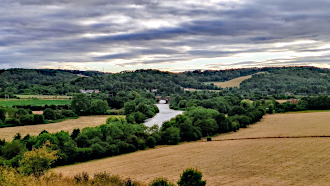
A view of the Thames from Hattonhill Shaw in Hartslock Nature Reserve.
These woods are privately owned but are managed for nature conservation.
Leaving the woods and crossing a field we encountered some very curious horses, which were intent on checking out the contents of our back packs.
We then descended down to the Thames Path via the Hartslock Nature Reserve and then to the actual Thames River for a very pleasant stroll before entering Goring, passing the late George Michael's house and Goring Mill.
Thank you to Ian for leading this walk and writing it up.
Walk 527 - Hazeley Heath, Mattingley and West Green

Looking at the WWII tank ramp on Hazeley Heath.
Fifteen people turned up at Hartley Wintney on Sunday 3rd July for an 8¼ mile walk I'd made up out of previous walks in the area. We began with a slightly urban walk through a housing estate in Hartley Wintney, before emerging on to Hazeley Heath.
Hazeley Heath is a biological Site of Special Scientific Interest (SSSI) and open access land, but during the second world war, parts of it were used for military training. Not much evidence remains except for a few concrete structures such as the tank ramp. I'm not sure how it was used, but this concrete ramp is built into the side of a steep hill. There are occasional bits of tank track to be found in the same area.
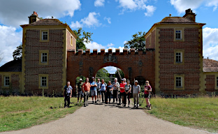
Standing in front of the gatehouse of Bramshill House.
Carrying on through the heath, we followed a footpath along the north-eastern boundary, which gave occasional views of Bramshill House - a huge Jacobean mansion that until recently has been home to a Police training college. Many ghosts are reputed to haunt the old house, including that of a bride who accidentally locked herself in a chest on her wedding night and wasn't found until fifty years later!

Picnic lunch in the grounds of Mattingley church.
Crossing the the B3011 that runs through the heath, we made our way to Hazeley Heath Cottage, where we left the heath to cross farm land. Some inquisitive bullocks approached us on Hazeley Bottom Farm, so we stayed together as a tight group as we crossed the field. The bullocks did the usual thing of only getting within about 10 metres before deciding to run away. Bullocks are quite inquisitive but not very brave.

Passing a field or barley and wheat on White Knights Farm.
We stopped for our picnic lunch in the grounds of Mattigley Church, a beautiful 15th century timber-framed building. The trees in the grounds provided welcome shade.
After lunch, we passed the picturesque Dipley Mill and then West Green House. Crossing West Green Common, we made our way back to Hazeley Heath through farmland. Part of this route has always been very muddy, even in summer months, but Hampshire Countryside Service have recently built a useful boardwalk over this area.
We took a different route from the heath back into Hartley Wintney to add variety. See our route on Google Maps. After the walk, some of the group went home while a few of us went for refreshment at The Waggon and Horses pub.
Thank you to Carol, Elise and Charlotte for taking these pictures while I (Rob) got on with leading the walk.


