Walk 586 - Fleet Pond and Pyestock Hill

Stopping on a landing stage on the western edge of Fleet Pond.
Saturday 24th was another hot one. It was already 23°C when we started the walk and got to 27°C (80°F) by the time it finished. The route was well suited to the weather, as much of it was though woodland or along paths shaded by large trees. The walk started from Fleet railway station, making it accessible by public transport, too.
Eight of us set off on a footpath from the station that took that us along the western edge of Fleet Pond. There were a number of jetties and viewing platforms along the way. We stopped at one to look across the pond and while we were there, a few inquisitive ducks came to inspect us, no doubt hoping for food.
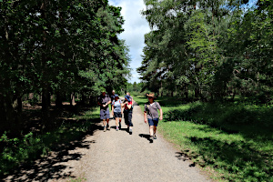
Entering the Forest of Eversley from the north.
Fleet Pond is the largest fresh-water lake in Hampshire and is part of a 141 acre nature reserve. It contains many islands, allowing birds and waterfowl to nest away from foxes and other land-based predators.
We stopped at a place called Sandy Bay were a dog owner was letting her dogs cool off in the water. Then we followed the Pond Tail stream up to the Basingstoke Canal. Following the towpath westward, we crossed under a very low bridge carrying the A323 Norris Hill Road before leaving the canal for the Forest of Eversley.

Watching the ducks at Boathouse Corner on Fleet Pond.
Zig-zagging through the mixed forest and heath, mostly sticking to shady paths, we stopped at The Foresters pub for some cooling drinks before continuing our trek through Norris Hill to a roundabout over the Basingstoke Canal.
After crossing the complicated roundabout we entered more forest at Pyestock Hill. We found a suitable place to stop and eat our packed lunches, avoiding the many ant-hills in amongst the trees. Although wood ants are quite big, they don't seem at all aggressive and left us alone. After lunch, we continued through the forest.
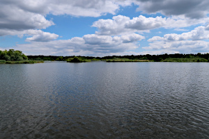
Looking south across Fleet Pond from Boathouse Corner.
Leaving the forest for heathland, we were now more exposed to the sun, but there was a gentle breeze. It was also starting to cloud over a little, which helped. Our route soon led us back into woodland and before long we were following a path along the eastern edge of Fleet Pond. My original walk design would have returned to the station along a more exposed path, so this was unfamiliar territory to me. Matt, a recent joiner, knew it well and confirmed I was on the right paths.
Our path joined up with other paths on the north-east corner of the pond at a place called Boathouse Corner. Here we stopped to admire the views before heading back into the eastern end of the station car park. See our route on Google Maps.
Rob led this walk and wrote it up.
Walk 584 - Pewsey to Great Bedwyn Linear Walk

Some English Longhorn Cattle.
Five walkers met at Pewsey Railway Station for the linear walk to Great Bedwyn. I was happy to see anyone as it was possible that it might have only been me, especially after two others dropped out the night before due to injury.
After leaving the station we made the quick trip to the bustling town centre whereby I convinced everyone that it was time for morning tea at the local community café - the cakes are marvellous and very well priced! We quickly moved on and made our way from Pewsey towards Milton Lilbourne via footpaths. We encountered eight stiles within 400 metres as we came into the village, some not in the best shape.

All Saints Church, Burbage.
After checking out one of the three super impressive manor houses we moved on to Easton Royal where the farm workers etc for the wealthy in Milton Lilbourne are said to have lived. Once we left Easton Royal the footpaths were not easily visible and the grass was long due to a lack of foot traffic, which made the trek even more enjoyable as we were yet to see another walker - I do like a walk where few tread.
Next stop was Burbage where we lunched in the impressive grounds of All Saints Church. We then continued our easterly travels and soon approached Wilton where we encountered our first undulation.

Posing in a Wiltshire wheat field.
Popular opinion was that a visit to The Swan pub was necessary and hot and cold drinks were enjoyed. We then traversed through Wilton, encountered another undulation, and then began our walk into Great Bedwyn along footpaths and eventually a short stretch via the canal.
Time was of an essence as one member, who had already completed an early morning park run, was keen to get home in time for his next outing to the pub at Didcot. Luckily for us the train was just coming into the station - the penalty for missing it would be an hour in The Three Tuns pub at Great Bedwyn! All in all a lovely walk in the Wiltshire countryside.
Thank you to Ian for leading this walk and writing it up.
Walk 583 - Mortimer and Wokefield Common Evening Walk
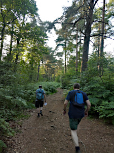
Walking through the woodland of Wokefield Common.
Thursday 15th June was a hot day, reaching 29°C during the afternoon. It had only dropped to 25°C by 7pm when we meet up in Mortimer Common for an evening walk. Maybe it was the heat, or perhaps it was the short notice (I had added it to the programme only a couple of days before) but only three people turned up. At least we didn't need a back-marker.
Crossing the recreation ground opposite the Horse and Groom pub, we briefly followed Windmill Road before taking a footpath into woodland. The shade was much appreciated. We passed Bridge's Farm, with it's frequent use of old baths as water troughs. I reckon the farmer is friends with the local plumber. They were out of date styles and some still had the taps attached!

Yes, there is a path here, somewhere!
Soon we were in Starvale Woods and then in Wokefield Common. First passing an unnamed pond and then Pullen's Pond, we left the shade of the woodland for a wheat field at Wokefield Farm. Someone coming the other way warned us about the path ahead being infested with nettles. We were wearing shorts! It really was overgrown, with tall grass hiding the brambles and nettles. It took ages to escape it for another wheat field. It was a relief to be out of that jungle!
The relief didn't last long as we were soon following a path around the edge of a field at Mann's Farm. This time it was mostly thistles, with nettles and brambles hiding within them. The tortuous trek through ferocious flora also took too long. Finally we escaped onto Nightingale Lane.
The rest of the walk was just a matter of crossing a couple of fields and through some woodland, taking us back to the recreation ground where we'd started. See our route on Google Maps. After the walk, a couple of us stopped off at the Horse and Groom for a refreshing drink. The sun was setting and it was still quite warm as we sat in the beer garden.
Thank you to Sue for providing photos of Rob's walk
Walk 582 - Hungerford and Ramsbury
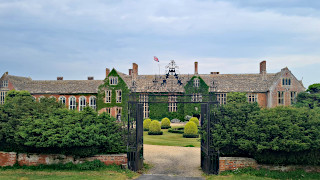
Littlecote House Hotel, Chilton Foliat.
On Sunday 11th June, ten of us met up at Hungerford railway station on what turned out to be a muggy but not excessively hot day. I had made plans to shorten the walk but everyone was keen to do the full 13 mile walk, so off we went. We were a mixture of old and new members, or those trying us out, and a couple of visitors from other Ramblers groups who were keen on the longer walk.

Crossing the River Kennet.
To avoid the possible sun, which stayed away to late in the afternoon, we reversed the walk and also traversed paths that were unknown - all in the spirit of adventure!
Upon leaving Hungerford we turned north through Hungerford Marsh and headed in the direction of Chilton Foliat before turning westwards in the directon of Littlecote House Hotel. This was my first visit to the house and it was certainly impressive.
We then continued our travels along a largely shaded footpath before crossing the Kennet River on the edge of Ramsbury. Everyone was very impressed with the quaint old buildings in the old part of town.
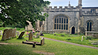
Holy Cross Church, Ramsbury.
Lunch was enjoyed in the impressive church surrounds before we headed on our way to Whittonditch and then onto Eastridge Estate. Some of the footpaths were rarely used and overgrown but we managed to find the secluded stile and make our way into Crooked Soley. We then turned south along a very long path to Chilton Foliat before crossing the Kennet River at a beautiful location. From there we retraced our steps back towards Hungerford but decided to return along the canal rather than through the marshes.
Thank you to Ian for leading this walk and writing it up.
Walk 581 - Twyford, Charvil and Whistley Green

A view of the lake in Loddon Nature Reserve.
On Saturday 10th June, we had a short (5½ mile) walk followed by a social event - a trip to Twyford Beer Festival. The beer festival raises money for Orchid, a men's cancer charity, and takes place on Stanlake Meadow recreation ground, which is close to Twyford railway station. So, it makes perfect sense to have a walk from the station that explores the local area and finishes at the festival. Ian led a walk here before the beer festival last year, so I thought I'd take a turn to do one this year.
Starting at the railway station, we walked down Station Road and took an alleyway into Polehampton Close. Here, those arriving by car rather than train were waiting in the car park. Now seven of us walked up to the High Street and westward to Silk Lane. Here we took a permissive path into Loddon Nature Reserve.
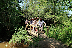
Posing on a bridge over a stream near Twyford Brook.
We followed the course of the River Loddon southward until we reached the railway embankment, where the path then took us west and then north on a circuit around the lake. Like so many lakes around here, it was once a gravel pit. After it had been worked out, it was made into a nature reserve, complete with small islands where birds and waterfowl can nest, away from land-based predators.
At the north end of the lake, we briefly re-joined the main road before heading south again into Charvil Country Park, where we followed a path between Larks Lake and Old River. The River Loddon splits into two just after Dinton Pastures and recombines north of Charvil. The west channel is known as the Old River, and the right as the Loddon. We continued to follow the edge of Larks Lake as it left the Old River.
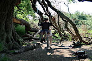
Trying out a swing hanging from an old oak tree.
Crossing under the railway, we followed the edge of another lake until we reached the ford at Giddy Bridge, where the Old River flows over Whistley Mill Lane. Rather than wade through the ford, we took a footpath and footbridge by the Heron on the Ford pub. We then followed Whistley Mill Lane as far as Whistley Bridge.
Leaving the road, soon after it crossed the River Loddon, we turned east and Twyford Brook Path and then Hogmoor Lane (track). These were mercifully tree-lined, offering much needed shade as the temperature was now in the high twenties and the sun beating down on us. Leaving the track, we crossed an open field and footbridge back into the shade of woodland. Here we encountered the first and only bit of soft mud. Everywhere else the ground was dry and cracked after such a long time without rain.

Twyford Beer Festival, with live music on the stage.
Leaving the wood, we were in pasture fields, filled with buttercups. There were a few ponies sheltering from the sun under an oak tree. We found our own oak tree to sit under and eat our packed lunches. Another oak in the next field had a swing attached to it. We stopped to try it out, of course. Well, why not?
Crossing Twyford Brook on a road bridge, we walked through Broad Hinton Park, which is mixed in with a housing estate. Emerging onto Waltham Road, we walked toward the railway station and the entrance to the beer festival. Here the walk ended, with some people making there way back to the station or to their cars, while the rest of us headed into the festival. See our route on Google Maps. It was now 30°C and we were a bit envious of those festival-goers who had brought their own gazebos.
Rob led this walk and wrote it up.
Walk 580 - Barkham and The Coombes

Stopping on Barkham Hill for a water break.
Sue B had organised a short walk and a pub lunch for Sunday 4th June. Eighteen people turned up for the walk and thirteen people attended the pub lunch afterwards. We started the walk at 9:30, which is earlier than most of our walks. This would ensure we finished the walk in good time for the 12pm pub lunch. Even at this earlier time, it was already a warm day, so sun-cream was being applied and hats were being worn. Some of us were even wearing shorts, despite the possible risk of nettles.
Crossing the church grounds, we were soon on a footpath that took us through Church Farm and Edneys Hill Farm before emerging onto a quiet lane called Edneys Hill. After a short walk along the lane, we turned off into a narrow footpath that squeezed between Daffield Farm and Highfield Farm before joining Doles Lane.

A glimpse of Barkham Manor from the footpath.
We followed the lane to the junction with Barkham Road, crossing it into Sandy Lane, which gradually became a track through woodland. Crossing Bearwood Road into Coombes Lane, we passed through more woodland to Barkham Hill. After a brief stop, we turned left and headed back down toward Barkham, but before reaching Barkham Road, we took a footpath that passed behind Barkham Manor, taking a quick stop to admire their garden and stew-pond. (Originally a pond stocked with fish for Fridays.)
This footpath then joined a track heading back up into the woodland of The Coombes, passing Barkham Rectory on the way. The woodland here is home to plenty of rhododendrons, which were in flower. They look beautiful, but are considered to be an invasive species in UK woodland an have to be carefully managed.

Walking through the mixed woodland of The Coombes.
A much more ugly invasion of the woods was waiting for us as we left The Coombes and joined Wood Lane. There was a large pile of rubbish (including empty containers of hazardous substances) dumped by fly-tippers, spoiling the environment. Why??
Heading down Wood Lane, we joined School Road and followed it down to Barkham Road. Here we crossed the main road into a farm and then a footpath passing behind Barkham Grange. Suddenly, we were on Barkham Street, almost opposite Church Lane where we had started the walk. See our route on Google Maps.
It was just after 11:30 and lunch was booked for 12:00, so we left our rucksacks in our cars and walked up to pub, with enough time to spare for a pleasant drink in their beer garden before going inside for an excellent lunch.
Thank you to Sue for leading this walk and organising the pub lunch.
Walk 579 - Watership Down, Harrow Way and Hannington
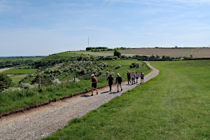
Crossing Cannon Heath Down. Cottington's Hill is visible in the background.
On Sunday 28th May, Emma led her second walk for the BWW group. Again, it was one of my walks that she had recced with me, and felt confident enough to lead it herself. I did the opening speech, describing the route and making sure everyone had enough water as it was a warm day and the walk would be 12¾ miles. Luckily my blether went on long enough for a couple of late arrivals to join us before I'd finished.
We set off on the Wayfarer's Walk along the top of Cannon Heath Down, following the gallops to Watership Down. We soon reached the spot where an ancient beech tree once stood, which featured in the 1972 book Watership Down by Richard Adams.
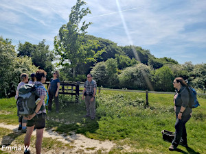
Discussing our memories of the Watership Down novel, standing by the replacement beech tree.
The tree blew down in 2004, but a replacement was planted on the same spot about ten years later. We stopped to exchange memories of the surprisingly violent children's book and film about a group of rabbits looking for a new home after developers destroyed their original warren at nearby Sandleford.
Our path now diverged from the Wayfarer's Walk and headed south. To our right we got views of Beacon Hill and the Hampshire downs. To our left was more of the rolling Hampshire countryside, including the tall and slender TV mast on Cottington's Hill. This mast could be seen on many occasions throughout the walk.
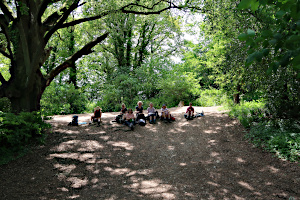
Our picnic lunch in a small clearing in the woods on The Harrow Way.
After several miles, we turned east onto the Harrow Way, an ancient (pre-Roman) trackway that connected Devon and Kent. The path was lined with mixed woodland trees and a lot of common hawthorn, which was in flower. Hawthorn flowers are usually white, sometimes with a hint of pink, but several times we came across some that were an incredibly rich pink - almost red.
We stopped for lunch on an embankment in a small clearing in the wood. There had been a rope swing hanging from an old oak when we did the recce, but someone had tied the seat end onto a high branch, well out of reach. No swinging for us today.

Colourful crops on Ashe Warren Farm.
After lunch, we continued on the Harrow Way, which followed a couple of quiet lanes before becoming a woodland path again. During that time, we passed Ashe Warren Farm, which had strips of crops with white, pink and red flowers. Very striking! Sadly, none of us had the knowledge to identify them. There were Flanders Poppies in a nearby field, which I could identify.
Soon we were at Patchbourne Wood, where there was an intersection with the Wayfarer's Walk. We joined this path, heading north-west, through woodland that had been brimming with bluebells during the recce, but they had all finished now.

Posing for a group photo in North Oakley.
Crossing Freemantle Farm, we reached North Oakley, where we left the Wayfarer's Walk. Next we crossed a wheat field and into a narrow strip of woodland. The path through this was winding and quite enclosed, with woodland flowers lining the path. It popped out quite suddenly onto Hannington Road, which we followed as far as The Vine pub, stopping there for some welcome refreshment.
After a pleasant rest in the beer garden, we finished our drinks and continued through Hannington village. Taking a footpath by the church, we left the village through a field and on to Meadham Lane, heading west and then north through woodland.
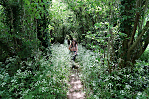
Approaching Hannington on a twisty woodland path.
A long, straight lane now took us to Cottington's Hill, where the Hannington TV transmitter mast stands. It looks very imposing as you walk straight toward it. Stopping at the foot of the mast, I was (quite easily) persuaded to tell the story about a mysterious event in the 1970s when the sounds channel of ITV was briefly hijacked by an alien voice. (See Walk 569 for the full story.) Unfortunately, I told it with the technical explanation first, which rather ruined the mystery and suspense.
Leaving Cottington's Hill, it was a gentle downhill walk through fields back to the White Hill car park. See our route on Google Maps. Having been sunny all day, it was just turning overcast and feeling a bit humid, so we'd had the best of the day.
Thank you to Emma for leading this walk.
Walk 578 - Bedwyn Common and Savernake Forest

Leaving Great Bedwyn, heading through wheat fields toward Shawgrove Copse.
Saturday 20th May was sunny and warm, with a light breeze. Eleven of us met up in Great Bedwyn for a twelve mile walk. This walk had been designed so that people wanting a shorter walk (eight miles) could join us slightly later (and leave us earlier) at St Katharine's church, which we would pass near the start and end of the walk.
Starting from Bedwyn station, we walked through the village along church lane, turning west onto a footpath soon after passing St Mary's church. Soon we were crossing fields of wheat and one of crimson clover before reaching Stock Common.
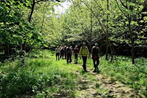
Making our way through Bedwyn Common.
Following a path along the edge of Bedwyn Common, we arrived at St Katharine's church, where another one of our members was waiting to join us for the shorter version of the walk. From here, we doubled back into Bedwyn Common. Ian, in his inimitable style, decided to take a different route to the one he knew, just to add a bit of jeopardy.

Stopping at St Katharine's Church.
Crossing a road and a field, we entered the eastern edge of the Savernake Forest. Following an overgrown path, we soon reached The King of Limbs, one of the many named trees in the forest. This oak tree is thought be be 1000 years old and had split down the middle, with many of its branches now resting on the ground. Ian pointed out that the Abingdon-based rock band Radiohead named one of their albums after this tree.

Stopping for a break by The King of Limbs oak tree.
Continuing our walk through the forest, we passed several other named oak trees, including the Crockmere Oak, the Pointing Oak, the Big-Belly Oak, the New Queen Oak and the Replacement King Oak.
We stopped for lunch, sitting on some large oak branches lying on the ground at the side of a track called The Gallops. Some of us spotted a couple of rope swings, hanging from trees nearby, so we tried them out. Well, it would be rude not to.

Crossing through the grassland of Tottenham Park.
After lunch, we continued our walk by heading further into the forest, looping around in a partial figure-of-eight. As well as the various named oak trees, we also visited the Ailesbury Column - a 27m tall stone monument, erected in 1781 by Lord Ailesbury, one time resident of nearby Tottenham House.
Although there is a clearing in a straight line from the column to Tottenham House, this is not a public footpath, so we took a parallel route via the tiny village of Durley into Tottenham Park. At one point, we could look back at the Ailesbury Column.

Looking back at the Ailesbury Column from Tottenham Park.
Looking the other way, we could just see Tottenham House itself, half a mile away. After crossing the open grassland of the park, we followed a path through a strip of woodland that brought us back to St Katharine's church.
Here we said goodbye to the one of us that started from here, while the rest of us began to retrace our steps back to Great Bedwyn. Although most of the route was just the reversal of the outward route, we took a detour along an old bridleway called Hatchet Lane. See our route on Google Maps.
Ending the walk, back in Great Bedwyn, we said goodbye to some of the group while a few of us popped into The Three Tuns pub for a post walk drink.
Thank you to Ian for leading this walk.
Walk 577 - Reading Abbey, Thames Path, Pangbourne

Exploring the ruins of Reading Abbey.
Sunday 14th May was warmer and sunnier than had been forecast. My fleece came off and the sun glasses went on before we'd even started the walk. This walk, led by Mark and Julie, was a linear walk from Reading to Pangbourne that involved a train ride. Luckily, the train strike on Saturday hadn't disrupted the Sunday service too much.
Starting from outside Reading station, we had fourteen people on the walk as we headed through town, passing through St Lawrence Church Cemetery to Forbury Gardens. There were already fifteen of us now and the phone was ringing with others who were on their way after after being caught out by changes to the train timetable.
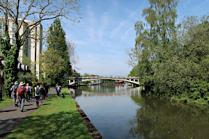
Approaching Reading Bridge on the Thames Path.
After looking around the Forbury Gardens, we moved on to the ruins of Reading Abbey. Now there were sixteen of us as we followed the River Kennet westward through the town. Passing Blake's Wharf, we left the river, following Gas Works Road and Kenavon Drive before heading northward.
Passing under the railway, we were soon crossing King's Meadow and joining the Thames Path by Caversham Lock. Now we followed the Thames Path westward through the town, passing under Reading Bridge and reaching Christchurch Bridge.
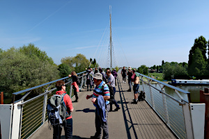
Stopping on Christchurch Bridge to admire the view.
We stopped on Christchurch Bridge to admire the views of the River Thames and Christchurch Meadow. Then, surprising everyone, the leader directed us off the bridge at the same end as we'd got on. It seemed our walk would continue on the south side of the river, passing under Caversham Bridge.
Reading Rowing Club looked busy as we carefully made our way through the numerous canoeists lifting their craft between the clubhouse and the river. There were the usual gaggle of swans on the river, undeterred by the canoeists.

A couple of Greylag geese and their gosling.
Continuing along the Thames Path through Rivermead Park, there were lots of people out enjoying the good weather. There was an ice cream van parked by the path, doing a good trade. Further along, there were many varieties of ducks and geese with their young by the water's edge.
As we passed by Tilehurst, we met up with two more of our group, who had arrived late and not realising we were exploring Reading, joined the Thames Path straight away, ending up in front of us. Now we were eighteen in number.
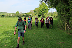
Leaving Bucknell Meadow for Mapledurham Lock.
Leaving the river at Purley-on-Thames, we followed the Thames Path through an upmarket housing estate. Then we were heading along Mapledurham Drive towards the lock. Before reaching it, we stopped in Bucknell Meadow park and sat on the grass to eat our packed lunches.
After lunch, we continued on the Thames Path, passing through the picturesque Mapledurham Lock. It was busy, as you might expect, with boats using the lock and people sitting on the many benches watching the activities.

Leaving Mapledurham Lock on the Thames Path.
There were a few more miles of Thames Path to take us the rest of the way to Pangbourne. Even the more remote sections were populated with families and individuals enjoying the scenery and warm weather.
Arriving at Pangbourne Meadow, we followed a footpath that passed by the weirs and emerged opposite the road leading up to Pangbourne railway station. See our route on Google Maps. Here, some of the group said goodbye and headed home while the rest of us popped into The Swan pub for a post-walk drink.
Although I've led a walk from Reading to Pangbourne in the past, mine didn't include the interesting tour of historic Reading that made Mark and Julie's walk quite special.
Thank you to Mark and Julie for leading this walk.
Walk 576 - Upper Bucklebury and Frilsham
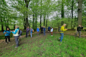
Stopping in woodland near Bucklebury.
On Saturday 13th May, twelve walkers met at the starting point for a walk expertly led by Mike. The walk started with a stroll through the woods of Bucklebury Common, complete with numerous criss-crossing paths: Mike, a relative local, knew exactly where to go as it would be easy to get lost. We emerged from the woods and crossed fields adjacent to the very affluent Brockhurst and Marlston House School.
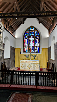
The church of St Mary the Virgin, Bucklebury.
A few inquisitive walkers had a quick look at the attractive St Mary's church which is next to the school. The Grade 2 parish church of St Mary dates back to the 12th century and contains commonwealth war graves.
We then moved onto St Frideside's Well for a picnic lunch in the woods. A group of DofE students were walking along the paths as we lunched - certainly not an easy task considering all the path options! After our lunch we walked to the Pot Kiln pub which is certainly off the beaten track. Hot drinks and cold drinks were enjoyed on the seating outside the pub.
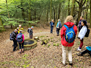
Stopping for lunch by St Fridewide's Well.
We then headed back through the woods towards our starting point but not before spending some time in the Grade 1 listed St Mary the Virgin Church in Bucklebury. Alison had done some research on the church and was able to give us a rundown of its history. We were hopeful of joining the nearby Middletons for afternoon tea but decided to not pursue this option.
We then continued our trek back to our starting point along a series of paths. Weather had been kind to us and the sun came out for our final stage. Thanks to Mike for leading the walk and guiding us safely.
Thank you to Mike for leading the walk and to Ian for writing it up.
Walk 575 - Finchampstead Bluebell Evening Walk

Plenty of bluebells in Coalpit Copse.
Our first evening walk of the year was on Thursday 11th May. With sunset at 8:45pm, there was plenty of light for a short (3.7 mile) walk after work on a weekday. Sue led this walk in an area near where she lives that she new would have lots of bluebells in flower. We weren't disappointed. The only thing to take the shine off our first evening walk of the year was a bit of rain. The weather had been dry and warn all day but light rain began just as the walk started.
Starting at 6:45pm from the Simons Wood car park on Wellingtonia Avenue, we crossed the aforementioned road and headed south through mixed woodland. Within minutes we saw a sea of bluebells in the surrounding woods. Photos can never do justice to the sea of blue and green that looks so impressive to the naked eye.
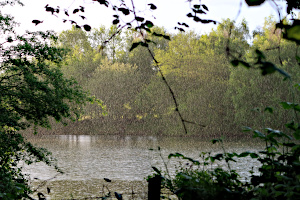
Raining over Moor Green Lakes.
Turning east, we continued through more bluebell laden woodland, finally emerging from Coalpit Copse onto Ambarrow Lane. This we followed down to Horseshoe Lake. We followed a permissive path around the north-west of Horseshoe Lake with Moor Green Lakes on the other side of the path. Then we joined the Three Castles Path which is also the Blackwater Valley Path along this section. Moor Green Lakes were to the north of the path and the River Blackwater to the south.
Looking at the lakes through gaps in the trees, we could see that the rain had become much heavier. Luckily the woodland was acting as an umbrella for us. Luckier still, the rain subsided as we left the shelter of the woods for a more open footpath. The evening sun produced a rainbow as we headed north past Colebrook North Lake.

An island of birds on Colebrook North Lake.
Leaving Moor Green Lakes, we headed north along Dell Road, admiring the cottage gardens before heading up into the mixed woodland of Finchampstead Ridges. Following a winding path through the wood, we came to clearing with a bench, high enough to give commanding views to the south. We could see over Fleet and Farnborough to Farnham and the North Downs.
Leaving Finchampstead Ridges, we followed the road back to Simons Wood and the car park. See our route on Google Maps. The walk description on our programme also mentioned an optional pub stop after the walk. A couple of people decided to go straight home, but six of us drove the short distance to The Greyhound pub in Finchampstead for refreshments and conversation before heading home.
Thank you to Sue B for leading this walk.
Walk 574 - Shalbourne, Ham, Buttermere and Botley Hill

Stopping halfway up Ham Hill for a breather.
Ian had originally planned to lead his walk on Saturday 6th May, but I suggested this might clash with a certain national event that might be of interest to our members - the Coronation of King Charles III. So, we moved the walk to Sunday 7th, which turned out to be a much better day for the weather. It had rained all day on Saturday, but it didn't rain at all on Sunday and by afternoon it was really quite sunny and warm.
However, there were a lot of street parties organised for Sunday, including one in Shalbourne, from where our walk was to start. To avoid complications, we parked in a small car park outside the village and walked in to the centre before starting the actual walk itself. Only four of us turned up in just two cars, so we probably could have parked in the village without a problem. Still, it's better safe than sorry.
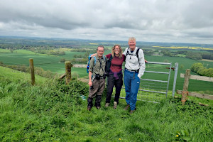
Resting at the top of Ham Hill.
The walk started from the green in Shalbourne, opposite the village pub, where there were people already setting things up for the street party as we set off. We headed eastward on a footpath through fields to the little village of Ham. We had started a walk from here a few weeks before, so the next section of the walk seemed quite familiar to some of us.
Following the Mid Wilts Way, we crossed a couple of wheat fields and ascended Ham Hill on a diagonal path, pausing half way up for a breather. At the top we stopped again before heading westward along the ridge and then south the the hamlet of Buttermere. We had a quick look around the tiny church and then followed a bridleway through Buttermere Bottom, just as we had on Ian's previous walk.
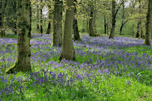
Bluebells in Buttermere Wood.
We then left the route of the previous walk to follow a track through Buttermere Wood, which was absolutely packed full of bluebells.
As the track left Buttermere Wood for Bushel's Copse, we saw what looked at first like a large and stylish bungalow, but as we got closer we noticed many of the windows weren't glazed. It was in fact a very smart complex of stables!
Crossing fields and woodlands, we continued west, over many undulations - as Ian calls them. At one point we were walking along a quiet lane called Ashley Drove when we spied a glider, silently flying overhead. Soon we passed a long thin field with a runway, which belonged to the Shalbourne Glider Club. There we a few more gliders on the ground with a number of people around them.

Shalbourne Glider Club.
One of these gliders then took off, being pulled into the sky on a long tow rope by a motorised winch at the far end of the field. Once the glider was fully airborne, it released the tow rope, which returned to the ground on its own tiny parachute.
The road became a track called Smay Down Lane, which we followed for a short while before heading off into fields and then an old farm that had seen better days. The route through the farm was unclear and seemed to involve crossing a field of cows with their newborn calves. We were careful not to get between the cows and their calves, but even so, one of the cows wasn't overly pleased to see us. It calmed down once it saw we were leaving and we were relieved to be out of their field.

Moordown Farm. Not as muddy as it looks.
We ate our packed lunches, sitting on a grassy mound near Little Botley Copse. After lunch we continued our walk by descending Botley Hill. At the bottom, we turned north-east on to our return leg to Shalbourne. Along the way, we passed through Starveall Farm where two very friendly long-haired pigs came to investigate us.
Crossing more farmland, we then passed by some relatively new vineyards and then a visitors centre, still under construction. This was once Carvers Hill Farm and now Carvers Hill Estate Winery and Vineyard. It will be worth a visit next year, I reckon, when there's some wine to try. Finally we followed Burr Lane into Shalbourne village and finished at the green. See our route on Google Maps.
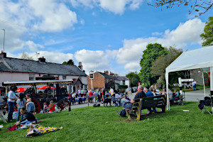
Coronation street party in Shalbourne.
The street party was still going strong so we bought some drinks at The Plough and found somewhere to sit on the green. Sadly the hog roast had all gone as it was now around five o'clock. There was a steam traction engine parked outside the pub and we watched someone stoke up the boiler. Soon after, there was an ear-piercing blast on its whistle and it set off, chugging up the road.
Finishing our drinks, we soon followed, making our way back to the car park. We took a little detour past the church, which is slightly outside the village and quite near the car park. The walk was 11.3 miles with 465 m (1,510 ft) of ascent in total, plus the additional walk to and from the car park, made it around 13 miles all together. We certainly got some good exercise that day.
Thank you to Ian for leading the walk and to Jo, Emma and Ian for some of the photos.
Walk 573 - Stratfield Mortimer, Wokefield Common and Mortimer West End
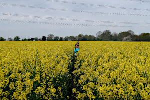
Wading through a field of Oilseed Rape.
We had twelve people on our walk on Sunday 30th April. This was a walk I'd devised a few weeks earlier and Emma came with me for the recce. She'd used my map to successfully navigate during the recce and had volunteered to be my co-leader on the day. In fact, I rather sneakily handed her the map just as we started and she led the group for the whole walk - and did a great job of it.
We started from the English Heritage car park by the remains of the Roman town of Calleva Atrebatum and took the path that crossed it from the West Gate to the East Gate, emerging by the church of St. Mary the Virgin. After a quick look around the Amphitheatre, we continued eastward through a couple of fields, one containing oilseed rape, which had grown considerably since our recce. It was now shoulder high!

Crossing a field on Wokefield Farm.
Leaving the field, we followed the course of The Devil's Highway along a quiet and not at all diabolical lane. It wasn't long before we left it and took a footpath northward across a field and over the railway on a pedestrian bridge. Now heading north-east, we followed the course of Foundry Brook to another church of St Mary the Virgin - this one in Stratfield Mortimer.
Crossing the main road, we walked along Mortimer Lane and then along a footpath through Wheat's Farm to Nightingale Lane. A narrow footpath opened into fields on Mann's Farm. Zig-zagging northward, we crossed Lockram Brook into Wokefield Farm. Then a short walk along Lockram Lane took us into Wokefield Common. Here we stopped to eat our packed lunches, sitting by Pullen's Pond.
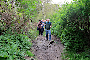
Crossing muddy puddles on a footpath through Bridges Farm.
After lunch we traversed the woodland of Wokefield Common and then Starvale Woods, crossing Lockram Brook again. A particularly muddy path had to be endured as we passed Bridge's Farm on our way to Mortimer village. Some hand-holding was helpful for getting people across the deepest of the muddy puddles - something that would have been frowned upon during the recent pandemic. (Hand-holding, that is. Not crossing muddy puddles, of course.)
In the village, we stopped at The Horse and Groom for a drink and sat outside watching the goats and ducks that live at the back of the pub garden. Refreshed, we set off along the main road, then West End Road and down Summerlug (an old back-lane) taking us out of the village and into Mortimer West End.

Standing in two counties.
Walking along Turk's Lane, we came across a county boundary marker. Mortimer appears to be in Berkshire and Mortimer West End in Hampshire. We stopped for a group photo, dividing ourselves into Berkshire residents and Hampshire residents, standing on the appropriate sides of the boundary marker. The Berkshire residents clearly outnumber the Hampshire ones.
Continuing along Turk's Lane, we branched into Simms Farm Lane and walked up the drive of Rose Cottage! We weren't trespassing as there is a public footpath there, which led us along the edge of a field and into a narrow and winding woodland path through Simms's Copse. Emerging into an open field, we then crossed West End Brook on a gated wooden footbridge.

Crossing the footbridge over West End Brook.
Now we were in a large field of sheep with their young lambs. We took care while crossing the field, not to get between lambs and their mothers. Another large field of sheep and lambs was crossed before reaching some farm buildings, where we saw two donkeys and a llama (or was it an alpaca?)
The last bit of footpath crossed Wall Lane, and surprisingly we were back in the English Heritage car park. See our route on Google Maps.
Everyone thanked Emma for leading the walk, which she did so well for someone who had never led one before. Leading your first walk can be a bit nerve-wracking, but once it's done, you get a great sense of achievement. Most first-time leaders go on to lead many more walks.
Thank you to Emma for leading this walk.
Walk 571 - Ham, Buttermere, Combe Gibbet and Inkpen
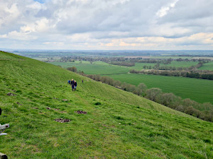
Ascending Ham Hill.
On Sunday 23rd April, twelve of us met up by the village green in Ham, a tiny village near Shalbourne, a few miles south of Hungerford. Ian, the walk leader, did his introductory speech and we set off along the lane that heads south out of the village. As we did so, we were joined by another walker, who had taken longer than expected to find the place. So now we were thirteen in number.
Leaving the road for a footpath, we followed the Mid Wilts Way through farmland to the foot of Ham Hill. At this point, one of our members, who hadn't been feeling that well at the start of the walk, decided to turn back. So now we were twelve again.
Ham Hill was a steep slog, taking us up by about 100m (330ft) in altitude over a fairly short distance. Catching our breath at the top of the hill, we admired the view before continuing on the Mid Wilts Way along the top to the west.
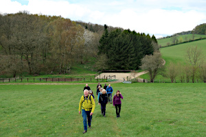
Leaving Buttermere Wood for Sheepless Hill.
Leaving the Mid Wilts Way we turned south toward Buttermere - not the Cumbrian lake, but a tiny village with a tiny church. Ian likes his churches, so we stopped off to have a look around it before continuing our walk.
A footpath by the church took us along Buttermere Bottom and to Buttermere Wood. Then is was an uphill yomp to get us onto Sheepless Hill where we joined the Test Way - a long-distance path that goes from the nearby Walbury Hill down to Eling, near Southampton. We followed this northward to Combe Gibbet on Gallows Down.
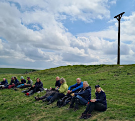
Having lunch by Combe Gibbet.
The gibbet itself is a replica, erected in 1992 on the spot were the original one had been. The original gibbet, erected in 1676, was used only once to hang a man and women that were having an affair and had murdered his wife. The prominent location was chosen to deter others.
We stopped here to have our lunch and admire the view before heading down the steep northern side of the hill and following a bridleway northward to the village of Lower Green. As we approached the village, we stopped at St Michael's Church (one of Ian's favourite churches in the area) for a look around.

Descending Inkpen Hill.
The village green had a circular bench surrounding a tree, which gave us an opportunity for a quick sit-down before continuing the walk. Heading north, we reached Balsdon Farm where there is a five-way crossroads of footpaths. Ian did his usual trick of pretending not to know which path to take. Our visitors found this slightly disconcerting.
We headed west along a hedged path and into a wood when suddenly everyone's phones began to emit an unusual alarm. This was a test of the new government emergency warning system. Now we know what it sounds like.

Having a quick sit-down in Lower Green.
Passing through the grounds of Totterdown House, with its display of daffodils and wild flowers, we joined one of the many Berkshire Circular Routes that appear on Ordnance Survey maps and followed it to Mount Prosperous, where we had been on another of Ian's walks a month ago.
One of our walkers was getting concerned about keeping an appointment later that afternoon and so we split into two groups, one marching ahead while the other took a more leisurely pace. The last leg of the walk was across farmland and then through a large garden of a private house before emerging back in Ham. See our route on Google Maps, which included 570m (1,870 ft) of ascent in total. Most of the group stayed for a drink at The Crown and Anchor before heading home.
Thank you to Ian for leading this walk and providing two of the photos.
Walk 569 - Wayfarer's Walk, North Oakley and Hannington
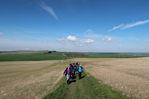
The Wayfarer's Walk near Stubbingtons Farm.
The weather on Saturday 8th April was unexpectedly good for a Bank Holiday weekend, with blue skies and only a light breeze. Seventeen of us (including a few visitors from Meetup and from other Ramblers groups) gathered in the free car park on White Hill, near Kingsclere, for a hilly nine-mile walk.
After I'd done the usual leader's speech and introductions, we began by following the Wayfarer's Walk, uphill to the east and then south-east to Walkeridge Farm. Here we saw sheep with their newly born lambs. The path continued, but downhill now, through a strip of woodland to the tiny hamlet of North Oakely.

The Wayfarer's Walk near Freemantle Farm Cottages.
Still on the Wayfarer's Walk we continued heading south-east, through farmland to White Lane, where we left the Wayfarer's Walk. At the other end of White Lane was a crossroads with an old-fashioned cast-iron road sign. One of its arms pointed north to Hannington Road, which we followed.
After a short walk along this road, we found the start of the Welly Boot Corner Walk. The fingerpost signpost had an actual wellington boot attached to it! Entering the woods of Warren Bottom Copse, we were slightly too early in the year to see the usually impressive spread of bluebells that we've seen there on previous walks.
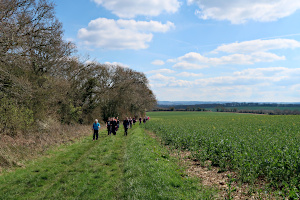
The Welly Boot Corner Walk near Hannington.
As the path emerged from the woods into an open field, we stopped for lunch, finding some logs to sit on. During lunch, the conversation drifted from Red Kites to James Bond and then from Basil Brush to the sweets and chocolates of our youth. Quite a random conversation.
After lunch, we continued on the Welly Boot Corner Walk to Hannington. Here we stopped at The Vine pub for a drink and sat in their large and sunny pub garden.
Refreshed, we continued the walk through the picturesque village of Hannington and then headed north, through more hilly farmland.

An obstacle on the path in the woods at Freemantle Park Down.
Turning westward, we crossed a field into the woodland of Freemantle Park Down. Taking the path across the top, we soon reached the mighty transmitter mast on Cottington's Hill. I know a story about this mast, which I duly told.
One day in the 1970's, viewers watching the ITV early evening news found that the picture became distorted and the sound was replaced by a strange, alien voice. It claimed to be Vrillon of the Ashtar Galactic Command and delivered a speech stating that the people of Earth were heading for a disaster of our own making. The speech lasted several minutes, telling us how we should mend our ways.

Standing on Cottington's Hill with the mast behind us.
Southern Television (ITV) were inundated with phone calls that evening from (understandably) worried viewers.
In those days, the transmitter received its feed from another TV mast via a microwave link, and it is believed that some pranksters with a technical bent had found a way to feed their own audio signal into the link, which was then broadcast by the transmitter. The police never discovered who did it. Perhaps it was intergalactic aliens!
With the story told, we did our final stretch of the walk, which went steeply uphill to the top of Cottington's Hill, where there were great views of North Hampshire and Berkshire. It was then downhill through fields back to the car park. See our route on Google Maps. We'd done 9½ miles with 1,600 feet (488m) of ascent in total.
Rob led this walk and wrote it up.
Walk 568 - Chapel Row, Stanford Dingley and Rotten Row
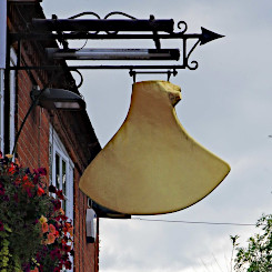
The mysterious bladebone, hanging outside the pub.
Following a few days of heavy rain, the weather forecast for Sunday 2nd April was significantly better and enticed fourteen ramblers to meet outside The Bladebone pub in Chapel Row for a seven-mile walk, including three new walkers who were trying out the group.
In the past, this walk has been included in the programme at different times of the year, including a heat wave in August and snow in March, but today, for a change, the route was reversed! Although the weather forecast was good, the route included long stretches of ankle-deep mud and in the ten years that I’ve been walking with the Berkshire Weekend Walkers, this walk could easily be the muddiest walk ever!

A very muddy path near Chapel Row.
Before starting the walk, we learnt a few interesting facts about the area. The sign at the entrance to The Bladebone pub is most unusual and local legend would have you believe that it was from a mammoth which terrorised the local inhabitants until as one, they trapped and killed it, burying the beast on the banks of the river. However, the bone is actually from a whale that was found at the beginning of the 17th century in the Kennet valley and the bone is now encased in copper. The fact that it is hanging outside the inn is a mystery, but might suggest that the inn sold whale oil which was used in the 19th century as oil for lamps.
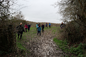
More mud on the way to Stanford Dingley.
The road to Chapel Row from Bradfield is lined with huge oak trees, which were planted to commemorate the visit of Elizabeth I to Bucklebury in 1568, the victory at the Battle of Waterloo in 1815 and to welcome Queen Elizabeth II in 1972. More recently Princess Anne planted an oak as a birthday present to the Queen Mother on her eightieth birthday and further rows of oaks were planted to commemorate the Millenium and to mark the marriage of Prince William to Catherine Middleton. On March 11th 2022, a number of trees were planted to commemorate the Queen’s Platinum Jubilee.

The River Pang at Bradfield.
For the first section of the walk, we headed northwest along the edge of Chapel Row Common to take a path northwards, past St Anne's Farm and St Crispin's Farm. From here, there are lovely views over the Pang Valley, but today, all eyes were firmly fixed on the ground in order to navigate the first stretch of mud.
After passing a row of Poplar trees, we continued straight ahead through fields leading to Stanford Dingley. A short stretch of road through the village, past the Old Boot Inn, took us to the start of a well defined footpath along the edges of fields, passing Bradfield Hall Farm, where we stopped briefly to admire a pair of long horn Highland cows. It wasn’t long before we were walking along the banks of the River Pang. Although the lunch stop was originally planned for later in the walk, but after all the mud, the sight of a bench and some dry concrete steps at the side of the river seemed the perfect location for an early lunch.
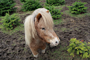
A field of tiny firtrees and miniature ponies.
Continuing along the river to the village of Bradfield, we passed the Bradfield College Art Department, where a lovely model village made up of small clay houses was on display. The grounds of the college are extensive and our path out of the village passed by the school golf course via a lovely avenue of trees. Crossing a road, we then took another well-defined path across fields, passing some miniature ponies surrounded by equally miniature Christmas trees.
The next part of the walk took us to the hamlet of Rotten Row via a pathway between banks, creating the impression of walking through a tunnel. A steep descent through the hamlet passed well-manicured gardens full of beautiful spring daffodils.
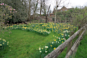
A sea of daffodils in a garden at Rotten Row.
Leaving Rotten Row, we headed towards Jennetshill Wood and then followed a path uphill towards some pretty cottages and Kings Copse. Emerging from the Kings Copse, we could see the poplar trees that we passed near the start of the walk and it was there that we decided to take an alternative route back. The new route looked promising on the OS map – a short stretch through some woodland, followed by a longer stretch of road back to Chapel Row. However, this proved to be the wettest part of the walk and felt like we were wading through a muddy stream! Finally seeing dry land and the road back to Chapel Row was a very welcome sight and a drink in the garden of the newly refurbished Bladebone pub at the end was very well deserved! See our route on Google Maps.
Thank you to Sue for leading this walk and for writing it up.


