Social Event - Foot-Golf in Wokingham

The BWW Foot-golfers, ready to start.
One day shy of a year since the first BWW Foot Golf, the follow up contest took place on a slightly damp Sunday morning at the end of June. Interest since last year had grown 50% with a total of nine willing foot-golfers. The majority had never played before, and so I gave a brief overview of what the game was about to the newbies.

Teeing off for the second hole.
In fact, the weather was virtually a replica of last year, but without the strong wind. Many of us were donning fleeces and waterproofs at the 1st tee but as time went on, these layers were peeled off during what turned out to be a pleasantly warm English summer’s day.
The hole lengths ranging between 60 and 160 yards in length, with the basic aim of trying to kick the ball down the fairway, onto the green and into the hole, in as few shots as we could.

The other team getting ready.
We tried to find ways to negotiate (with various levels of success) the obstacles between the tees and the holes, such as the thick rough (unmown grass to the uninitiated), ditches, and finally the artificial greens which were quite unforgiving to slightly underhit or overhit putts.
Everyone did really well, posting a number of 3s and 4s which were "par for the course" or only just over. Karen and Richard were winners of the respective groups with Kathy, Nicola and Mark following closely behind. Lots of fun was had by all and afterwards we settled in for a drink and lunch at the nearby club café for lunch.
There was a level of interest in trying the Adventure Golf and perhaps the Pitch and Putt too later in the summer. If after reading this you would like to try either, then feel free to email social@berksww.org.uk, with an indication of what days of week are best for you.
Thanks go to Richard for organising this social event and for writing it up.
Walk 646 - Fleet Pond and Pyestock Hill

View of Fleet Pond from the north-east corner.
On Saturday 29th June, ten of us assembled at Fleet Railway Station for a 7½ mile walk around Fleet Pond and Pyestock Hill (starting slightly late due to a delayed train). This was a modified version of a walk I've led here many times before, and is a good summer walk as much of the route is under the cover of trees. It was 24°C today, with a gentle breeze - a pleasant temperature in the shade.
A few steps led us from the station car park onto a footpath by the northern edge of Fleet Pond, the largest freshwater lake in Hampshire, surrounded by 140 acres of nature reserve. We saw fish, ducks, geese and swans in and on the pond.

Walking through access land between Fleet Pond and Southwood.
Leaving the edge of the pond, we ventured into "Managed Access Land", woodland and heathland used occasionally by the army for training, but usually open to the public. One section is also used by the local model aircraft club, and we saw a couple of radio-controlled stunt planes doing aerobatics.
We headed south, following a strand of Fleet Brook, until we reached the Basingstoke Canal. We followed its towpath westward for a short while before crossing the canal on a road bridge on the outskirts of Fleet and entering the Forest of Eversley.

Stopping for refreshments at The Foresters pub.
We stopped to eat our packed punches in the woods, finding a number of suitable logs to sit on. After lunch we stopped for refreshments at The Foresters pub, sitting in their pub garden.
Continuing our walk, we followed forest paths to Norris Hill, where we crossed a large roundabout that bridged the Basingstoke Canal. We left the road for more woodland footpaths at Pyestock Hill.
Along the way, we came across a few ant nests. From a distance, these looked like piles of dead pine-needles and small sticks, but as you got closer, you could see the continuous movement of many wood-ants, often carrying bits of woodland debris many times their own size.

A footbridge south of Fleet Pond.
Next, we followed another section of Fleet Brook to Fleet Pond, stopping for a group photo on a bridge over the brook. After that, we stopped for a break at an area that used to be nick-named "The Beach" due to the very sandy soil there, although it doesn't seem as sandy as it used to.
The rest of the walk followed the south-western and western edges of the pond, back to the railway station. See our route on Google Maps. Along the way, there were a number of viewing platforms, but the reeds were so tall it was hard to see the pond, but we did get to see some ducks with their young waddling along one of the jetties.
Thanks go to Rob and Emma for leading the walk and Rob for writing it up.
Walk 645 - Aldworth and The Ridgeway

Amazing diamond-shaped patterns in a crop.
On Sunday 23rd June, fifteen BWWs met in the lovely village of Aldworth outside the Bell Inn pub. The walk started earlier than usual at 9:30am and this was to make the most of the coolest part of the day. Taking a footpath that crossed several fields, including one full of corn, we were soon in the small hamlet of Westridge Green. From here we headed north along a track that descended through woodland with lovely views across fields, some of which had been cultivated and displayed amazingly regular diamond shaped patterns.

Giant Daisies on the Ridgeway.
After passing Kiddington Cottage, our route took us through a field in which there have been wonderful displays of poppies in previous years, but sadly only a handful were seen on this walk. The hedgerows and paths however, were lined with an abundance of beautiful wild flowers and on reaching the Ridgeway, we enjoyed a short drink stop next to a verge full of tall daisies.
Although the walk was only 5½ miles long, it included 486 feet of ascent, most of which was along the 1.6 mile stretch of the Ridgeway. From the Ridgeway, there were many lovely views south over Streatley Warren, but the best was yet to come when we turned south off the Ridgeway and looked east, right down Streatley Warren.

The Aldworth Giants in St Mary's Church.
Continuing along the lane, we soon came to the road that leads back to Aldworth, but we chose to take a more scenic route down a track that passed Dumworth Farm. From here a short stretch of road walking took us to the church of St Mary’s, which dates back in part to around 1200. Here there was plenty to see, including an ancient yew tree in the churchyard which is at least 1,000 years old and the grave of Laurence Binyon who is remembered for writing the poem “For the Fallen” which is quoted at Remembrance Day services. We also found a grave that has connections to one of the members of the Rolling Stones family.

Lunch at the Bell Inn pub, Aldworth.
On entering the church we saw what are popularly known as the Aldworth Giants from the 14th century - nine stone effigies of members of the de la Beche family along the aisles, under richly carved canopies and upon tombs in the nave.
Back in the village of Aldworth, the walk ended outside the award winning Bell Inn, which has been in the same family since the 18th century. We arrived just as it was opening and eight of us decided to sample their tasty, generously filled rolls whilst sitting in their lovely beer garden; a perfect end to the walk!
Thanks go to Sue for leading this walk and writing it up.
Walk 644 - Henley, Remenham Wood and Hambledon Lock

Approaching Remenham Wood from Henley-on-Thames.
On Sunday 16th June, Petrina and Richard led a short walk around Henley-on-Thames, Remenham and Aston, with an option for a picnic afterwards and a free open-air concert, performed by the Woodley Concert Band.
The walk started from the bandstand in Mill Meadows, not far from Henley railway station. We walked along the Thames Path and crossed Henley Bridge. We departed from the Thames Path to follow the Chiltern Way through Remenham Wood.

Approaching Hambleden Lock from Aston.
On reaching Aston, we left the Chiltern Way for a footpath across fields, leading to Hambleden Lock. Here we stopped for a snack-break and to watch the boats, ducks and geese on the Thames.
After our break, we continued along the Thames Path, passing Temple Island, Remenham, and the Upper Thames Rowing Club, on our way back to Henley.

Some tents already erected for the Henley Regatta.
As we approached the town, the riverside was lined with large tents, seating gantries and other paraphernalia associated with the Henley Regatta, due to take place in the first week of July. There were also lane barriers set up in the river, ready for the boat racing.

The Woodley Concert Band playing in the Bandstand at Mills Meadows.
Crossing Henley Bridge, we retraced our steps back to Mill Meadows. See our route on Google Maps. Here, some of the group said goodbye while the rest of us got out our picnics, sat on rugs or folding chairs, and settled down for lunch in the warm sun. Some of us also bought cakes and ice creams from the local café.
During lunch, members of the Woodley Concert Band (including Petrina) gradually assembled on the bandstand. After lunch, we were treated to a two-hour concert of arrangements of well-known film and popular music.
Thanks go to Petrina and Richard for leading this walk.
Walk 643 - Finchampstead and California Country Park - Evening Walk

California Country Park.
Evening walks are the perfect way to wind down after a busy day, and our third one of the year was on Thursday 13th June. The weather all week had been rather dull with intermittent rain and the weather forecast for our walk predicted an 80% chance of rain. This however did not deter seven Ramblers from meeting outside the 12th century church of St James’ in Finchampstead for a short four mile walk.
Leaving the church, we passed the Queen’s Oak pub and headed north-east along the lane to Warren Lodge and then west towards Warren Woods, passing Warren Wood Bell Barrow on the way. This is the largest burial mound in Berkshire, dating back to the Bronze Age between 2000-1100 BC.

The lake at California Country Park.
From Warren Woods, we then crossed the road and entered California Country Park, to walk around the lake. Except for a pair of swans and a few ducks, the lake and country park were very much quieter than usual.
On leaving the Country Park, we took footpaths along the edges of fields, first south and then north-east back to the church.

Our route back to the church.
As we walked through the churchyard, one of the group pointed out some of the interesting graves, notably Bramwell Bernard Booth and Jane Levers Booth, both of whom had been colonels in the Salvation Army and another member of the same family who had lived until the age of 105!
Compared to an evening walk from the same location a year ago, the weather was somewhat colder. However, we were extremely lucky that we managed to complete the route without rain – it stopped as we started walking and was just starting again as we stopped – perfect timing! After the walk, a few of us enjoyed a drink in the Queen’s Oak pub.
Thanks go to Sue for leading this walk and writing it up.
Walk 642 - The Parish of Wickham

Following the Roman road through woodland near Radley Farm.
On Saturday 8th June, Mike and Alison led a 6½ mile walk around the parish of Wickham. Fifteen of us (including some recent joiners and newcomers trying us out) assembled outside the primary school in the village of Wickham. Crossing the main road we followed Windingwood Lane, a tree-lined sunken track, heading westward and then southward to Radley Bottom. Here we stopped for an early light lunch, sitting on a grassy hillside with views of Heath Hanger Copse and some wheat fields.

Following a footpath through Clapton Farm.
After lunch, we headed upward and eastward into woodland containing the remains of a Roman road. Emerging from the woodland, we were at Radley Farm, where we saw a lot of lambs in a field by the footpath. They weren't at all shy, and came over to examine us.

The elephant heads in St Swithen's Church, Wickham.
Passing through another wood containing a section of Roman road, we continued eastward and then south-east past Clapton Farm. At Elcot Farm we turned north, on our way back to Wickham village.
On the way, we stopped off at St Swithen's Church, where Mike had promised us an unusual sight. Inside the church were eight papier-mâché elephant heads attached to the roofing timbers. These had been acquired at the Paris Exhibition in 1862.

Stopping for refreshments at the Five Bells pub.
As Mike was explaining this, a gentlemen already in the church, possibly the vicar or verger, joined in with a lot more information about the church and the local area. He also explained that the Saxon church was built on the site of a Roman fort, and furthermore, the Saxon church had been rebuilt by the Victorians. The original Roman lookout tower was used as the church tower by the Saxons and then an extra section added on top by the Victorians.
Now back at Wickham village, the walk was over. See our route on Google Maps. Some of us went to the local Five Bells pub for refreshments and chat while others went on their way.
Thanks go to Mike and Alison for leading this walk.
Walk 641 - Virginia Water and Cowarth Park

A woodland path in South Ascot.
On Sunday 26th May, Ann and Kathy led a seven mile linear walk from Ascot to Sunningdale via Virginia Water and Cowarth Park. Starting at Ascot railway station, we first took a tunnel under the station, walked along a few roads before taking a woodland path into South Ascot. Next came a footpath through Sunninghill, where the path became a bit overgrown. The brambles and nettles were doing well from recent combination of wet weather and sunshine.

The church of St. Michael's and All Angels.
Soon we arrived at the Saxon church of St Micheal's and All Angels, near Ashurst Park, where we stopped to look at an ancient yew tree. Believed to be around 1200 years old, it is held together by an iron girdle. Passing by the extended churchyard, we took a footpath through Silwood Park.

Coworth Park.
Passing Silwood Lake, we made our way to Virginia Water, on the edge of Windsor Great Park.
Heading into Coworth Park, we passed the Guards Polo Academy grounds, then a horse-drawn carriage passed us before we stopped for lunch at some picnic tables by a pond in the park.

Walking through Wentworth golf course.
After lunch, we left Coworth Park for Wentworth. Passing some very grand houses on West Drive, we entered Wentworth golf course. Following a public footpath through the golf course, we were guided to a nature reserve. The contrast between the manicured golf course and the wild heath-land was quite dramatic.

The nature reserve next to Wentworth golf course.
We made use of a board-walk that had been constructed in a marshy section of the heath before heading up to drier land and into woodland - mostly tall pine trees.
The woodland ended abruptly as we entered suburban roads on the edge of Sunningdale and Broomhall. There were fairly regular footpath signs attached to lamp posts, etc., to guide us to the A30 and Sunningdale railway station where the walk ended. See our route on Google Maps.
Despite a weather forecast threatening showers, thunder and lightning, all we had was a couple of spells of very light rain and quite a lot of sunshine.
Thanks go to Ann and Kathy for leading this walk.
Walk 640 - Watership Down, Sydmonton and Ladle Hill

Following the Wayfarer's Walk past Nuthanger Down.
There had been a walk in Theale planned for Sunday 19th May, but the leader cancelled it on hearing that there were road closures on the M4 between J11 and J12 that weekend. As there was now a gap in our programme for the weekend, I thought I'd recycle a walk I'd done before and put it on the Saturday instead.
Six of us (mostly local to the Kingsclere area) met up at White Hill (just south of Kingsclere) for an 8½ mile walk. There would have been a seventh, but his journey was seriously affected by the road closures and he eventually abandoned it.
Although the skies were cloudy, it was warm with very little breeze, and apart from a tiny sprinkling of raindrops at the start, the walk was dry.

Sheep with their lambs in Sydmonton Farm.
We set off from the car park at White Hill and followed the Wayfarer's Walk across Cannon Heath Down and Watership Down, stopping to look at the Richard Adams memorial tree. At Nuthanger Down, we descended into Sydmonton. We followed the footpath through the well-kept gardens and buildings of the Sydmonton estate.
There were a lot of lambs lying along the side of the drive as we walked along it. Most jumped up and moved away as we got close, but there were a few braver lambs that stayed put and just eyed us up as we walked past them.
A sharp left turn took us towards Wergs Farm and onto a quiet lane. Following this to a crossroads, we were now on a tree-lined track, leading steadily uphill.

Stopping for lunch with a view of Beacon Hill.
As we emerged from the wood, we could see Beacon Hill and Highclere to our west. We decided to have our lunch-stop on a patch of grass facing that view. (We could also see the busy A34 road in the valley between us and Beacon Hill.)
After lunch, we re-joined the Wayfarer's Walk and finished our uphill section at Ladle Hill. After a quick vote, we decided not to walk around the Iron-Age Hill-Fort, as we'd all seen it before. Instead, we continued to follow the Wayfarer's Walk eastward.
Soon we were at Nuthanger Down again, but instead of just following our original outward route, we took a little detour to Ashley Warren Farm before returning to the Wayfarer's Walk near the Richard Adams tree and then retracing our outward route back to White Hill. See our route on Google Maps.
Thanks go to Emma and Rob for leading this walk at short notice.
Walk 637 - Beeches Way - Langley to Burnham

Following the Colne Valley Way to Langley Park.
On Saturday 4th May, Chris led an 11½ mile linear walk for us that mostly followed the Beeches Way from Langley to Burnham railway stations on the Elizabeth Line. Some of us parked at Burnham and got the train to Langley, in time for the start of the walk; some parked at Langley station and would get the train back from Burnham station at the end of the walk; while others got the train from near where they lived.
There were fifteen of us, including a few visitors from other groups and a newcomer trying us out. We set off from Langley station and almost immediately crossed the Grand Union Canal, joining Love Hill Lane and the Colne Valley Trail, heading north.

A view from Langley Park, with Windsor Castle in the far distance.
We followed a line of sequoia trees as we arrived at Langley Park, where the rhododendron garden was in full bloom. We walked through a maze of paths, admiring the spectacular display of different coloured flowers and stopping to look down a long avenue that focused on Windsor Castle in the distance.
We left the park on a path lined with deep-red rhododendrons, following the Beeches Way, which is also the Shakespeare's Way along this stretch of footpath.

The Shakespeare's Way, lined with rhododendrons.
Soon we were in the mixed woodland of Black Park, with its fair share of beech trees. We walked around Blackpark Lake before heading out of the park on the Beeches Way aka Shakespeare's Way and into the village of Fulmer, where we stopped for lunch.
After lunch, we continued our walk, entering Stoke Common. Here, our leader took a diversion from the Beeches Way as it had been badly flooded when Chris had done the recce. The diversion was quite soggy under foot, too, after all the recent rain.

Following the Beeches Way through Burnham Beeches.
Crossing from Stoke Common into Farnham Common, where the paths were much drier and beech trees dominated the woodland. After a very pleasant walk through this common, we crossed the main road and followed another road to Burnham Beeches national nature reserve.
We stopped at the Beeches Eco Café for drinks and cake, or ice creams, as the mood took us. Suitably refreshed, we left the café and the Beeches Way, heading south. In the woodland, we saw a Mandarin duck perched in a tree near Middle Pond.

Leaving Burnham Beeches via Leys Farm.
Crossing Leys Farm, we left Burnham Beeches and followed footpaths of varying quality on our way southward back to Burnham railway station. Some of these paths were a bit muddy and overgrown, requiring us to take extra care.
This last section of the walk was littered with rubbish of all sorts and sizes, despite the frequent notices saying No Fly Tipping with warnings of hidden cameras etc. Why do people do this? Is Slough short of recycling centres and refuse collection services?
The last bit of boggy ground was at Lynch Hill Valley and then it was plain sailing back to Burnham station. See our route on Google Maps. Chris kindly offered to lead an extra section of walk for those with some time before their trains arrived.
Thanks go to Chris for leading this walk. (Photos and write-up by Rob)
Walk 636 - Hannington, Cottington's Hill and Bluebells

Following the Wayfarer's Walk through Stubbington Farm.
When we pre-walked (did the recce for) this walk a couple of weeks ago, it was sunny but very muddy underfoot. There were also a lot of bluebells in flower. On Saturday 27th April, when we led the walk for twelve people (including a newcomer trying us out) the weather was very dull and grey. On the plus side, it wasn't windy, it didn't rain, the paths were less muddy and the bluebells were still in flower.
We started from the car park on White Hill and immediately began following the Wayfarer's Walk south-eastward. After the steep climb past Stubbington Farm, we had a slow descent from Walkeridge Farm to the hamlet of North Oakley.

One of the many patches of bluebells in Frith Wood.
We continued to follow the Wayfarer's Walk, as it passed through The Manor Farm and Freemantle Farm. On reaching Frith Wood, we were greeted by a spectacular display of bluebells. Even better than during our pre-walk.
It seems that no matter how impressive the bluebells look to the naked eye, the camera always struggles to do them justice. Nevertheless, most of us took photos when we stopped (on several occasions) to admire them.

The Wayfarer's Walk between Frith Wood and Patchbourne Wood.
Leaving Frith Wood, we crossed a field into Patchbourne Wood where we saw more bluebells, mixed with wood anemones, celandines and other woodland flowers.
We left the Wayfarer's Walk and followed White Lane to a crossroads where we joined Hannington Road. We left this road on reaching a finger-post signpost with a wellington boot attached to it, signifying that we'd joined the Welly Boot Corner Walk. This interestingly-named local walk took us through the woodland of Hay Wood and Warren Bottom Copse, which were also home to many more bluebells.

The Hannington transmitter mast on Cottington's Hill.
We stopped by Sheeplane Plantation and sat on a dry corner of a field for lunch. Although we hadn't seen any sun today, the wind was gentle as we ate our packed lunches and chatted.
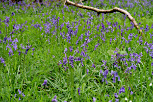
More bluebells at Warren Bottom Copse.
After lunch, we continued following the Welly Boot Corner Walk to its end at the village of Hannington. When leading this walk in previous years, we've stopped for a drink at The Vine, but this has sadly closed, like many country pubs have done in recent years.
From Hannington, we followed Meadham Lane, then an unnamed lane that took us up to Cottington's Hill and the transmitter mast. Now at the highest point on the walk, we descended through Stubbington Down and back to the White Hill car park from where we'd started. See our route on Google Maps.
Thanks go to Emma and Rob for leading this walk and Rob for the write-up.
Walk 635 - Maidensgrove and Nettlebed
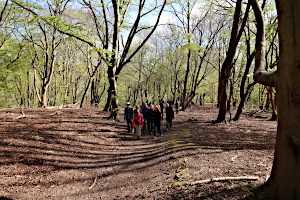
Walking through woodland in Warburg Nature Reserve.
Seventeen of us headed off from a sunny and breezy start on Maidensgrove Common in the Chiltern Hills on Saturday 20th April. Being fairly high ground in South Oxfordshire it's often a windy spot - with plenty of parking usually available. It was good to welcome some new members on this walk, and lovely to have see recent joiners out with the group again, as well as our longstanding members.

One of the many bluebell-lined paths around Nettlebed.
We began by walking downhill into the Warburg Nature Reserve, managed by Berkshire, Buckinghamshire & Oxfordshire Wildlife Trust.
This was shortly followed by a climb up the other side of the valley, watching the squirrels among the trees. Crossing parkland near Crocker End, as we approached Nettlebed, happily there were carpets of bluebells and wild garlic to be seen.

A heard of deer near Redpits Manor.
The Cheese Shed café was our next point of call - for coffee and cake to refuel after the climb uphill. Some of us also popped in to St Bartholmew's church to see the nature themed stained glass windows designed by John Piper.

A bluebell-lined path in Russell's Water.
Leaving Nettlebed, it was lovely to find yet more bluebells flowering as we headed towards Park Corner. A large herd of deer were also seen in the fields near Redpits Manor as we approached our lunch spot. Fallow or Roe deer? We weren't sure which!
After lunch, we continued along the valley, followed by a slow and steady climb back up the hill to Russell's Water. Taking a path initially through the bracken, then back across the wide open expanse of Maidensgrove Common to return to our start point. See our route on Google Maps.
Thanks go to Ruth for leading this walk and for writing it up. (Photos by Rob C)
Walk 634 - Finchampstead Bluebell Evening Walk
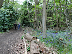
Walking through Coalpit Copse.
Our first midweek evening walk of the year was on Thursday 18th April. Starting at 6.45pm from the NT Simon’s Wood car park in Finchampstead, sixteen Ramblers set off in search of bluebells and they weren’t disappointed. Heading south from the car park, we took the path down through Simons Wood to Coalpit Copse, where the woodland on both sides of the path was a carpet of deep blue and appeared even more vibrant compared to the same woodland this time last year. At the bottom of Coalpit Copse, we turned right onto Ambarrow Lane in the direction of the Moor Green Lakes. After skirting around the edge of Horseshoe Lake we joined the Blackwater Valley Path past Grove Lake, following the meandering Blackwater River.
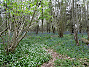
Bluebells and Wild Garlic in Simons Wood.
On leaving the Blackwater Valley Path, we headed north through the nature reserve past Colebrook Lake South and Colebrook Lake North, both of which are popular for bird watching, the small islands in them being named Snipe, Sandpiper, Tern, Goose and Plover Islands. On reaching the road, we continued north along Dell Road, admiring the attractive thatched cottages and beautiful spring flowers, before taking a path to the NT Finchampstead Ridges. To make the most of the fading daylight, we took paths through some of the more open woodland, before a short relatively steep ascent up to the ridge and Wellingtonia Avenue. We followed a path parallel to the road back through Simons Wood to the car park, finishing the 3.6 mile walk at 8.07pm, just three minutes after the sun had begun to set.
Thanks go to Sue B for leading this walk, providing the photos and writing it up.
Walk 633 - Swallowfield, Farley Hill and Blackwater River
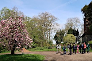
Standing outside All Saints church, Swallowfield.
Saturday 13th April was the perfect spring day – plenty of sunshine, blossom and birdsong. Following a couple of weeks of heavy rain, the warmer weather this weekend enticed nineteen walkers (including three new walkers trying out the BWWs) to join us for a 6.6 mile walk, starting from the Parish Hall in Swallowfield.
We set off through Swallowfield Park, following the River Broadwater to the thirteenth century church of All Saints, passing the river flood monitoring station on the way.

Bluebells of blue, white and pink in All Saints churchyard.
The churchyard was full of spring flowers, including our first glimpse of bluebells and forget-me-nots. On leaving the pretty church-yard, we encountered our first section of mud as we passed through a gate before heading north east along a much dryer path between hedgerows.
Following the recent rain, the fields beyond the hedges were partly flooded and a flock of Egyptian Geese, together with a lapwing were making the most of the shallow ponds that had been created.

The River Broadwater at the confluence of the rivers Whitewater and Blackwater.
We then turned onto a path heading south towards the George and Dragon pub, after which we walked along Nutbean Lane, before turning right onto a footpath just past Wheeler’s Farm. Here, we had to negotiate another muddy section and those with walking poles were at a distinct advantage.

The path was badly flooded approaching Wheeler's Copse.
Fortunately, the next section of the route was very much dryer through the water meadows next to the Broadwater River and it wasn’t long before we passed where the Broadwater divides into the Whitewater and Blackwater Rivers. Apparently, in summer, after low rainfall, the Whitewater can hardly be seen.
On reaching the Ford near Jouldings Farm, we followed a track northwest towards Wheeler’s Copse. A small section of this track is often flooded during the winter months and local walkers have established a short diversion through a neighbouring field, which we made good use of, having found the flooded track totally unpassable.

A sea of bluebells at Wheeler's Copse.
On reaching Wheeler’s Copse, there was the most magnificent carpet of bluebells for us to admire. From here, we walked north along Sandpit Lane to Farley Hill, where there were flowering cherry trees in full bloom and we were accompanied by the sound of pheasants.

Cherry Blossom at Farley Hill.
Continuing north towards Farley Castle, we then headed west towards New Plantation, which was our lunch stop, with plenty of fallen trees for everyone to sit on and a few more bluebells.
After lunch, we headed west along the edge of the plantation and then re-entered Swallowfield Park, where there was a magnificent row of old oak trees. It wasn’t long before we rejoined our outward path through the park, past the church and back to the Parish Hall. See our route on Google Maps.
Thanks go to Sue B for leading this walk and writing it up. (Photo by Rob C)
Walk 632 - Pinkneys Green, Hurley and Temple
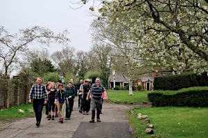
Walking through Burchett's Green.
On Saturday 6th April, seventeen of us, including a couple of people trying us out, met up in the NT car park at Pinkneys Green, near Maidenhead. Our leader for this walk was Neil, who explained that he may have to modify the route if the paths by the River Thames were still impassable. These paths had been flooded a few weeks earlier.
We set off across a grassy field full of cowslips before crossing the A404 dual carriageway on a footbridge on our way to Maidenhead Thicket. Passing Stubbing's House and garden centre, we arrived at Burchett's Green.

Entering the Berkshire College of Agriculture.
We walked through this pretty village and into the grounds of Berkshire College of Agriculture, firstly crossing their playing fields and then following a footpath through the maze of college buildings. This path used to pass through the BCA Zoo, but has been moved in recent years, so we didn't get a look at the animals this time.
Leaving the Berkshire College of Agriculture, we headed through fields and uphill to High Wood on Prospect Hill. A steep downhill path the other side brought us to Hurley.

Walking by the Thames at Hurley Lock.
We walked along Hurley High Street to the River Thames, where we crossed onto an island separating the river into two branches, one passing through Hurley Lock and the other through a weir. We stopped by the lock for lunch.
After lunch, we walked along the previously flooded paths by the Thames, which were now quite passable. These took us too Temple and then on to Bradenham Lane. A permissive path took us alongside the A404 to Temple Golf Course, where we passed under the A404 in a pedestrian tunnel.

The war memorial in Dungrovehill Wood.
We followed Dungrove Hill Lane uphill and entered Dungrovehill Wood. Here Neil showed us a small war memorial, consisting of a deep trench and a number of allied airforce flags. On 18th July 1944, a Halifax heavy bomber aircraft on its way to bomb enemy gun positions in France caught fire after takeoff. The pilot changed course to avoid populated areas before it crash-landed, fully laden with fuel and bombs. Only the Canadian rear gunner managed to parachute to safety. All other crew members were lost without trace, such was the power of the explosion.
Leaving Dungrovehill Wood, we followed the old Henley Road back to Pinkneys Drive and to the car park where we'd started. See our route on Google Maps.
Thanks go to Neil for leading this walk. (Photos and write-up by Rob C)


